Walk
130 Dartmouth to Torcross (Devon)
(Second
leg of English coastal walk – Broadstairs to Lands End)
Map:
L/R 202
Distance:
12 miles or 20km approx
Difficulty:
moderate – mixture of climbs and flat
Terrain:
paths, some road
Access:
Parking at both ends
Public
transport: 93 bus goes to and from Dartmouth/Torcross every hour in
the week
This
walk can be started at Kingswear and one of the ferries taken across
to Dartmouth or from Dartmouth itself.
In
the centre of Dartmouth is the square lagoon surrounded by old
buildings which make the area attractive and reflect its history.
Look out for the 17th century Butterwalk. Further back up
the River Dart, just outside the town, is the Royal Naval College.
Richard
the Lionheart's armies set off for the Crusades from here in the 12th
century. The town was twice under attack from the French during the
100 years war in the 14th century. After this a huge chain
was placed across The Dart to prevent such raids. In 1620 the
Mayflower made an unscheduled stop at Dartmouth for repairs to her
escort ship 'Speedwell'. Over the centuries merchants have traded
English wool for wine from Bordeaux.
On
the walk south out of Dartmouth is Bayard's Cove Fort built in 1534.
It was to protect the river but it has been suggested that the gun
embrasures or openings faced the wrong way!
Just
before Dartmouth Castle is the ancient church of St Petrox or St
Petrocus. This is one of 17 churches dedicated to him in Devon. He
lived in the 6th century and settled in Cornwall, founding
a monastery at Padstow.
Dartmouth
Castle looks out over the estuary and was built between 1480 and 1500
to protect the harbour against raids. The castle was the first one in
the country to be designated for artillery.
The
walk continues around Blackstone Point where there are some good
views to the east and west. Soon after Compass Cove the path goes
inland, then along a road to Stoke Fleming before returning to the
coast just before Blackpool Sands. A bigger contrast to the other
Blackpool Sands is hard to imagine! The coast here is surrounded by
pine and other woodland. The pleasant, privately managed beach, had
been awarded the Blue Flag (when I walked there).
The
walk to Strete is via some steep terrain. There was once a coastal
village near here called Strete Undercliff (famous for smugglers)
which was swept away in the late 1700s.
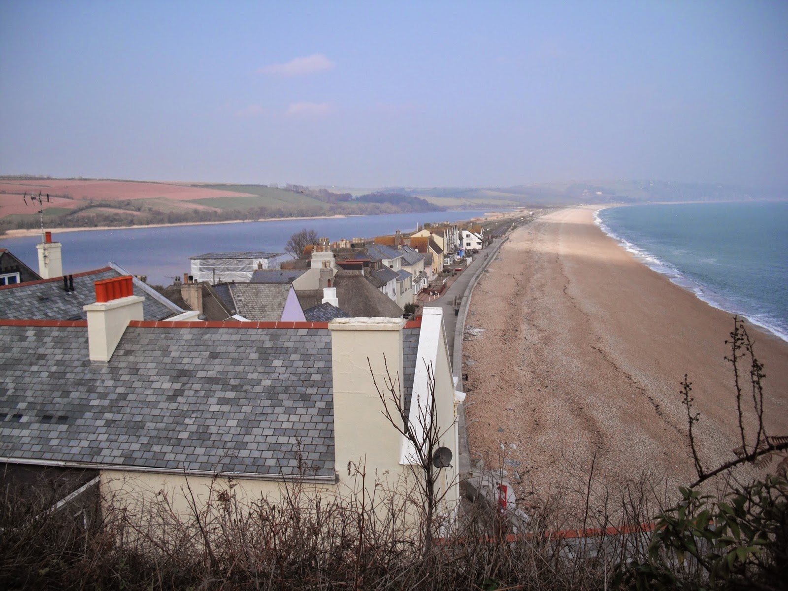
The
rest of this walk is flat alongside Slapton Sands on one side and
Slapton Ley on the other. The Ley is the largest freshwater lagoon
in the south west. It is 1.5 miles long and is a national nature
reserve of special scientific interest. The beach here is comprised
of tiny red pebbles. This whole area is very vulnerable to erosion
including the road which has been rebuilt in the last few years.
Look
out for the obelisk which commemorates the area as a practice ground
for American D Day forces in 1943. The villages (about 3000 people)
near here were evacuated for these practices (including their
livestock) for about 12 months. The obelisk memorial was presented by
the USA authorities. Also watch out for the Sherman tank which was
used in the practices – it was abandoned in the water and recovered
and restored in the 1960s.
The walk finishes at Torcross.
Photos show: Slapton Ley and sands; The Square Lagoon, Dartmouth; Dartmouth Castle.