Total Pageviews

Monday 24 December 2012

Walk 86 Eastbourne to Cuckmere Haven


Walk  86 Eastbourne to Cuckmere Haven (East Sussex)

(Second leg of English coastal walk – Broadstairs to Lands End)

Map: L/R 199
Distance: about 10 miles or 15km.
Difficulty:  Challenging in parts especially the Seven Sisters Country Park 
Terrain: footpaths including cliff paths and pavement
Access: Parking at both ends (off A259 at Cuckmere Haven)
Public transport: 12, 12A and 13 buses run between Eastbourne and Brighton past Cuckmere Haven.

Start at Eastbourne pier and walk westwards. A number of rather splendid buildings adorn the seafront; these include The Grand which was built in 1875. The white façade is often compared to a wedding cake. The town became a fashionable resort from about 1780 when the children of George 111 stayed here. Further well kept, attractive, buildings (mostly 19th century) are clear evidence of the areas popularity. Near the seafront is the art deco bandstand which is still regularly in use during the season.

The wide promenade out of Eastbourne allows a good view of Beachy Head. On the promenade is a statue of the Duke of Devonshire who owns much of the land in the town. The walk continues up the cliff and an impressive panoramic view of Eastbourne and beyond can be enjoyed. Early Venetian sailors called the head Devil’s Cape because of the treacherous shallow waters. A sign marks the top of Beachy Head which is 534 feet above sea level.

Beachy Head is a beautiful and a sad place. The iconic red and white striped Beachy Head Lighthouse is 144 feet tall but is dwarfed by the surrounding cliffs. It was built in 1902 and is now fully automated. Near to this point is Lovers’ Leap. About 100 people a year jump or attempt to jump from here; the crosses and floral memorials are a poignant reminder of this. A chaplain is stationed at Beachy Head; his vehicle is clearly marked.

From this point The Seven Sisters Country Park can be seen stretching westwards towards Cuckmere Haven. The seven cliff hills provide some challenging walking – I’m sure I counted eight! The walk from Beachy Head continues to The Belle Tout Lighthouse. This was built in 1834 but was made redundant when fog blocked its light. It is now a home and B&B. A few years ago it was in danger of falling into the sea because of cliff erosion. The owners had it moved 55 feet inland using hydraulic jacks – quite an operation.

Beyond the lighthouse is Birling Gap. There is a café in the Gap and rock pools to enjoy – care needs to be taken with the incoming tide. The cliff edges of the Seven Sisters are unprotected and it is essential top keep to the path. The views of the coastline here are spectacular.

 After tackling the seven or (eight) hills is the attractive estuary of the River Cuckmere (pronounced Cookmere). It is one of the rare UK river mouths to have no industrial or domestic settlements. In the 1800s it was used by smuggling gangs to carry French brandy up the river to Alfreston. As the path moves inland the meandering of the river can be spotted together with examples of oxbow lakes in the flood plain. It is very popular with school geographical field trips.  

Continue the walk back to the A259.
Snaps show: The Grand, Eastbourne; Bandstand, Eastbourne; Belle Tout Lighthouse; Birling Gap and the Seven Sisters.


Wednesday 12 December 2012

Walk 85 Bexhill to Eastbourne


Walk 85    Bexhill to Eastbourne (East Sussex)

(Second leg of English coastal walk – Broadstairs to Lands End)

Map: L/R 199
Distance: about 12 miles or 18km.
Difficulty:  Easy – mostly flat
Terrain: footpaths, pavement and beach.
Access: Parking at both ends
Public transport: Rail and bus links between the two towns.

Start at the De La Warr pavilion in Bexhill. A mile or so to the west is Cooden Beach. You can get here by walking along the beach or by road. If the tide is in, clambering over the groynes can be tiring. Cooden has a long sandy foreshore and is popular with kite and windsurfers. Take care – they can get up a fair speed.

The walk to Norman’s Bay can be partly on the road but the remaining half mile needs to be on the beach. The shingles near the top of the beach are hard going so opt for sand near the shoreline if the tide is out far enough. Norman’s Bay is generally accepted as the place where William the Conqueror landed on 28 September 1066. King Harold was 250 miles away defeating a Norwegian invasion at Stamford Bridge in Yorkshire at the time. When he heard this William is supposed to have fallen as he jumped ashore and said that he had seized the very soil of England. Which he had!

To the west of Norman’s Bay is a rather dilapidated Martello Tower – one of many such buildings on this coast. (Erected to defend the coast during the time of the Napoleonic Wars and based on a tower in Mortella, Corsica which the British forces found difficult to capture in 1794). 

The walk passes the private beach estate at Beachlands. Rightly or wrongly, I continued walking on the lower part of the beach near to the groynes without being shouted at. Soon after Beachlands is Pevensey Bay. This is now a pleasant small resort which originally provided a safe haven for the Norman fleet in 1066. William the Conqueror built Pevensey Castle and the ruins can still be seen. In the 18th and 19th centuries smuggling was rife as it was an easy  place to land contraband.

The walk continues along the beach and paths into Eastbourne. Further Martello Towers can be seen before arriving at Sovereign Harbour. This whole area has been redeveloped with housing and apartments which look out on a new harbour, it is expensive to live here but not very attractive in my view. Some map navigation is needed to walk inland and follow the cycle route towards Langney Point on the other side of the harbour.

Follow the promenade into Eastbourne. The Dotto Train runs along here – the only problem being it is not strictly a train (no railway) but a vehicle pulling carriages along a road.

On the walk into Eastbourne you can spot that the groynes have been numbered for easy location – a good idea for emergencies. Eastbourne has been a popular resort for many years mainly because of its sheltered position and sunny climate. Its population dipped during the Second World War when it was badly bombed. Nowadays, it retains its popularity as a quiet resort and many pensioners now live in or near the town.

Continue along to the pier along one of the promenades (they are at different levels). The pier is Victorian and is held up on cast iron legs. The walk finishes here.

Snaps show: Beachlands; a 'desirable property' near Norman's Bay; Sovereign Harbour; Martello Tower; Dotto Railway; Eastbourne Pier.


Wednesday 28 November 2012

Walk 84 Hastings to Bexhill


Walk   84 Hastings to Bexhill

(Second leg of English coastal walk – Broadstairs to Lands End)

Map: L/R 199
Distance: about 5 miles or 8km
Difficulty:  A few steep parts but fairly easy on the whole
Terrain: footpaths, pavement and beach.
Access: Parking at both ends
Public transport: Rail and bus links between the two towns.

This is a relatively short walk which allows some time for visits to the attractions in both towns. The walk is straightforward out of Hastings and St Leonards it then follows paths/beach alongside the railway line then cliffs into Bexhill. The route is not fully evident on the map.

Start at Hastings Pier. There are some impressive buildings to be seen including the ex Grand Hotel which is now apartments. On the beach are a series of mostly wooden groynes. In the Middle Ages Hastings became one of the Cinque Ports (the town was allowed trading privileges in exchange for helping to provide the British Navy). In the 13th century much of the town was washed away by the sea. The next century saw the French invade twice and burn the town. Like many coastal towns it remained a fishing village until the advent of the railways in Victorian times built up its popularity as a holiday destination.

Several famous people have connections with Hastings, these include: Robert Tressell who wrote his brilliant book The Ragged Trousered Philanthropists when living here; Gareth Barry the footballer who was born in the town; Jo Brand the comedian who went to a Hastings school; Harry H Corbett, the Steptoe and Son actor who lived and died here. Perhaps the most famous connection is with John Logie Baird who made the first TV transmission in Hastings in 1925. Hastings Museum has more information on how the town became known as the home of TV. The area is popular for film locations including its use for the TV series Foyles War.

Walking out of the main part of Hastings and towards St Leonards, a large, curvilinear building can be seen near the seafront. This block of flats, built in the 1930s, was designed to reflect the grandeur of an ocean liner but some locals call it ‘Monstrosity Mansions’.

Two other significant landmarks in St Leonards are the church and Warrior Square. The town takes its name from the old church which was demolished in medieval times. The modern town was designed in the 19th century by the London architect James Burton who was also for constructing the Anglican church. This building was destroyed by a V1 ‘doodlebug’ World War 2 and was replaced by the current impressive building you can see now; ­it is listed by English Heritage for its architectural importance.

Follow the road, paths and beach out of St Leonards towards Bulverhythe. On this part of the walk, very large sections of rock acting as sea defences dominate the beach. Bulverhythe has a few small boats pulled up on to the beach and a large number of beach huts. Bulverhythe is translated as ‘Burghers landing place’ (a burgher normally referring to a wealthy citizen). The village is also known by a few other names including the rather odd ‘Bo Peep’. Remains of a ship called the Amsterdam can be seen at very low tide – this was on its way to Java in 1749 before coming to grief.

The path approaching Bexhill goes alongside the railway line and past Galley Hill. The first motor car races in the UK started here in 1902 and finished in Bexhill. Thousands of people came to watch cars travelling around 50mph when the speed limit on the road was just 12mph. The last competition was held in 1925 after which racing was not allowed on public roads. These events led Bexhill to become known as the home of motor racing. Classic car shows are still held annually to celebrate the town’s past. A metal sculpture near to the seafront is an artistic impression of the record breaking ‘Easter egg’ car driven by Leon Serpollet in the 1900s.

Further along the front are some single storey houses with unusual oriental domes. A local told me these were built by a Maharaja living in the town. I have been unable to confirm this.

No visit to Bexhill is complete without a visit to the De La Warr Pavilion on the front. In late Victorian times the seventh Earl De La Warr transformed the village of Bexhill into an exclusive seaside resort. This is reflected in the many examples of Victorian architecture to be seen around the town. The ninth Earl De La Warr had the pavilion built as a public building in 1935. The ‘art deco’ and modernist designs have resulted in it being listed. It was reopened in 2005 after a couple of years of refurbishment and now houses a contemporary arts centre. The local museum has further information with particularly helpful staff willing to talk to you  e.g. they told me that the family prefer the pronunciation ‘De La Ware’ rather than ‘De La Warr’. On the coast side of the pavilion is an outdoor structure for performers. A local told me it was impractical as the performers suffered from uncomfortable back drafts from the sea breezes.

Two more notable landmarks near the sea front are the clock tower, which was built to celebrate the coronation of Edward V1,1 and a pitch and putt course with information about the famous local golfer Max Faulkener (born 1916). He was known as the ‘Clown Prince of Golf’ as he chatted to the spectators and dressed in bright yellow. Other famous people with Bexhill connections include: Eddie Izzard the comedian who is patron of the local museum; Spike Milligan who spent some of his army time here and wrote about the town in one of his books; Ted Lowe the snooker commentator who lived here until his death in 2011.

Snaps show: the performance structure at The De La Warr pavilion, Bexhill; the Easter Egg car sculpture, Bexhill; St Leonard's Church; Warrior Square, St Leonard's; Galley Hill, Bexhill.

Sunday 18 November 2012

Walk 83 Winchelsea Beach to Hastings (East Sussex)


Walk   83 Winchelsea Beach to Hastings (East Susses)

(Second leg of English coastal walk – Broadstairs to Lands End)

Map: L/R 189 and 199
Distance: about 10 miles or 15km
Difficulty:  Moderate, flat to start with some strenuous steep cliff walking in the second part
Terrain: footpaths and pavement.
Access: Parking at both ends
Public transport: Bus 344 every hour Mon – Sat connects Winchelsea Beach with Hastings; much restricted service on Sunday.

The walk along the sea wall from Winchelsea, which is parallel with the road, provides a good view of the beach and the Pett Levels inland. After about a mile or so there are some lakes which come close to the edge of the road. These are the Colonel Body Memorial Lakes. I have read that he was the Deputy Lieutenant of Kent in 1945 and that he died suddenly in the same year. There used to be a tram way along this section which was used when the sea defences were constructed in 1934. Although the track was removed in the 1950s I have heard that there is still some evidence of its existence.

The last part of the flat walk finishes at Cliffs End. The eastern end of the beach is dominated by the sandstone cliffs. At low tide the remnants of an ancient submerged forest can be spotted by those who know what they are looking for.

The next part of the walk begins on the cliff but soon enters the roads of a housing estate.  The roads towards the cliff edge were blocked off due to erosion and there appeared to be no access to Fairlight Cove. However, I spotted an A4 sheet of paper pinned to a fence saying ‘Nudist beach this way’!

The path passes along the cliff top through Fire Hills which is believed to get its name from the bright yellow gorse which grows there in April and May. The hills are part of Hastings Country Park, an area of special scientific interest and outstanding beauty. It is popular with families and others enjoying an afternoon walk. A visitors’ centre provides more information about the fauna, flora and geology of the area.

Further along, Hastings Pier, then the old town become clearly visible. At the end of the walk you could choose whether to walk down or use the East Cliff Lift. This was opened in 1903 and is the steepest funicular (i.e. using two counter balanced carriages) railway. There is a further Cliffside lift on the West Cliff which takes visitors to the castle and Smugglers’ Corner attraction. The castle was first built in 1068 by William the Conqueror and made into a stone structure after 1070. William is supposed to have had his first meal near Hastings although the actual Battle of Hastings was at Battle six miles inland. The seafront at the bottom of the cliffs provides good views back to Covehurst Bay.

Soon the walk passes through the old fishing part of Hastings. Fishing boats or ‘luggers’ (from the 4 sided lugsails once used) are pulled up on to the shingle beach on rollers. The catch is auctioned most mornings from the ‘net shop’. The tall wooden buildings were built in the 19th century to store fishermen’s nets and ropes. Some are converted boats and so built to make best use of the limited beach space. The Hastings Fishermen Museum is well worth a visit for more information.

Continue the walk past the attractive sea front buildings and pedalo pool towards Hastings Pier where the walk finishes.

When I walked this section the pier was closed as it was deemed unsafe. However, soon after this (in 2010) there was a serious fire which destroyed 95% of the structure. Efforts are being made to reinstate it but so far nothing tangible has happened. (Update opened in 2016). The pier was built in 1872 and was very popular in the 1930s and again in the 1960s when several pop groups used it as a venue.
Snaps show: The Firehills; Covehurst Bay; Old Town, Hastings; fishermen's huts, Hastings; two views of the pier before the fire.

Tuesday 6 November 2012

Walk 82 Camber Sands to Rye and Winchelsea Beach (E Sussex)


Walk   82 Camber Sands to Rye and Winchelsea Beach  (East Sussex)

(Second leg of English coastal walk – Broadstairs to Lands End

Map: L/R 189
Distance: about 11 miles or 16km
Difficulty:  Fairly easy – flat, some beach walking
Terrain: footpaths, pavement, beach
Access: Parking at both ends
Public transport: Bus 100 links Camber Sands to Rye and other towns; Bus 344 links Winchelsea Beach to Rye and other towns (both Mon – Sat check with Traveline).

From Camber, walk east to Jury’s Gut Sluice - an odd name which I have tried to research but with no luck. From this point you can see (and probably hear) the Lydd firing ranges which make the beaches from here to Dungeness too dangerous to walk. Walk back towards Camber along Lydd Road and its views of Broomhill Sands.

Camber Sands is a very popular place for families and wind surfers. Film directors often use it for location filming. For example, the 1962 war film The Longest Day starring Robert Mitchum was filmed here as the setting for the Normandy Beaches. During World War 2 the beach was fortified (some examples can still be seen around the area including alongside the River Rother) and used for military exercises.

It is worth a walk along the sands and alongside the Rother up to the point it enters Rye Bay. However, take care if the tide is coming in as you can get stranded on sand banks. Follow the path northwards back towards Rye, past Rye Harbour and into the town. It is interesting to look around Rye with its cobbled streets and its medieval buildings.

Rye stands at the confluence of the rivers Rother, Tillingham and Brede. In medieval times it was an important port providing ships for the service of the king. In the 18th and 19th centuries smuggling gangs such as the notorious Hawkhurst Gang used inns such as The Mermaid and Old Bell Inn – making use of secret passages. Apart from the general charm of the town, attractions such as the Castle Museum and Lamb House provide an informative background to its history and life. Many writers were attracted to live at Lamb House including Henry James and E F Benson.  Other famous residents in the area of Rye have included Tom Baker, Paul McCartney and Spike Milligan.

Take the Saxon Shore Way out of Rye and across the Rye Harbour Nature Reserve. The wide range of habitats on the reserve is home to a variety of animal and plant species. Camber Castle is a couple of miles along the path. It can only be visited by a pre-arranged tour with English Heritage. It was built by Henry V111 to protect Rye Harbour. It was disbanded in 1637 and is now a ruin.

The walk finishes at Winchelsea  Beach which is about two miles south of the town of Winchelsea. Looking inland from the sea wall is a large field. This was once a harbour built at considerable expense in the 1700s. It was to replace Rye Harbour a few miles away but was a financial disaster. It lasted just 3 months before it silted up and was never used again.
Snaps show: Winchelsea Beach; the old harbour at Winchelsea Beach; Broomhills Sands; Rye Harbour entrance.


Tuesday 23 October 2012

Walk 81 Dymchurch to Dungeness (Kent)


Walk   81 Dymchurch to Dungeness (Kent)

 (Second leg of English coastal walk – Broadstairs to Lands End

Map: L/R 189
Distance: about 10 miles or 15km
Difficulty:  Fairly easy – flat some beach walking
Terrain: footpaths, pavement, beach
Access: Parking at both ends
Public transport: Romney, Hythe and Dymchurch Railway has stations at both ends – check the seasonal timetables.

A military firing range at Hythe means that the coast is inaccessible for a few miles, consequently this walk starts at Dymchurch.

Dymchurch is now a popular seaside resort. In the past it was an area rife with smuggling; Russell Thorndike’s books about Doctor Syn are based on this activity and the town holds a celebration of the stories every couple of years.  In the sixteenth century the village had a magistrate known as the
Leveller of the Marsh Scotts. The ‘scot’ was a tax to fund maintenance of the sea wall paid by Dymchurch residents. Those outside the boundaries of the village did not have to pay and were said to have got away ‘scot free’. Thorn bushes were used to help build the sea wall as it was believed that the leaves were impervious to sea water. Those who failed to make a contribution were said to be in danger of having one of their ears cut off!

There are three Martello Towers in Dymchurch. One is now a home, one is empty and the other is a museum run by English Heritage with exhibits explaining the history of these buildings which were designed to defend against an invasion by Napoleon.

The walk continues along the wide promenade to St Mary’s Bay. This area, which once housed a major school journey centre, is now mainly housing. E Nesbitt, the author of the Railway Children lived here for a time and is buried in a local churchyard. A mile or so further along is Littlestone on Sea. A major landmark is the red water tower near the beach. Looking out to sea it is possible to spot the section of an old Mulberry Harbour. During the allied invasion of Europe in 1944 a complete floating harbour was built and towed to the landing beaches of Normandy. Some of it broke off and a section of it lies here.

Inland from Littlestone is New Romney. This was one of the original ‘cinque’ ports and was at the head of the River Rother until it changed course. The headquarters of the Romney, Hythe and Dymchurch railway is here and worth a visit if you are interested in the history of this small gauge railway.

Greatstone-on-Sea  is a fairly recent development with most of the housing built in the 1960s and 70s. An RNLI station is near to the pebbly beach. A local rector once warned that many witches were living on the nearby Romney Marshes.

From here the choice is to walk on the large pebbly foreshore or on the pavement. Lydd on Sea has a row of bungalows facing the foreshore; some residents have gardens on the beach which is on the opposite side of the road; ‘Private’ and ‘ Keep out’ notices are on roped off plots on the shingle. Near to this point is a path going to a sound mirror similar to the one described on the previous walk from Dover – this will involve a few miles detour. Unfortunately, it can only be seen at a distance unless permission is gained to enter the site.

The walk from Lydd on Sea to Dungeness is probably best done on the road. Dungeness is a wild, desolate place with a unique landscape favoured by those who choose to live here. Bungalows are dotted around on the shingle in no particular order – many appear to be no more than fishermen’s shacks. Nevertheless, they evidently have a high value for those wanting to get away from the ‘rat race’.  

 Dungeness Nuclear Power station is in fact two buildings; one is now closed but the other has had its licence extended until 2018. Nearby are two lighthouses; the newest one, built in 1961, replaced the older one built in 1901 as shipping could no longer see it when the power station was built.

Dungeness has one of the largest areas of shingle in the world. A path enables you to walk out on the headland and look along the coast. The surrounding area is a wildlife sanctuary with a wide range of protected wildlife. If you arrive at the right time you will be able to get a drink in the Britannia Pub which can be easily found near to the paths.

Snaps show: popwer stations, Dungeness; Britannia Pub, Dungeness; centre the water tower near Littlestone; Dymchurch beach; huts on the beach at Dungeness; the front at Littlestone; New Romney narrow gauge rail station.


Friday 12 October 2012

Walk 80 Dover to Hythe (Kent)


Walk   80 Dover to Hythe (Kent)

(Second leg of English coastal walk – Broadstairs to Lands End

Map: L/R 179
Distance: about 12 miles or 18km
Difficulty:  Moderate, a few steep climbs
Terrain: footpaths and pavement
Access: Parking at both ends
Public transport: Trains to Dover, buses from Hythe to Folkestone

Start from near the docks in Dover- the ferries started sailing from here in 1953.  On the right are white cliffs towering above the buildings lower down. The town was in the front line for attacks in the Second World War and was extensively bombed.

Keep walking as near to the sea front as possible. You will come to the old harbour which was built at the time of Henry VIII, however, the discovery of a bronze age boat showed that the port had been used for over 3500 years. This boat is the oldest one in the world and can be seen at Dover Museum.

The walk goes along the pleasant promenade and beach. Julius Caesar considered landing at Dover but was apparently deterred by the sight of the natives haranguing him from the cliff tops! Adjacent to the beach is a statue of Charles Rolls who was the first man to cross the channel and return in a single flight. Bleriot also landed here on the first one way channel flight in 1909. Further along the landward side of the seafront is a sculpture of ‘The Waiting Miner’. It was originally sited at Richborough Power Station near Ramsgate (buildings now demolished); it was relocated here in 1997 next to the former offices of the National Union of Mineworkers. Further along is a memorial to the 202,000 allied troops evacuated during the evacuation of Dunkirk in 1940.

The walk out of Dover involves some steep climbs. Looking downwards is the railway line to Folkestone and a large beach which appears to be only accessible by a railway footbridge – very few people were using it when I went on a hot sunny day. Further along is Shakespeare Cliff which features in King Lear - hence the name.

A couple of miles out of Dover is Samphire Hoe. A strange stone near the path records that Matthew Pepper was mayor of Dover in 1895 – I cannot find out why it is here or if this is where he is buried. Beneath the cliffs are buildings connected with the Channel Tunnel which runs underneath. This area was formed from the workings of the tunnel and a plaque lists the eleven people who lost their lives during its construction between 1986 and 1992. The place gets its name from rock samphire an edible plant which is mentioned in King Lear. The area is particularly popular with fishermen.

The walk continues past Abbots Cliff then cuts a little way inland to Capel Le Ferne. At this point you pass an old sound mirror. This was an early radar type device to hear enemy aircraft approaching and was used around the time of the First World War. At Capel Le Fern it is well worth taking a break to look around the Battle of Britain Memorial. This part of Kent was known as Hellfire Corner during the Second World War. The centre piece of the memorial is the sculpture of an airman overlooking the channel and there is a memorial listing all those who fought in the Battle of Britain.

Follow the road out of Capel Le Ferne then along the cycle route down the road towards Folkestone. The area round here was notorious for smuggling and is known locally as Little Switzerland because of its diverse flora and fauna. Look out for two Martello Towers built between 1805 and 1808 to help defend the country against Napoleon. The name comes from Cape Martello in Corsica where such a tower proved difficult for the English to capture in 1794.

The view into Folkestone past Copt Point is an attractive one and does not support Daniel Defoe who described the area as a ‘miserable fishing town’. The walk goes past a popular beach to the east of the town before reaching the harbour. Folkestone used to operate ferries but much of this area has been redeveloped and is popular with tourists.

On the west cliffs of Folkestone is an area called The Leas. A hydraulically operated lift carries passengers from the top and bottom of the cliff; it was built in 1885 and is one of the oldest of its type still working. A statue of Folkestone born William Harvey who discovered how the blood circulated is on the Leas. The area was popular with fashionable Edwardian society and features in H G Wells book Kipps (Half a sixpence). The impressive building facing out to sea is The Grand Hotel. Edward V11, Princess Margaret and Agatha Christie have all stayed here. Christie wrote Murder on the Orient Express when she was a resident.

The walk passes alongside a significant coastal protection scheme. A mile or so from Folkestone is Sandgate which has a number of houses built close to the beach promenade. H G Wells lived near this spot in Beach Cottage and his novel ‘The Sea Lady’ was set here. Sandgate Castle was built in 1539 by Henry V111 who feared a French invasion, it is now in private ownership. During Napoleonic times part of it was converted into a Martello Tower.

The walk continues into Hythe along a long promenade. Hythe was one of the Cinque Ports (a group of medieval ports in Kent and Sussex which were allowed trading privileges in exchange for supplying the bulk of the British navy). In 1293 the French landed here and the townspeople slew all 200 soldiers. Further inland is the small attractive town of Hythe. The terminus of the Romney, Hythe and Dymchurch 15” gauge  railway and The Royal Military Canal (which was built as a defence during the Napoleonic Wars) are two of the interesting features.
Snaps show: Sound mirror near Capel Le Ferne; statue of Charles Rolls at Dover; part of the Battle of Britain Memorial at Capel le Ferne; Dover Beach; Grand Hotel, Folkestone; Sandgate Castle; Martello Tower Folkestone; Leas hydraulic lift, Folkestone.


Wednesday 3 October 2012

Walk 79 Sandwich to Dover (Kent)


Walk 79          Sandwich to Dover (Kent)

(Second leg of English coastal walk – Broadstairs to Lands End

Map: L/R 179
Distance: 14 miles or 22km.
Difficulty:  Moderate, some climbs
Terrain: footpaths and pavement
Access: Parking at both ends
Public transport: Trains to Sandwich and Dover to surrounding towns.

Sandwich, with its riverside, timber framed buildings, old archway and connections with Thomas Paine is well worth a stroll around. It was one of the original cinque ports but the harbour silted up in the 18th century and its importance diminished. It was attacked by the French in 1457 and ever since this time the mayors have worn black robes in memory of the many residents killed during the raid. I tried a sandwich in a pub here which claims to have the original ‘open’ format. The story goes that the Earl of Sandwich could not leave the table during a long gambling session so he put beef with his bread - hence the sandwich.

Follow the path out from the car park and alongside some fields before starting on the route across St George’s golf course. To avoid flying golf balls and the anger of serious golfers keep strictly to the marked path. The British Open is held here every nine years and for James Bond fans may be interested to know that it is here that he played golf against his enemy in the film Goldfinger.

After the trek across the golf course you emerge at Sandwich Bay. It is usually very quiet along here partly because vehicles have to pay a toll to pass through the exclusive Sandwich Bay Estate. Many of these impressive houses can be seen on the walk towards Deal. As you enter Deal watch out for the (few) remains of Sandown Castle. This was built as a coastal fortification by Henry V111. Further along are some interesting old buildings looking out to sea – these include a 1623 Tudor Cottage. The Royal Hotel has a plaque announcing that Lord Nelson and Lady Emma Hamilton ‘visited’ here in 1801.

Ramsgate can be seen from Deal Pier on a clear day. It is 1000 feet long and is used mainly for fishing although a bar/café at the far end is good reason to walk its length.

Continue the walk past the fishing boats and further attractive buildings. The distinctive Time Ball on top of its dedictaed museum is worth a closer look and visit (if open). This tower once enabled ships setting off on a voyage to check their chronometers with GMT. The black ball was dropped at 1 p.m. by electrical current sent from Greenwich.

Further along is Deal Castle built by Henry V111 to protect his fleet when anchored nearby. It is built in the shape of the Tudor Rose and is open to the public.

On the way out of Deal and into Walmer look out for a bandstand on the grass between the promenade and the road. This has plaques for the eleven bandsmen tragically killed by an IRA bomb in 1989. Alongside the coastal path is a plaque celebrating the first Roman landing in Britain – it features an engraving of Julius Caesar.

Further along, Walmer Castle can be seen set further back from the path. This castle was a favourite of the late Queen Mother who was The Lord Warden. Previous holders of this post include the Duke of Wellington (who died here) and Winston Churchill. Well worth a visit.

The walk continues past the unspoilt village of Kingsdown and The Zetland Arms which faces the sea – a great place to stop for a break. The path from here goes up on to the cliffs. One significant landmark  before getting to St Margaret’s at Cliffe is the memorial to the Dawn Patrol which guarded the English Channel from 1914-1919.

St Margaret at Cliffe with its stunning sea front is a popular place to start cross channel swims – the French coast is at its closest here (22 miles). Noel Coward once lived in the village and later rented the house out to Ian Fleming. The author was an ornithologist and named James Bond after a writer of books on birds.

The cliff walk gives great views out to the channel which is the busiest sea lane in the world. Most of this area is owned by the National Trust and includes South Foreland Lighthouse (open to visitors) – the first lighthouse to use electricity.

The path gives good views of Dover Castle – a must to visit with its Norman connections, medieval tunnels (spooky) and wartime tunnels. The path drops down into Dover with a good view of Dover Docks.

The walk finishes when the road near the docks is reached.   
Snaps show: the remains of Sandown Castle; the time ball tower in deal; entrance to Deal pier; St Margaret at Cliffe.


Sunday 23 September 2012

Walk 78 Broadstairs to Sandwich (Kent)


Walk 78          Broadstairs to Sandwich (Kent)

(Second leg of English coastal walk – Broadstairs to Lands End

Map: L/R 179
Distance: 10 miles or 15km. approx..
Difficulty:  Fairly easy
Terrain: footpaths and pavement
Access: Parking at both ends
Public transport: Trains from Broadstairs to Sandwich – change at Ramsgate

Update - parts of this walk have improved recently with footpath instead of road walking.

Start at Broadstairs sea front. Along the cliff promenade is the ‘retro’ ice cream and coffee café called Morrelli’s. The fifties/sixties décor is unspoilt and has been recommended as a place to visit in the national press over recent years. Fort House (now named Bleak House) was visited by Dickens for his summer holidays and can be visited (update - not open for visiting in 2016). His desk and chair overlook the Goodwin Sands and it is where he wrote some scenes from his novels. Dickens also stayed in other buildings in the town and plaques mark these places e.g. The Albion Hotel. One wit has placed a notice on his house in York Street saying ‘Dickens did not live here’. A festival is held every summer to celebrate Dickens connection with the town.

Turn right out of Morreli’s and head south. You will notice a field and bandstand on your left. These are used for various events and form one of the venues for the large and very successful Broadstairs Folk Festival which is held every August. Over the cliff is the main beach, Viking Bay, so named because the Vikings are thought to have landed here.

Follow the cliff promenade to Louisa Bay. The large building behind here used to be the Louisa Bay Hotel which is now fitted out as apartments. There is a choice at this point – you can either walk on the lower promenade to Dumpton Gap or stay on the cliff top. The lower walk provides a good view of the cliffs with their unique formations. They are well worth a look especially for those interested in geology.

Dumpton Gap has a pleasant beach away from the more crowded areas of Broadstairs and Ramsgate. The walk from here is more interesting if continued on the cliff top rather than on the beach. About a half a mile along there is a unique house which appears to be modelled on a lighthouse. From here the path passes through a park where there was once a house which Queen Victoria stayed in when she was young. The house’s greenhouses have been preserved and can be seen hidden to the right as you walk through the park.

Exiting the park the promenade continues along the Eastcliff top into Ramsgate. The Granville, a former very fashionable hotel, designed by Pugin can be seen on the right. Look out for the many styles of architecture as you progress along Ramsgate seafront. Further along past the kiosk take the road that slopes down to the left on to the beach promenade. The walk takes you past the old outdoor swimming pool (still some marks on walls giving evidence of this) and near to the point where the old Ramsgate Sands train used to stop. On clear days you can look out to sea and make out the French coastline near Calais.

The hoardings past the end of the road and mini roundabout cover a re-development of the old Merry England site. This was an amusement park which had run for many years but burnt down in the 1990s. It has been bought for development as a hotel and apartments but progress has been very slow. Enterprising locals have used the hoardings to display large artworks done by local people and have called it The Ramsgate Wall.

The walk continues towards Ramsgate Harbour – look out for the old Victorian Pavilion which has until recently been used as a casino. The large needle structure on the edge of the harbour was presented by George 1V when he sailed into the town, bestowing Ramsgate as the only royal harbour in England. Near here is a plaque placed by Vera Lynn to celebrate the Dunkirk rescue; the town and its boat owners had a big part to play – visit the maritime museum for further details.

The attractive harbour, designed by Smeaton is the second biggest in England. It once included former prime minister Edward Heath’s boat ‘Morning Cloud’; he went to school in Ramsgate and lived in Broadstairs. Many other famous people are associated with the area, these include: Wilkie Collins, Frank Muir, Brenda Blethyn, Francis Frith, Elizabeth Fry, David Niven and Lily Langtry.

Continue along the road into the harbour alongside the large harbour wall. You will pass the old Smack Boys Home which was accommodation for the young boys who worked on the fishing boats (called smacks). The small sailors’ church is here as well and can be visited at times. A little further along go up the zig-zag steps which are known as Jacob’s Ladder. The cliff promenade continues with a good view of the old ferry terminal and the existing one which carries freight and cars to Ostend (update no longer operates) The passenger routes to France closed some time ago partly due to a tragedy in 1980 when 9 people fell to their deaths after a walkway collapsed. On your right is The Grange, a famous house designed and lived in by Pugin now owned by The Landmark Trust (who open it for a few weekends every year).

The walk continues along the West Cliff with a view to a large factory area which was, until recently, occupied by the American chemical giant Pfizer. Look out for the sculpture, Hand and Molecules’, donated by Pfizer, which is situated alongside the promenade.

The walk cuts inland and towards the village of Pegwell. Look out for the art-deco Pegwell Hotel with its distinctive tower overlooking Pegwell Bay. The walk goes across the cliff top where there is much evidence of erosion. Further round are the remains of the old hoverport which used to operate here.

The path winds round to an impressive replica of a Viking ship. This arrived here in 1949 from Denmark. It celebrates the landing of Hengist and Horsa 1500 years earlier. St Augustine is thought to have landed in Pegwell Bay before going to Canterbury and establishing Christianity in Britain. St Augustine’s Cross in Pegwell village marks this event.

The walk continues on the road before a path behind a petrol station passes alongside the marshes and a nature reserve. Then it’s back on the road again to complete the walk into the town of Sandwich. (Update - this is now improved with dedicated footpaths).
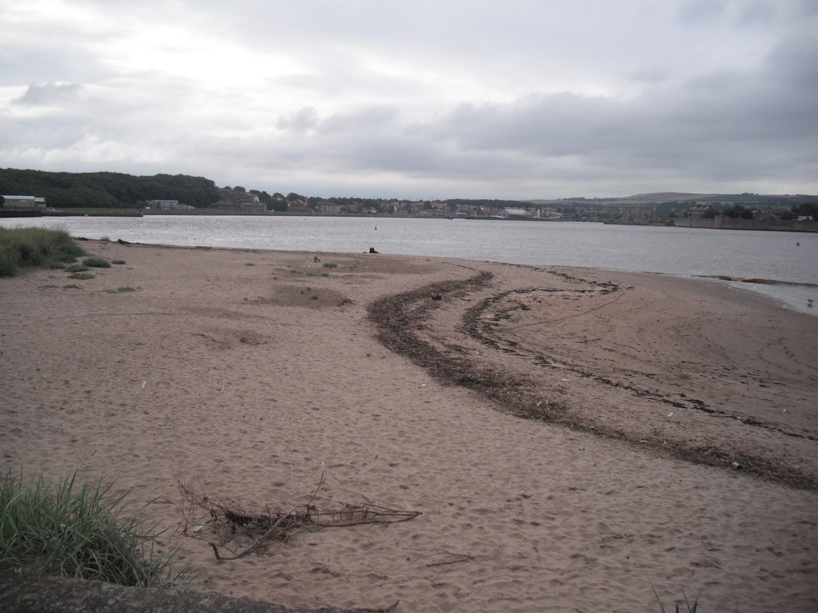
The four snaps show: Viking Bay, Broadstairs; Pegwell Bay Hotel; Pavilion and monument, Ramsgate Harbour; The Smack Boys Home, Ramsgate.


Sunday 9 September 2012

Walk 77 Berwick upon Tweed to the border with Scotland


Walk 77          Berwick upon Tweed to the border with Scotland

 (First leg of English coastal walk – Broadstairs in Kent to Berwick at the border with Scotland).

 Map: L/R 75

Distance: 5 miles or 8 km (the return can be straight down the A1 and into Berwick on the main road if walking back).
Difficulty:  Fairly easy
Terrain: footpaths and pavement
Access: Parking at Berwick and on the A1 near the border.
Public transport: Buses run from Berwick to and fro and use the A1 where there are various bus stops.

Start in the centre of Berwick. If you get a chance it is well worth a visit to Berwick Town Hall where a guide (a halberdier when I visited) provides a very interesting tour of this building. A potted history of the town is brought to life and is reflected in the history of the town hall. Highly recommended – go to the tourist information office for tour times.

Information boards provide details of the paintings of Berwick by L S Lowry. Vantage points near the river give you a chance to admire the Grade 1 listed viaduct built in 1850. It was designed by Robert Stephenson, son of George and opened by Queen Victoria. The east coast rail line still crosses it.  

Take a walk towards the river and town wall – you may well pass The Kings Arms where Charles Dickens gave one of his famous readings. There are several remaining fortifications on the wall reflecting the fact that the town changed hands between Scotland and England several times. These are reputed to be the best surviving medieval walls in Europe. They are 1.5 miles long and approx.7 metres high and were completed by 1560 during the reign of Elizabeth 1st. The architectural historian Nicholas Pevsner loved Berwick describing it as one of the most exciting towns in the country.

Follow the wall then road towards the estuary. Look out for Fishers Fort designed for 6 cannons in the 1770s. The one on display is Russian and kept as a trophy after its capture at the siege of Sevastopol in 1855 during the Crimean War. There is a bulwark (defensive point) overlooking the river and an 18th century guard house called the Main Guard now cared for by English heritage.

The path passes alongside the river edge then climbs the cliff and passes near a caravan site. The coastal path goes along the cliff to the border. However, heavy rain was falling when I tried it and it was impassable so I had to go back to the A1, walk along the road then cut back in at Marshall Meadows. About half a mile north of this point is the border; the path goes inland for a short distance - Scotland and England are clearly marked alongside the railway line.   
Pictures show: the Main Guard; Fishers Fort; caravan site between Berwick and the border; the railway line and border marker.


Tuesday 28 August 2012

Walk 76 Holy Island to Berwick-upon-Tweed


Walk 76          The coast opposite Holy Island to Berwick-upon-Tweed (Northumberland)

(First leg of English coastal walk – Broadstairs in Kent to Berwick at the border with Scotland).

Map: L/R 75
Distance: 10 miles or 15 km approx
Difficulty:  Fairly easy
Terrain: footpaths, sand and pavement
Access: Parking at Berwick (There is some parking near where the Causeway starts for Holy Island).
Public transport: 501/505 link to Berwick - times vary according to tides at Lindisfarne.

Walk through Beal to the Northumberland Coast Path. The vast stretches of Goswick then Cheswick Sands are alongside the sand dunes. Don’t be tempted to walk out towards the sea as there are dangerous quick-sands and when the tide turns it races in and there is a risk of being cut off.  

Much of the walk north meanders alongside a golf course. Parts were flooded when I went and were just about passable.  For a small stretch the path runs parallel with the main east coast rail line. I took my own route down to the coast so I could see Spittal Sands. The official coast path follows the road into Berwick.

Spittal is a former fishing village – its name derives from a leper hospital which stood here in the middle ages. L S Lowry, the famous painter, was active in painting scenes in and around Berwick. The sands at Spittal were one of his subjects. Information boards here and in Berwick provide lots of background detail. Until the 1950s a little ferry crossed the estuary to Berwick and Lowry painted this and other sailing boats.

With its long sandy beach and spa, Spittal became a popular holiday resort in the 19th century. There is an old chimney near the beach but I could not find out what it was used for.

Cut along the estuary to England’s most northerly town. Between 1147 and 1482 Berwick changed hands between the Scots and English thirteen times. The slightly ambiguous nature of the town is reflected in the status of its football team. Berwick Rangers are firmly in England but play in the Scottish league.

The town is particularly attractive, especially the old bridge which dates back to the 17th century. It was built after James 1st is said to have complained about the dodgy wooden one that he was forced to use. It is now used one way for traffic and for pedestrians; this is the one you should use to cross into the main town. Further along the river is The Royal Tweed Bridge which was opened in 1920 and takes most of the heavy traffic. Also down this end is the impressive railway viaduct.

Pictures show: Goswick Sands; estuary near Spittal; the old bridge at Berwick; looking along the old bridge to the town.


Sunday 19 August 2012

Walk 75 Holy Island (Lindisfarne)


Walk 75          Holy Island  (Lindisfarne) 

(First leg of English coastal walk – Broadstairs in Kent to Berwick at the border with Scotland).

Map: L/R 75
Distance: about 20 km or 13 miles unless driving on to the island in which case probably 4 miles max
Difficulty:  Fairly easy
Terrain: footpaths and pavement
Access: Parking on the island
Public transport: Bus 501,505 stopping near Beal on the main road.

THIS WALK NEEDS TO BE PLANNED CAREFULLY IN ADVANCE OTHERWISE YOU COULD BE STRANDED ON THE ISLAND OR WORSE FIND YOURSELF STUCK IN DEEP WATER IN A VEHICLE OR ON FOOT. CHECK THE SAFE TIMES TO CROSS TO THE ISLAND AND GET OFF AGAIN. BUSES VARY DEPENDING ON THESE TIMES.


Walk the couple of miles from the main road through Beal and on to the start of the Causeway to Holy Island. You will see many notices warning of tide dangers; despite these many cars get stranded every year and suffer terminal damage. I don’t suppose the coastguard people are very amused either! Half way across is a refuge – you don’t want to be using this. The views to the mainland are very attractive and well worth several stops to gaze back.  


The path follows the road and crosses a nature reserve. Continue on this path jointly known as St Cuthbert’s and St Oswald’s Way until the main village. It is well worth a visit to the heritage centre to learn about the history of the island which, together with Canterbury in Kent, is recognised as the cradle of Christianity in England. No visit is complete without a visit to the atmospheric priory of St Aidan. Although a ruin, there is enough left to appreciate the construction of the building and there is helpful information around identifying the various parts.


St Aidan established the priory in the 7th century but virtually nothing remains of this building which was destroyed by Viking invaders. Benedictine monks formed a new monastery here two centuries later and the Norman Priory now stands on the same site. Aidan is originally believed to have chosen this location because of its isolation and proximity to the Northumbrian capital at Bamburgh. It was therefore a good place to launch his conversion of the area to Christianity. In the mid 7th century Cuthbert became the fifth bishop and further built on the island’s reputation with his ability to heal the sick and work miracles. The monastery was used until the suppression of the monasteries by Henry V111 in 1537.


Try to  visit Durham when in the area (the cathedral there is the most magnificent one I have seen) there is an impressive statue in a shopping area showing the monks of Lindisfarne taking the body of St Cuthbert to ‘found’ Durham Cathedral – his tomb is to be found in the crypt.


Bcak to the island, take a walk to Lindisfarne Castle which is clearly visible from the priory (or if you are feeling lazy take the 'shuttle' bus). The Castle was built in the mid 16th century to defend the island from the Scots and then as a fort from 1559 until 1893. Sir Edwin Luytens, the famous architect turned the castle into a holiday home early in the twentieth century. The National Trust now own it and it is worth a visit.


Look out for the upturned boats around the castle which now serve as storage sheds. From near this point you can see some lime kilns. These were built in 1860 and were in use until 1900. Limestone was quarried on the island and was mainly used as a fertiliser. A walk to the nearby peaceful Gertrude Jekyll garden is worthwhile on a pleasant day.


The walk finishes with a stroll northwards across the links to appreciate the more remote areas of the island. Backtrack to the car park or back on to the main road past Beal.


Photos show: monk sculpture in Durham; two views of the Holy Island monastery/priory; upturned boat sheds near Lindisfarne Castle. 


Monday 6 August 2012

Walk 74 Seahouses to Belford (Northumberland)


Walk 74          Seahouses to Belford (Northumberland)

(First leg of English coastal walk – Broadstairs in Kent to Berwick at the border with Scotland).

Map: L/R 75
Distance: about 10 miles or 16 km
Difficulty:  Mainly easy
Terrain: footpaths, pavement, cliff paths, sand
Access: Parking at both ends
Public transport: Bus 401, 411 from Alnwick to Craster, 501/505 Berwick/Alnwick/Belford Seahouses – check with Traveline.

The first part of the walk out of Seahouses is along the road. There is then a choice to continue along the road or to take a much more pleasant route along the beach to Bamburgh. This is possible when the tide does not come right up to the foreshore so it is worth checking the tide times first.

The Farne Islands can be spotted 2/3 miles offshore. It has the most famous bird sanctuary in the British Isles and has a large colony of grey seals. There are 28 islands of which 15 are visible at high tide. The islands are associated with St Aidan and St Cuthbert who used to stay here and meditate. Farne is also famous for the heroics of Grace Darling. She made headlines in 1838 when, at the age of 23, she helped her father (who was a lighthouse keeper on the islands) row out and rescue a number of men from the stricken steamer Forfarshire. Sadly she died from TB aged just 26. The lighthouse can be visited by boat and there are specialist trips to observe the wildlife. A museum in nearby Bamburgh is devoted to Grace Darling and provides interesting background to her story.

Bamburgh Castle is a significant landmark along this shore. There was a castle here originally built by King Ida of Northumberland but the present building was begun by Henry 1st. It has played its part in the tussles between England and Scotland and The Wars of the Roses. The walls of the castle form a 150 foot precipice. Most of the visible parts of the building were completed in the 18th and 19th centuries when it was used as a boarding school to train servant girls. In 1971 it was chosen as Macbeth’s stronghold in the film version of the play by Roman Polanski. The castle is now in private hands and is open to the public – well worth a visit.

The walk to Budle Bay can be a bit confusing at times as you are never quite sure whether you are on the path or the golf course. A lighthouse is nestled on Harkess Rocks.   

Follow St Oswald’s Way into Belford. This path links some of the places associated with St Oswald, King of Northumbria in the 7th century. He played a major part in bringing Christianity to the area.

The walk finishes at the old village of Belford.

Pictures show: beach walk between Seahouses and Bamburgh; looking south to Bamburgh Castle; Bamburgh village and castle; lighthouse at Harkess Rocks.


Monday 23 July 2012

Walk 73 Craster to Seahouses (Northumberland)


Walk 73        Craster to Seahouses (Northumberland)

(First leg of English coastal walk – Broadstairs in Kent to Berwick at the border with Scotland).

Map: L/R 81 and 75

Distance: about 10 miles or 16 km
Difficulty:  Mainly easy
Terrain: footpaths, pavement, cliff paths, sand dunes
Access: Parking at both ends
Public transport: Bus 401 from Alnwick to Craster, 501/505 Berwick/Alnwick to Seahouses – check with Traveline.

Walking out of Craster through pleasant fields the first significant landmark is the impressive Dunstanburgh Castle. This ruin, on a small hill close to the sea front, was built in the 14th century. The nearby derelict harbour once sheltered the navy of Henry V111. It changed hands several times during the Wars of the Roses in the 15th century and has been a ruin since 1538. The castle is now run by English Heritage and can be visited for a small admission fee. Coloured quartz crystals known locally as Dunstanburgh diamonds can be seen on the shore near the castle.


The walk continues past the sandy Embleton Bay and towards Low Newton by the Sea. This was once a fishing village and some of the quaint fishermen’s cottages are still there. An offshore reef has created a natural harbour.


Out past the intriguing named Football Hole is Beadnall Bay. This includes a bird sanctuary and a large area owned by the National Trust. Some distinctive lime kilns from the 19th century have been preserved.


After Beadnell you can walk along the road or across the sand dunes until the golf course to the south of Seahouses is reached. The path then goes around Snook Point before arriving in the town.     


Throughout the 19th century Seahouses attracted wealthy naturalists, birdwatchers and artists. Some visited because of the town’s proximity to The Farne Islands and many still do. The islands have been important wildlife sanctuaries since the days of St Cuthbert of Northumbria who lived on them from 676-684AD. From the 1920s Seahouses became a holiday destination – mainly due to the development of road and rail travel.


Pictures show: Dunstanburgh Castle; shore near the castle; Embleton Bay; harbour at Seahouses.


Tuesday 10 July 2012

Walk 72 Amble to Craster (Northumberland)


Walk 72          Amble to Craster (Northumberland)

(First leg of English coastal walk – Broadstairs in Kent to Berwick at the border with Scotland).

Map: L/R 81

Distance: about 19 km or 12 miles
Difficulty:  Moderate
Terrain: footpaths, pavement, sand, cliff paths
Access: Parking at both ends
Public transport: Buses from Newcastle/Alnwick to Amble. Bus 401 runs every couple of hours or so from Craster to Alnwick Bus Station – check with Traveline.

Amble is at the mouth of the River Coquet. This area has seen many invasions first by the Anglo-Saxons then the Danes. The accent of the local people is said to have originated from the settling immigrants. The town grew in later years as collieries opened; it was an ideal point to export coal and build and repair ships. There is now a modern, attractive harbour and it is an important base for touring the area.

The coastal path works its way past Amble harbour towards Warkworth. There is a stunning view of Warkworth Castle and its reflection in the estuary of the river. I was lucky as it was a sunny day, unfortunately the photo beneath does not do justice to the view. It was at this castle that Henry Percy and his son Harry Hotspur plotted to overthrow King Henry 1V. The castle features in the play by Shakespeare.


Warkworth is an attractive town to walk through. On the way out to the north is one of the few remaining fortified bridges in the country. It was built in the 14th century at an idyllic spot that spans the river. Take care to look for the path on the right after this point – I nearly missed it.


The walk continues across the dunes, with access points to the beach should you fancy a paddle. Birling Carrs (a cluster of rocks in the white sand) and a caravan site are two of the features along this stretch. Some of the caravans had strong straps holding them to the ground – presumably the winds can be very strong here! Along the path I saw hundreds of toads and was lucky not to have trodden on one. They seemed to be in twos – was this some sort of mating ritual?


The path cuts inland before Alnmouth and follows the road before cutting over to a bridge over the River Aln. (there is a shorter way across the estuary which is marked on the map but a bit chancy as it is only passable for 90 minutes a day). Follow the road into Alnmouth.


John Wesley the preacher once describe Alnmouth as a small seaport famous for all kinds of wickedness. This is partly borne out by an event in 1895; riots were caused  when a bunch of fishermen from Amble on a pub crawl clashed with locals. A local constable was beaten up and peace was eventually restored when reinforcements from Alnwick arrived and made several arrests. It looks a peaceful enough place now with an attractive main street and good views.


Alnmouth was a shipbuilding centre in the 13th century but suffered from Scottish raiders and later the Black Death. The town took several centuries to recover and was prosperous again by the 17th century. Today it is a popular holiday resort.


Follow the beach from Alnmouth then cut through to the golf course and the main coastal path. The golf course is the second oldest links course in England.


The walk to Craster has some very attractive views e.g. at Boulmer Haven. Unfortunately, the peace is regularly shattered by fast, low flying, air force planes.


Near to Howick look out for a fenced off structure on the cliff top. Excavations took place along here during 2000/2002 to reveal a stone-age settlement. A stone-age hut has been reconstructed on the site to show what the huts would have looked like in approximate 8000 BC.

Craster is a quiet place with a tiny harbour built early in the twentieth century. A dark rock was extracted here in 'heughs' or quarries (the road where the bus stops is called The Heugh) and used in the building of roads. However, it is the herring that made the place famous. A hundred years ago fish were brought here to be gutted, washed and smoked then exported to Billingsgate in London and to as far away as Russia. The smoke houses are still active with fish sent down from Scotland. One near the sea front boasts a shop, coffee lounge and restaurant. The smell from the smokehouse which was in operation when I visited was quite distinctive.   


Pictures show: Warkworth and castle; the old bridge at Warkworth; a caravan strapped down; view of Alnmouth and estuary; sculpture near South Sands; Anglo Saxon hut cliffs near Howick; herring smokehouse at Craster.