Total Pageviews

Friday 24 December 2010

Walk 16 – Canvey Island

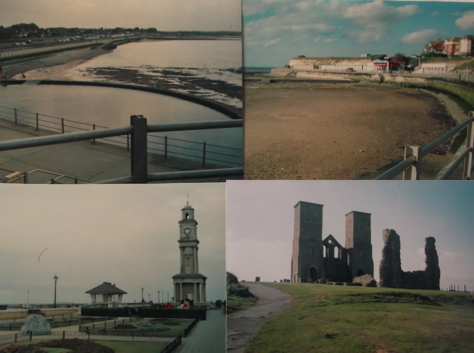
Walk 16 – Canvey Island (Essex)

Map: L/R 178
Distance: About 8 miles – this is a circular walk
Difficulty: easy - flat
Terrain: mostly paths and pavements but some marshy areas
Access: park in or near the centre of the town
Public transport – Buses from nearby areas run to the centre of Canvey

This walk requires careful navigation along the roads to and from Canvey centre. A compass in conjunction with the map may be helpful. Canvey Island (origin reputed to be – The Island of Cana’s people) is very flat and much is built on land reclaimed from the sea. It has been inhabited since Roman times and was a popular seaside resort from the early 1900s until around 1970 when cheap overseas package holidays were introduced. It is still a destination for holidays and day trips but there is also a large amount of industry, mainly related to the petro-chemical trade. The island is linked to the mainland by a bridge over Benfleet Creek.

Head to the west and walk to the Dutch Village and museum which are marked on the map.  In the 1620s a number of Dutch workers were brought here to use the skills gained in Holland and build a land wall to protect Canvey. They also drained the area and reclaimed some land which had been regularly flooded in the past. As part of the deal the 200 Dutch workers were granted a large part of land to settle. The two preserved cottages (one of which is now a museum) were part of this development. About 1/3 of the town's roads have names of Dutch origin.

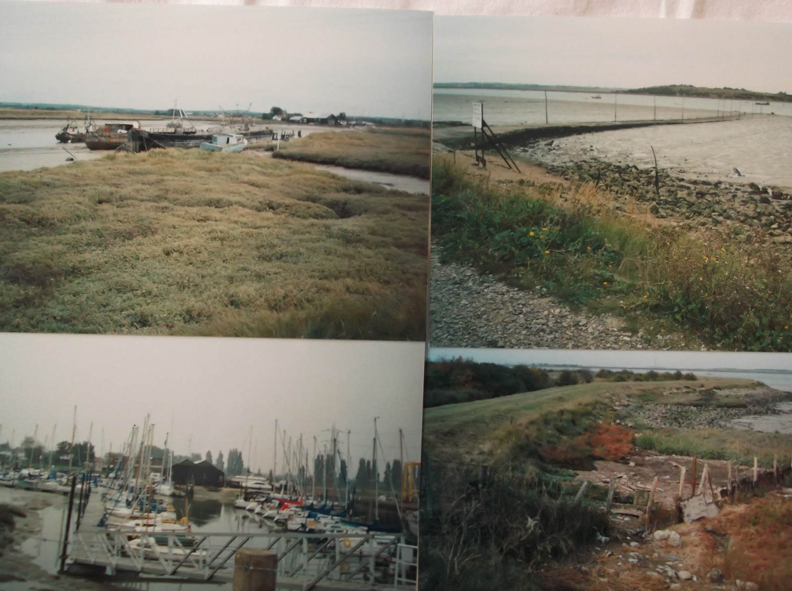
Walk in a southerly direction then along a road that goes south west past the oil refineries. Join the path here and walk westwards to the jetty at Shellhaven Point, this projects one mile into the estuary. Beyond this are the Coryton Oil Refineries. Canvey was the first site to receive liquefied natural gas. Surprisingly, there were several walkers along this stretch on a cold, foggy, February day. There is not much to be gained from walking further along this path so turn around and retrace your steps, walking eastwards. On the walk the marshy coastline is prominent and an area called Canvey Wick (a wick is a shed in which cheese is made and this was an occupation on the island) has been designated as a public community space nestled amongst the industrial surroundings.

The path follows the sea wall and passes The Lobster Smack pub. This very old pub was rebuilt in the 1700s as The World’s End and was later renamed. It is rumoured to be the hostelry made famous in Great Expectations by Dickens. It was a haunt for smugglers who would ship in and out from the sea wall.

Continue eastwards and past some rather basic looking mobile homes which have the tanks of the oil depot as a back drop. After the oil terminal is some sort of beach environmental garden in need of some TLC when I saw it. The land adjacent to the sea wall gradually becomes more pleasing with green space on one side and the metal gates of the sea protection on the wall. These were built in 1953 after the flood disaster which claimed 300 lives on the east coast including 58 here in Canvey. In just 15 minutes the sea broke through the original wall and was above the window sills of most buildings. Some people drowned in their beds, others died from exposure on the roof tops. Do not miss the flood memorial which is in the Memorial Gardens opposite the sea front; some interesting sculptures and facts are found here. Walk past the usual amusements and, if it is low tide, you will see a man made pool exposed (typical of other resorts such as Broadstairs).

Further along is Canvey Island FC ground. The club became famous in the 2000s for winning the FA trophy and defeating professional clubs to get to the third round of the FA cup. Continue in an easterly direction past Leigh Beck to Canvey Point. A footpath is marked on the map but I decided not to walk to the end when I sank down past my boot top into the marsh! Follow the footpath back along the eastern edge of the marsh towards Canvey (it follows a road/houses on the left, I do not think much can be gained from walking across the marsh to the north of this). On this final part of the walk you will be looking at reclaimed land which now has football pitches and public open space.

Navigate your way back to the centre of Canvey.

Snaps show: flood memorials; caravan park Canvey; interesting fact board; flood defences; Canvey Wick; The Lobster Smack Pub.


Sunday 12 December 2010

Walk 15 – Tilbury to Stanford Le Hope (Essex)

Walk 15 – Tilbury to Stanford Le Hope (Essex)

Map: L/R 178 (the very start is on L/R 177 but it is easy to find your way without going to the extra expense of another map.)
Distance: About 6 miles
Difficulty: easy - mostly flat
Terrain: reasonable but can be very marshy in places
Access: Park near Tilbury Fort in Fort Road and there is plenty of parking in Stanford Le Hope
Public transport – 30 minute rail service to Tilbury ferry from Tilbury centre. A bus service runs from Stanford Le Hope back to Tilbury at least every 2 hours but there may be others. Mon – Sat only.

This is the point where the walk moves to the other side of the Thames. It is a matter of debate where coastal walking ends and river walking begins. There seems to be no hard and fast rule. The tidal range doesn’t help; if this rule is followed then the walk would go through London all the way down to Teddington! Battersea and Chelsea suggest the coast goes at least this far and there was once a popular man made beach near Tower Bridge. However, I feel this is stretching the idea of a coastal walk a bit far and feel (along with one or two books) that Gravesend is a sensible place to finish and Tilbury a good place to start on the northern side.

Park in the most westerly car park (if you can) near the sea wall and just east of Tilbury Docks. Wherever you begin you should be able to walk along the sea wall path to the Worlds End pub. This used to be the ferry house for the ferry between Gravesend and Tilbury. It is a Grade 2 listed building built 17/18 centuries with timber frames. The ferry still runs.

Looking back towards the west there is the Port of Tilbury which opened in 1880 and was a major port for goods and passengers. Not as busy as before but it is still an important port. Near to here is the unwelcome edifice of Tilbury Power Station.

Continue walking eastwards to Tilbury Fort, it is very close to the path. If it is open it is worth a visit and the audio commentary provides a helpful guide. The seventeenth century fort has a unique double moat on the landward side. A variety of guns are on display including some from World War 2. The fort has never seen action but bloodshed occurred in a bizarre cricket match in 1776. A fight started between Essex and Kent players, one of the Kent team stole a gun from the guardroom and killed an Essex player; the commanding officer and an elderly invalid were also killed. The players rapidly left the scene!

The fort is the scene of Queen Elizabeth 1st famous speech to her army before facing the Spanish Armada: “I have the body of a weak and feeble woman……..”

Continuing the walk, Gravesend and, further along, Cliffe can be seen on the opposite bank with East Tilbury marshes on the land side. The banks are stony and muddy. The sea wall is ‘rich’ in graffiti some dating back to the 1980s miner strikes. I wonder if it is still there?

Further along there is a much more congenial area surrounding Coalhouse Fort. This was built in the 19th century by General Gordon of Khartoum. It was derelict but there are plans to regenerate the area. These buildings were called Palmerston Forts (Lord P. was prime minister at the time) to defend against a possible invasion by the French. Most of the other coastal forts of this time have been destroyed.

The walk continues eastwards alongside the aptly named Mucking Marshes. I diligently followed the path to the jetty near Mucking Flats and planned to walk up the track marked on the map and make my way in to Stanford Le Hope. This was a bad idea, explained underneath, so I suggest taking the path near the 079 eastings map line and going back to East Tilbury or along the roads to Stanford Le Hope.

I pursued the walk marked on the map to a small beach area south of Mucking Flats. These turned out be only just accessible and very marshy. I got through a gap in the fence on to the track which heads inland on the map. This whole area turned out to be a massive refuse tip. I sunk to my knees in stinking mud at one point. It was a Sunday so the tip was closed and the way out was blocked by barbed wire fencing against intruders from the road. Alternatives were jumping a stream (risky) or walking down a railway line (also risky) until I got to a road. I chose the latter by which time it was getting dark. My welcome at a Stanford Le Hope pub was less than warm, only when I was picked up did I realise why when my wife complained about the smell!

The author Joseph Conrad lived and wrote his books at Stanford Le Hope.

Snaps show: two views of Tilbury Fort; graffiti; Coalhouse Fort; rubbish tip at Mucking Flats.


Friday 3 December 2010

Walk 14 – Cliffe to Gravesend

Walk 14 – Cliffe to Gravesend (Medway)

Map: L/R 178
Distance: About 6 miles
Difficulty: easy - mostly flat, hilly around Cliffe
Terrain: reasonable but can be very muddy in places
Access: Road parking at Cliffe – car parks or road parking at Gravesend
Public transport – A 133 runs from Chatham to Cliffe. (Mon-Sat). Rail station and several buses from Gravesend to various destinations – the 417 operates 3 times a day between Gravesend and Cliffe and return (Mon-Sat)

A pleasant walk with a bit of interesting history at the end. 

Take the path out of Cliffe and follow the Saxon Shore Way crossing a narrow piece of land between Cliffe Pools. This is a large RSPB reserve with 235 species of birds. Unlike the last walk you are very unlikely to be on your own at this point!

Walk away from the pools and continue until you reach Cliffe Fort at the entrance to Cliffe Creek. This was built in the 19th century to defend London against invasion along the Thames. It is now owned by a local aggregate works (stone, gravel etc. used for building) and is derelict and inaccessible. The fort is also known as a site for the Breman torpedo the first effective weapon of this type and was used to defend at the fort for 15 years at the end of the nineteenth century. (Update the path here has been closed recently due to erosion - may now be open but needs checking).

Near here is a lop sided memorial stone. This marks the limit of the Thames Watermen who used to ply their trade taking goods from ships to quayside using flat bottomed barges called ‘lights’. The trade has largely died out because of the introduction of container ships.  

From the lightship at Higham Saltings you can look back to the fort although this is dwarfed by the aggregate works. The walk towards Gravesend presents a few possible hazards. Part of it can be very marshy and this makes for slow going. Do not stray from the path near the danger area marked on the map as the path is in fairly close proximity to a firing range. In addition, the walk passes through a number of industrial areas including quarries and jetties. I missed the path out to Gravesend and had to climb up a vertical ladder on the tall riverside wall with the (slightly) amused encouragement of some workmen. Across the river Tilbury power station is prominent.

One of the first landmarks approaching Gravesend (the name coming from Greve – a small wood not a burial grave) is the Royal Terrace Pier. This was built in 1844 and was often used by day trippers mainly in the nineteenth century. It was given its royal status in 1863 after Princess Alexandra arrived here to marry the then Prince of Wales.

Further along is the Port of London Authority building. The Port of London stretches 150 km. from the tidal limit of the Thames at Teddington to the North Sea. Pilot ships operate out of Gravesend guiding ships along the river.

The Clarendon Royal Hotel faces the river and was in a sorry, dilapidated state when I saw it despite being a listed building. It was built in 1665 for the Duke of York (later James 11) – Clarendon was his father in law. It became a hotel in the 1840s and was popular with aristocrats. UPDATE: 2013 - have just seen a Channel 4 programme called Four in a bed. The hotel has been completely refurbished and updated and is open for business.

Opposite this building is the Tudor Blockhouse. This is the only remaining part of one of the artillery forts built by Henry V111 to defend the Thames.

Further along at Bawley Bay is St Andrew’s Mission House. This was built by the daughter of Beaufort (the man who classified wind speeds) in 1840. It was originally set up to raise the spiritual and moral condition of the waterside community including the families living in coal hulks moored off the town. Gordon of Khartoum used it as a reading room to teach poor children.

As you walk along the riverside you will come to the Town Pier, the oldest remaining cast iron pier in the world. Thousands of tourists once used the pier to alight from London and explore the once famous Gravesend pleasure gardens.

If you have time, take a walk into town and find St George’s Church. This is where you will find the statue of Pocahontas. In 1617 she was rowed ashore and buried here. Her story is well documented and people from all over the world visit here – many claiming to be her descendants! Charles Dickens is strongly associated with the area. Musicians may like to know that Rimsky-Korsakov the composer was posted here in 1862 when in the Russian navy and wrote part of his first symphony.

This is the final part of the coastal walk before crossing to the north side of the Thames.

Snaps show: St Helen's Church, Cliffe; Cliffe Pools; the pier at Gravesend; The Clarendon Royal Hotel, Gravesend.


Friday 26 November 2010

Walk 13 - Allhallows on Sea to Cliffe on Isle of Grain/Hoo Peninsula

Walk 13 - Allhallows on Sea to Cliffe on Isle of Grain/Hoo Peninsula (Medway)

Map: L/R 178
Distance: About 10 miles
Difficulty: easy - mostly flat
Terrain: great care needed can be very muddy, marshy and can get flooded.
Access: Road parking at Allhallows on Sea and Cliffe
Public transport – A 191 bus runs from Chatham to Allhallows on Sea, a 133 runs from Chatham to Cliffe. (Mon-Sat)

CAUTION. Check the tides before starting this walk. Do not attempt if the tide is coming in  or due in over the next few hours. I nearly got stranded and got wet up to my waist. Could have been disastrous

This is a rather strange, eerie and lonely walk. It is easy to understand why Dickens used these marshlands as the atmospheric settings for some of his novels. I met just one person on this walk, a council employee who was surveying all the stiles and tracks. He had been doing it for a few days and said I was the first walker he had seen! Some of the derelict farm buildings and shepherd’s dwellings were 'creepy' and he was glad to get away from these areas.

Leaving Allhallows, walk to the west on the footpath. It is mainly along this stretch that the parts of the path have broken up and you need to walk on the beach. A pill box and other World War 2 defences can be seen on the beach. Across the river, Southend and the oil refineries near Canvey Island can be spotted. The flat featureless St Mary’s Marshes are adjacent to this part of the walk and stretch inland towards High Halstow.

Approaching St Mary’s Bay a sign on a post announces that ‘Curlews, convicts and contraband’ are in the direction of the arrow. The curlews refer to the rich bird life found here, the convicts are the prisoners who were once held in the ‘hulks’ anchored in the estuary and contraband the goods smuggled in from boats across these lonely marshes.

Further along is Egypt Bay where prison ships were once moored in the Napoleonic wars. Several ‘fleets’ or marshland creeks or ditches can be seen along this section of the walk. This area is renowned for being very cold in the winter – I can confirm this!

The sun can catch the water and make interesting photographs sometimes highlighting the debris that can be found washed up on to the shore; a keep left sign and artistic looking seaweed hanging off groynes and fences were two of the more unusual sights.

About a mile or so south of Lower Hope Point there is a short pier. I suggest you walk up the track just north of here and follow the footpath into Cliffe. This avoids duplicating part of the next walk.

St Helen’s Church at Cliffe is a large building with some grand memorials reflecting the strategic importance of the settlement (along the Thames) in 1558. Known as The Cathedral of the Marshes. An enthusiastic vicar insisted I went in and looked around - it is certainly attractive and unusual.

The (failed) building of a canal at Cliffe and the coming of the railway (now closed) boosted the village in Victorian times together with a cement works which closed in 1970. In 2002 the area was identified as a possible site for another London airport. There was much protest from wildlife groups and villagers and the idea was dropped in 2003. Recently the idea has reared its head again.

Snaps show: pier near Cliffe marshes;The British Pilot Pub at All Hallows on Sea; sign and views on walk between Cliffe and All Hallows.


Friday 19 November 2010

Walk 12 - Grain, Allhallows on Sea and Yantlet Creek on Isle of Grain/Hoo Peninsula

Walk 12 -  Grain, Allhallows on Sea and Yantlet Creek on Isle of Grain/Hoo Peninsula (Medway)

Map: L/R 178
Distance: About 8 miles
Difficulty: easy - flat
Terrain: reasonable but can be muddy on the tracks
Access: Car park at Grain - road parking at Allhallows on Sea
Public transport – Not the best. A 191 bus runs a few times a day from Chatham to Grain during the week, it goes via Allhallows which is about a mile from Allhallows on Sea (Check with Traveline for latest times)

This walk is made up of two short walks, both require backtracking. Take the path south from Grain, quite a pleasant walk to start with. Eventually you reach Grain Power Station a large oil fired blot on the landscape. (update - now demolished). Further down is a jetty where the path ends. Looking over the water Grain Tower can be spotted, this was part of a fort built to defend the River Thames in the mid 1800s. The fort has been demolished but the tower, rumoured to have secret tunnels connecting to the land, was used in both World Wars. A huge net was attached to it to prevent German U boats getting up the Thames.

Return to the starting point and carry on to the northern part of the path passing the beach at Grain. There is a commercial sand pit at the end backing on to a military range where red flags fly to warn of activity. Erosion has taken its toll on this part of the coast. All the area around here is marshland and in bygone times malaria (then known as marsh fever) was rife. Grain (Greon) means gravel. Return to starting point at Grain. Drive to Allhallows on Sea or, hopefully get a bus or possibly a taxi to The British Pilot pub.

The aforementioned pub was renamed (as far as I can tell) after a British pilot who baled out here after fighting with a German plane over the Thames. The settlement takes its name from the nearby village of Allhallows which is centred on a 12th century church. In the 1930s there was an attempt to make this place the premier resort in Europe – publicity of the time suggested that it would far surpass Blackpool. The idea was promoted by Southern Rail who built a branch line here. Unfortunately, World War 2 put paid to these plans and the railway was closed in 1961. Nevertheless, as can be seen, there is now a large holiday and caravan park.

Take the path to the east and head towards Yantlet Creek. This creek was once a fortified trade route operating from Roman times. You will come across two memorials. One is in the marsh and should be approached with caution especially as it marks the spot where an artist and naturalist drowned in 1975. It was laid by the Dickens County Protection Society. The walks around the Hoo Peninsula reflect the landscape known to Dickens and feature in many of his stories.  The second memorial commemorates the flood defences built here between 1975 and 1985 – underlining the fact that there is more to London’s flood defence than the Thames Barrier. 

Return to Allhallows on Sea.

Snaps show: container ship seen across the marshes; Yantlet Creek; Grain power station; shorelines near Grain; Allhallows on Sea.


Friday 12 November 2010

Walk 11 - Frindsbury to Hoo St Werburgh on the Hoo peninsula

Walk 11 -  Frindsbury to Hoo St Werburgh on the Hoo peninsula (Medway)

Map: L/R 178
Distance: About 6 miles
Difficulty: fairly easy – mostly flat a few hills going inland
Terrain: easy, pavement and mud/grass track
Access: Car parks at both ends
Public transport – Strood Rail Station at the Frindsbury end, bus 191 will return you to Strood from Hoo St Werburgh

Follow the footpath/cycle path to the north east through Frindsbury. Arriving at a reasonably pleasant paved area you get a good view back across Limehouse Reach to the places visited on the previous walk. The path goes inland soon after this as access to the commercial area on the bank is not possible.

Follow the path back onto the riverside until you get to Upnor Castle. This is well worth a visit. The Elizabethan castle was of great strategic importance. Latterly it was used as an armoury and explosive store. The floors are wooden so that sparks would not ignite the explosives and there is a fascinating spiral staircase. Further information can be gleaned from an audio commentary provided at the entrance.

Follow the path along until you get to a children’s boating/sailing centre. If the tide is out then the next section can be walked along the coast, if not there is an alternative route inland. Carry on past the marina at Hoo St Werburgh. Kingsnorth Power Station dominates the landscape beyond here. It is an oil/coal fired power station that was due to be closed in 2016. (Update - it has) The owners decided to build a replacement and this caused a great deal of protest, including a climate camp, from environmental groups. News came through recently that the plans have now been shelved.

Further down the path is a small airport with a few hangars. When I walked past there was a keep left sign at the edge of the grass – how did it get there and why? Further on is a view across the marshes towards the cranes, refineries and jetties near Elphistone Point. Container ships moving in and out of Sheerness on the Isle of Sheppey are a regular sight.

Return along the bank and cut back inland to Hoo St Werburgh. Hoo indicates a coastal peninsula and this village is one of several in the area to have it as part of its name. St Werburgh was the daughter of King Wulfhere of Mercia born around 640; she was a nun who lived in Hanbury, Staffs. Her body was moved several years after she died and was miraculously found to be intact. This was thought to be a sign of divine favour and her tomb became a place of pilgrimage. The church here has a unique coats of arms belonging to King James 1 and Queen Elizabeth 1 – they can be seen inside.

If you have a car it would be worth taking a trip to nearby Cooling where the unused church of St James has several small children’s graves clustered together. These provided the inspiration for the start of Great Expectations – as did the nearby marshes – setting for the horrific end of Magwitch.

Snaps show: circular staircase at Upnor Castle; the airfield near Stoke Ooze with the keep left sign; Lower Upnor looking towards the marina at Hoo St Werburgh; child graves at St James Cooling.

Friday 5 November 2010

Walk 10 Chatham to Rochester via St Mary’s Island

Walk 10  Chatham to Rochester via St Mary’s Island (Medway)

Map: L/R 178
Distance: About 7 miles
Difficulty: easy – mostly flat.
Terrain: easy but quite a bit of tiring pavement walking
Access: Car parks in Rochester and Chatham
Public transport - plentiful trains and buses to both places

This walk involves some retracing of steps. There is a lot to visit and see in the area and this would require a 2/3 day stay to fully visit the various attractions.

Leaving Chatham railway station follow the cycle path marked on the map northwards leading out of the town. You will pass the historic dockyard with its many links with British and local history; it has been here for 400 years and used extensively for boat building including Nelson’s flagship The Victory. If you decide to visit, it will need the best part of a day to do it justice. Do not miss the rope making!  There are also many connections with Dickens in the area, including in Chatham; Charles arrived when he was 5 after his father got employment here. Perhaps unfairly, the town has become associated with the origin of the word ‘chav’ although it is far from certain that this is correct. Some believe it was connected with Chatham girls and a certain style of hair and clothes, others thought it originated as an abbreviation of ‘Chatham average’. It is quite possible that there are more historic origins elsewhere.

Continue onto the more minor road that crosses to St Mary’s Island – marked as a cycle path on the map. You will pass a tall mast with a bell at the top. This was taken from a ship in 1859; from 1898 the bell was used to summon workers to the old dockyard. The structure was moved here in 2001. Near here is Dickens World, a light hearted look at Dickens characters and settings (Update - now closed).

Walk on to St Mary’s Island where you will find access to a path on the west side that goes around most of the island. Nineteenth century convicts created the island from marshland. Many had been kept as prisoners on the hulks in the Medway. Conditions were tough and this led to a revolt by 1000 convicts in 1861. When complete the area was used as an extension to the dockyard. A view of Upnor Castle (more of this on a future walk) on the opposite bank, and many moored boats, provide a pleasant outlook.

Continue around the island towards the east past many newly constructed houses of various colours. An historic river crossing point marked with a sculpture is near this development. This marks a crossing which has existed from Roman times until the early twentieth century. Follow the road and paths until you reach the bridge on the eastern end of the island, cross back onto the mainland and follow the road into Rochester.

There is much to see and do in Rochester. It was called Durobrivae by the Romans, meaning the stronghold by the bridge. Many parts of the area feature in Dickens stories e.g. the town is known as Cloisterham in The Mystery of Edwin Drood. The town museum/Dickens Centre is well worth a visit. A walk guide from the museum helps you to explore the town and spot places such as the original inspiration for Miss Haversham’s house in Great Expectations. The cathedral has an altar in the crypt dedicated to Ithanor the first English bishop. The castle with its Norman keep provides panoramic views across the area including the Medway. The audio guide is very informative.

Take a walk towards the river and bridge ( actually made up of 2 bridges). The old bridge carrying westbound traffic was originally a Victorian swing bridge but was not successful and was rebuilt in 1914. The other part carrying traffic eastwards was once a rail bridge. It is worth walking over it and looking both ways along the river. The rail bridge is impressive.

Follow the road route back to Rochester Station or car parks.

Snaps show: Rochester Cathedral taken from Rochester Castle;  Rochester Bridge; view over the Medway towards Strood; one of the ships at Chatham Dock Yard.


Sunday 31 October 2010

Walk 9 Lower Halstow to Gillingham

Walk 9  Lower Halstow to Gillingham (Medway)

Map: L/R 178
Distance: About 10 miles
Difficulty: easy – mostly flat - can be windy
Terrain: easy but can be muddy, earth/grassed paths, some road.
Access: Car - park in road at Lower Halstow village or Gillingham
Public transport – train to Gillingham, then bus from Gillingham Municipal Buildings (326/327) to Lower Halstow.

Walk through Lower Halstow village until you come to the church which is near the wharf. You meet the Saxon Shore Way here. Keeping to the westward walk towards Gillingham.

St Margaret of Antioch Church at Lower Halstow (one of 250 churches in the UK named after this saint – Antioch is in present day Turkey) is worth a look.The church is of Saxon origin; built in the 7th century, it is one of the oldest in the UK. Halstow means ‘holy place’. 

The nearby wharf, now dotted with a few small boats, was the basis of the area’s involvement with fishing and brick making. Further back in time the Romans harvested oysters here. Examples of Roman bricks and pottery have been found and some have been recycled for use in the church, including some of the roof tiles.

There now follows a rather lonely and bleak walk beside the marshes to the area called Ham Green. Mysterious pieces of rotting wood in various shapes appear in the water. As the path starts to go inland you come to a remote boatyard. The walk across land to Upchurch and then to Otterham Creek is unavoidable.

The quay at Otterham Creek was once important in local brick making. The walk takes you on to peninsula near Motney Hill. This part of the coast has several abandoned and rotting boats of various sizes. Along the walk to Bloors Wharf you get a good view of the ugly Kingsnorth Power Station on the opposite bank. (update - now partly demolished and decommissioned).

Further along is the start of the Riverside Country Park, a pleasant area to the north of Twydall near Gillingham. It is 125 acres of marsh, meadow, pond and grassland. You will soon come to a path (which is not part of the Saxon Shore Way) that leads to the end of Horrid Hill. Follow this to the end. A viewing area here identifies points in the distance and birds that can be spotted. The spit was once part of a cement factory. The name of Horrid Hill is said to have originated from the time prison ships were moored here in the Napoleonic Wars and the dreadful conditions suffered by the inmates.

Walk back to the Saxon Shore Way and continue west. The beach at Gillingham is an unlikely and pleasant surprise. Gillingham is one of the Medway Towns and is recorded in the Domesday Book. In 1667 the town was invaded by a Dutch fleet which had sailed up the river. It was a short lived occupation but one which caused great embarrassment to the Royal Navy. It became known as the Raid of Medway. Notable people from the town include Gary Rhodes (Chef)  and David Frost (TV presenter).

Finish the walk by heading inland to the town and station or car. 

Snaps show: across the river at Horrid Hill; the creek at Lower Halstow; Gillingham Beach; old boat opposite Hoo Salt Marshes.


Wednesday 20 October 2010

Walk 8 Circular walk around Chetney Marshes

Walk 8  Circular walk around Chetney Marshes (Kent)

Map: L/R 178
Distance: About 6 miles
Difficulty: easy – flat - can be windy
Terrain: easy but can be muddy, earth/grassed paths, some road.
Access: Parking in Iwade ( on 90 Easting)
Public transport: The walk could be started a bit further along at Swale Station

I parked in Iwade. Its is worth stopping for a while to admire the medieval All Saints Church in Iwade  Walk north out of Iwade then follow the footpath north eastwards to rejoin the road which is also a cycle path. On reaching the Swale follow the path north-west along the waterside.

This can be a very lonely walk. Looking back towards the bridges crossing to the Isle of Sheppey gives a firm reminder that the noise and bustle of modern life is never far away.The other way, the Isle of Grain can be seen with power station dominant.  (Update - much of this landmark was demolished in 2015). On the west bank at the far end of the Swale is Deadmans Island. Sailors who died from deadly diseases while in quarantine were buried here.

The path crosses inland and arrives near Chetney Hill. An isolation hospital (lazaret) for potential plague carriers from abroad was started here in the 18th century but not finished. The soft mud put paid to it although around £200,000 had been spent! Foreign vessels were also held in nearby Stangate Creek under quarantine restrictions.

Just before the path heads inland you will see the several rotting hulks in Bedlams Bottom. Across the water are the strangely named Barksore marshes.   

Snaps show: All Saints Church, Iwade; looking north from the Swale in the direction of Deadman's Island; rotting hulks; looking west from Chetney Marshes;


Friday 15 October 2010

Walk 7 Elmley Marshes to Dutchman’s Island and back (Isle of Sheppey)

Walk 7  Elmley Marshes to Dutchman’s Island and back (Isle of Sheppey)

Map: L/R 178
Distance:  About 7 miles return.
Difficulty: easy – flat - can be windy along The Swale
Terrain: easy but can be muddy, earth/grassed paths
Access: Car can be parked in dedicated car park on Elmley Marshes.
Public transport: Difficult. Maybe a route from Swale Station otherwise taxi from Queenborough Station. 

This is a pleasant enough walk although you will see the water only occasionally, you are not allowed to stand or go over most of the sea wall – this is a RSPB reserve and they fear that the wildlife could be frightened. Lots of sheep congregate on the path and stare at you like bouncers at a night club then run away like chickens when you approach. This is the largest area of coastal grazing in south east England.

There are ‘hides’ along the path including one near Spitend Point. I was the subject of some angry mutterings when I decided to photograph the view from in there. The flash went off and caused large flocks of birds to rush into the sky!

The coast north of Sittingbourne can be seen on most days. To the east is Dutchman’s Island, a reference, perhaps, to the short occupation by the Dutch navy in 1667. People of Sheppey were sometimes called Swampies but many consider this an insult now!

Pictures: views across Emley Marshes and sheep 'bravely' parading on the sea wall.


Thursday 7 October 2010

Walk 6 Warden to the Ferry Inn, Isle of Sheppey

Walk 6   Warden to The Ferry Inn/Harty Ferry (Isle of Sheppey)

Map: L/R 178
Distance: 13 miles approx there and back - half this if you leave a car at each end 
Difficulty: quite easy
Terrain: quite easy, mostly earth/grassed paths
Access: Car only. Car parks at Warden and The Ferry Inn.
Public transport: Train to Sheerness and bus to Leysdown on Sea (a bit further round from Warden).

Walk in an easterly direction from Warden towards Leysdown on Sea. The coast around Warden Point is inaccessible due to erosion. Prisons dominate the centre of the island.

It is a reasonably pleasant walk to Leysdown on Sea, particularly if you like mobile homes! Leysdown has been popular with Londoners and is popular because of its amusement arcades. I went here on a January day when it was deserted apart from a solitary bingo caller’s voice echoing around the street. The Sheppey Light Railway stopped here in 1903 and there were grand plans to expand the resort and build hotels. These never materialised and the railway was closed in 1950. Leysdown is the site of the first aircraft factory in the UK built by Short Bros in 1909. After a year it was moved inland to Eastchurch. The beach is mainly shingle.

A rather bleak walk (during the winter anyway) continues to Shellness. There was a somewhat remote cafĂ© further along when I went there. A group of ramshackle buildings surrounded by various objects suggest beachcombing is someone’s hobby. You will arrive at a point where you have permission to remove you clothes on what must be one of the less likely nudist beaches on the UK coast.

Shellness has a housing estate with high security and, what appears to be, exclusive access to some parts of the coast. A Roman beacon and watchtower were positioned here to warn of invasions. The area was used for similar reasons in WW2 and there are a few concrete constructions around which may be from this time. Past Shellness and walking south west there is a large RSPB nature reserve. There are good views across the Swale and back to Whistable.

After a while the path cuts inland and you arrive at the fascinating church of St Thomas the Apostle which overlooks the Swale. It is described as Kent’s remotest church. There are very few houses nearby now but the graveyard shows that this was not always the case. Several Christians make pilgrimages here to attend a mass held on the first Sunday of every month. The church was built in 1089 and added to later. It has no electricity – just oil lamps and candles. Most of the more recent burials in the 1800s appear to be the victims of drowning. Next to the church is a derelict building which was once Harty School attended by 20+ children in 1923.

Further along and dropping back down to the coast is The Ferry House Inn. The ferry was the most important line of communication to the mainland. The landlord of the inn still holds the rights to the ferry. The road to the ferry can still be seen with views across to Nagden marshes near Faversham. Talk of reviving the ferry has remained just that. The area is considered a ‘magical’ spot by some with the ever changing light.

There looks to be a shorter walk across the marshes for the return journey. I always get rather nervous about chancing these marsh walks especially during a rainy winter. I followed my tracks back to the car at Warden.

Snaps show: St Thomas the Apostle Church at Harty; Ferry House Inn; derelict building possibly part of old school; view to Shellness.


Friday 1 October 2010

Walk 5 - Queenborough to Minster (Isle of Sheppey)

Walk 5 Queenborough to Minster (Isle of Sheppey)

Map: L/R 178
Distance: 6 miles approx
Difficulty: quite easy
Terrain: quite easy, mostly earth/grassed paths and pavement
Parking: OK at both ends
Public Transport: Train to Queenborough via Sittingbourne, bus back from Minster to Sheerness station.

There is a path that comes out of Sittingbourne and follows Milton Creek and works its way round until you reach Swale Station. Part of this path was closed when I was in the area due to the building of the new bridge to Sheppey. This narrow part of the River Swale, is probably not worth the effort, especially as there is no shore access on the island until you get near Queenborough on the Isle of Sheppey so this walk starts there. The Isle of Sheppey means the Isle of Sheep.

From Queenborough station walk to the Town Quay and then to Queenborough Park. The town has strong naval and royal connections. Edward 111 had Queenborough Castle built here in 1360 for his wife Phillipa – hence the town’s name. The front here is quite pleasant with The Old House at Home pub (nice and friendly for a pub lunch and/or a drink). Outside there are seats with views across to the Isle of Grain.

Queenborough was given the right to export wool by Edward 111. Nelson took his naval exams at nearby Sheerness and was a communicant at Queenborough church - he lodged in the town’s high street. Daniel Defoe thought little of the area describing it as a ‘miserable dirty fishing town’. In World War 2 a mine-sweeping fleet was based here to protect the Thames.

All around the Sheppey, North Kent and Essex coast you are likely to hear occasional loud bangs. These may be from the military ranges on the Essex bank but it could also be the army carrying out regular controlled explosions on World War 2 bombs or mines still in the estuary.

Opposite Queenborough is Deadman’s Island; Napoleonic prisoners who were kept in ‘hulks’ on the Medway are buried here. The path goes inland to the north of Queenborough to by pass a very large dock. The walk to Sheerness, which is by road, goes past the new docks – a major facility for the import of cars and fresh produce. The old main dockyard was closed in 1960. Naval ships were repaired there for 300 years and were partly designed by Samuel Pepys. The ‘Blue Town’ area housed the dock workers. Sheerness was also the site of the Royal Arsenal until 1960. Sheerness was so called because of the bright water of the Medway.

Pop into the town to look at the iconic clock tower. Walking eastwards out of Sheerness you will see a high sea wall, built after major floods in 1952 and 1987. Many small boats assembled here before departing for Dunkirk. 

The beach between here and Minster was deserted when I walked it apart from two suited figures from the Mormon Church who tried to persuade me to watch one of their videos. What were they doing there? Notices on the sea wall warn against eating shellfish from the beach without thorough boiling in fresh water. I wondered what was being put into the sea.

There are many caravan sites, of varying quality, on the walk to Minster. At Minster Lea beach the sea was frozen in 1789 with a sheet of ice spreading across to Essex. At the furthest eastern point of Minster there is a view of Warden Point.

Minster derives its name from the monastery built in the town in 670. You can visit the Abbey Gatehouse Museum and the remaining tower. The old parish church contains Roman tiles and Norman features. Minster in Sheppey (to distinguish it from Minster near Ramsgate) is mentioned in The Old Curiosity Shop.

Snaps show: Queenborough Park; looking towards the Medway at Queenborough; interesting garden on the lonely walk near Warden point; Minster beach.


Thursday 23 September 2010

Walk 4 Faversham to Sittingbourne

Walk 4 Faversham to Sittingbourne (Kent)

Map: L/R 178
Distance: 12 miles approx
Difficulty: quite easy but can be windy and cold at times
Terrain: quite easy, mostly earth/grassed paths and pavement
Access: parking at both ends
Public transport: train links between the two towns

Leaving Faversham carry on up the east side of Faversham Creek along the Saxon Shore Way.
Although marshy and sometimes bleak, the often lonely walk has its own quiet atmosphere. The views are renowned for their variation in light.

As you turn westwards along the River Swale you will see a hide for keen birdwatchers. The nearby Oare Marshes are part of a nature reserve supporting a wide range of wetland birdlife.

Soon you will come across the old Harty Ferry landing. This used to link the shore with the Isle of Harty (which is part of the Isle of Sheppey) on the opposite bank. If the weather was calm the ferry was rowed across and had to cope with the treacherous currents in the Swale. There is a record of a ferryman having been drowned in the 1800s. The ferry men had a monopoly and were reportedly sullen, sometimes asking the passengers to help out!  The ferry was last used in 1946 having been made redundant by the building of bridges. A bascule bridge (meaning part of it can be raised using weights) at Kingsferry was followed in 1960 by a reinforced concrete bridge, then a further bridge was built recently. 

Walking past Teynham Level and the marshes inland, Fowley Island can be spotted in the estuary. A popular annual yacht race takes place around the island organised by Whistable Yacht Club.

Soon the path sweeps inland to the village of Conyer with its marina. Continue up the west side of Conyer Creek. Much of the land in this area has been reclaimed from the sea. Smuggling was supposed to be rife in the area. An interesting signpost on this bank indicates distances to Dover, Faversham, Sittingbourne and Inverness. Why the latter is there I have been unable to discover. For the record, it is 1151 miles to the latter!

Opposite the Saxon Shore Way is Elmley Island (part of the Isle of Sheppey). It was near here that James 11 was arrested by fishermen in 1688. He was reportedly on the Elmley ferry (no longer exists) when first trying to flee the country.
Some wrecks can be seen (not just boats, a car was poking out of the water when I walked it) especially at lower tides. At an area called The Lilies the two bridges to the Isle of Sheppey can be observed. The older one is lifted every day to let shipping through. Kemsley paper mill was still open and could be seen on the opposite bank when I walked this stretch. A 2’6” gauge steam railway (Sittingbourne – Kemsley) is/was on the other bank. It was open to the public but was closed when the mill land was sold. I understand it is due to reopen in 2011 when viaduct repairs have been completed. (Update - it reopened to the public in May 2011 and is a popular attraction).

The walk finishes with a walk down Milton Creek into Sittingbourne. Although the area has a history since Roman times, the walker mainly sees the more industrial, commercial and residential aspects of the town.

Snaps show: rusty hulks at Faversham Creek; the old Harty Ferry point; boats at Coyner Creek; the end of the path at Coyner Creek.


Friday 10 September 2010

Walk 3 Herne Bay to Faversham

Walk 3 Herne Bay to Faversham (Kent)

Map: L/R 179 and 178
Distance: 12 miles approx
Difficulty: quite easy but can be windy off the estuary
Terrain: quite easy, mostly earth/grassed paths and pavement
Access: Good train links

Follow the Wantsum Way which changes into the Saxon Shore Way.The flat, sometimes bleak, looking coast has pebble, mud and sand beaches. Pass through Hampton with its small concrete pier used for fishing, nearby is the yacht club. Then through Swalecliffe with its wooden holiday homes close to the sea.

Tankerton is next with its colourful beach huts. In 2005 these were up for sale at £15000 (no mains services and rather open to vandals!) This area has the rare hogs fennel, also known as sulphur weed, growing, distinguished by it's yellow flowers. The beaches here were part of a thriving copperas or green vitriol industry in the 17th and 18th century. This was extracted from stones on the beach and used to make nitric and sulphuric acid. One use was for chlorine in the textile industry.

On the east side of Whistable Harbour is the site of the first steam operated railway. The trains went to Canterbury; known as the Crab and Winkle line it was closed in 1952. A plaque gives further info.

Whistable has been famous for its oysters fro 2000 years and has the largest oyster beds in Europe. The pungent smell of the fish market dominates the area. Nonetheless, the quaint properties make this an attractive walk. There would be more of these buildings but, many years ago, a candle knocked over by a monkey in a workshop caused a major fire. On the west side of the sea front is Cushing’s View where the Isle of Sheppey can be viewed and, on a clear day, Southend on Sea. The actor Peter Cushing lived and died in the town and enjoyed this view. The local museum has further info. The diving helmet was invented in Whistable and, occasionally, there are exhibitions and demos.

As you come out of Whistable you pass the Old Neptune Inn which was locked in by ice in 1956. Go through Seasalter which takes its name from salt pans which once existed on the shore. A church stood near here serving the salt works in medieval times. The sea defence wall was built after extensive flooding and stopped the industry.

Walk beside South Cleve, South Oare and Nagden Marshes. Don’t expect to meet many people! There are old rusty hulks in Faversham Creek. Follow the path along the creek side into Faversham. The area was once the centre of Britain’s explosives industry. It is well worth a visit to the local museum to learn about this. The Shepherd and Neame Brewery (oldest independent brewer in the UK) is in the town and produces excellent beers. Tried, tested and vouched for!

Snaps show: Cushings View, Whistable; The Old Neptune Pub, Whistable; The fish market; private beach at Seasalter.


Tuesday 31 August 2010

Walk 2 Westgate on Sea to Herne Bay

Walk 2  Westgate on Sea to Herne Bay (Kent)

Map: L/R 179
Distance: 9 miles approx
Difficulty: quite easy, a few hills
Terrain: quite easy, mostly paths with some earth trackway and a few slopes
Access: Parking at both ends
Public transport: Good train links

Continuing on the Thanet Coastal Path which passes through Epple Bay, Birchington on Sea and Gresham Bay. It’s a half mile or so inland to Birchington village (it feels more like a town). The artist Dante Rossetti is buried in the local church yard and the Powell Cotton Museum contains several displays of stuffed animals acquired by Major Cotton on his trips to Asia and Africa in the 19th century.

Minnis Bay is a popular spot especially for surfers. It can be cold and windy on this coast and loud bangs can often be heard from the military areas opposite on the Essex coast.

Look out for the strangely named Plum Pudding Island and Coldharbour once the site of an ancient harbour. The two towers of Reculver can be seen clearly from here.

It is worth spending a short time at Reculver. This contains the remains of a Roman fort within which are the ruins of a medieval church. The fort was built to guard the River Wantsum which was much wider in Roman times and separated the Isle of Thanet from the rest of Kent. The church, like the fort, has suffered from erosion and was abandoned in the 18th century to be rebuilt a few miles inland. It has a certain eeriness when darker and legend has it that babies can be heard crying.......excavations in the 1960s resulted in the find of infant skeletons!

The visitor centre in the nearby country park offers plenty of information about Reculver including its use as a testing area for the bouncing bombs of Barnes Wallis.

A walk across the cliff-top to Herne Bay reveals further examples of erosion. On the outskirts of Herne Bay is the Kings Hall Theatre looking out to sea. Parts of Herne Bay were used for the filming of BBC's Little Britain including the sea front and The Bun Penny Pub.

Herne Bay is not really a bay at all but a straight pebble beach. The end of the pier has been separated from the rest since 1978 when the middle section was destroyed by a storm. The seafront is at risk from flooding at times.

The resort, originally a farming and fishing community, grew in the 19th century when investors built the promenade and pier – the coming of the railway and the London steamships, which used to stop at the end of the old pier, also helped its growth. Look out for the seafront sculptures, the north pole sign on the Divers Arms and the impressive clock tower.

Snaps show: Minnis Bay; Westgate Bay; Herne Bay front; Reculver Towers.


Monday 23 August 2010

Walk 1 Broadstairs to Westgate on Sea

Walk 1 Broadstairs to Westgate on Sea (Kent)

Map: L/R 179
Distance: 7 miles approx
Difficulty: quite easy, a few hills
Terrain: easy
Access: car parking at both ends
Access: Good train and bus links.

The south side cliff promenade offers a good view of the attractive front at Broadstairs. Variety of buildings, sandy beaches and harbour.

Morrellis is a famous ice cream/coffee cafĂ© with an interior redolent of the fifties/sixties – on the road parallel with the cliff top.

Dickens spent many holidays here and a few plaques around the town show where he wrote parts of various novels. One wag in York Street has put up a sign saying that: “Dickens did not live here”. The Dickens Museum is further down from Morrellis. Dickens got the inspiration for Betsy Trotwood in David Copperfield from Mary Pearson who lived here. She is said to have insisted on her right to stop the passage of donkeys in front of her cottage.

Up on the east cliff is a large grey bricked building looking out to sea. Dickens stayed here for longer periods when it was known as Fort House (now Bleak House). When you walk past the house you will see the room he worked in jutting out overlooking the treacherous Goodwin Sands (known by sailors as the ship swallower and widow maker). Many wrecks here, infact the largest concentration of wrecks in the world, and an inspiration to some of the sea tragedies and rescues in Dicken’s books. It was a tradition to play cricket on the sands once a year, revived in 2006 by the Coast TV programme - who had to be rescued by the local lifeboat! Some roads and businesses in Broadstairs are named after Dicken’s characters. There used to be a shoe shop (oddly) called Smike’s. There is a Dickens Festival every summer.

Edward Heath (bust in the local library) and Oliver Postgate of Clangers fame are both associated with the town. A blue plaque showing where the Bagpuss creator lived is in Chandos Square off the seafront. The town is also host to a large folk festival every August.

Further along is Harbour Street with its 16th century stone arch. This used to have wooden doors on it to protect the town from the sea. On the right, before the arch, is one of the smallest cinemas in England, holding just 100 people.

John Buchan wrote The Thirty Nine Steps when living on the East Cliff at Broadstairs. The steps that inspired the title were here.

At North Foreland is one of the last manned lighthouses in the UK. Closed in 1998 it is open to the public at times.

Joss Bay is named after a local smuggler - Joss Snelling who was active in the area.

Kingsgate Bay has interesting rock erosion including an arch. On one side is the Captain Digby Pub, on the other, Kingsgate Castle (now flats) the home of Lord Avebury (died 1913) – he instigated bank holidays so hooray for him!

Botany Bay has further erosion features including stacks.

The walk to Palm Bay on the cliff tops is pleasant although the smell of seaweed and the sewage works can detract at times.

Cliftonville used to be a major holiday resort. Now it is in sad decline, as are parts of Margate. At Fort Hill on the cliff top you can see Napoleonic cannons originally used to repel French and Spanish raiders. Further along is the Walpole Bay Hotel – you can visit the living museum here at times. The Grand Hotel is now apartments and some of the ex B and Bs look rather scruffy. Take a little detour from the front to the Eastern Esplanade and you can find the Tom Thumb Theatre which has the smallest stage for public performance in the world.

Past the Lido (no longer used) is the controversial costly Turner Gallery part of the regeneration of Margate. The nearby main sands are still attractive - the light from the sky was admired by Turner. Tracey Emin was brought up and lived in Margate; she still visits and has produced a neon pink message attached to Droit House near the sea front.

Margate was well known as a fashionable watering place for pursuing medicinal cures. No longer as popular. There was once a pier at Margate which was the drop off point for London eastenders who arrived on hoys (cargo ships). There are still some interesting buildings including the iconic clock tower but others are in sad neglect. The classic bathing machine was designed in Margate.

Dreamland, once a major ride attraction, was severely damaged by fire although it was already in decline. It has recently been revived with mixed success.

On the way out of the town the lifeboat statue commemorates the loss of life on the Goodwin Sands. Nearby the Nayland Rock Hotel (in better times) accommodated the wedding of Mick Jagger of the Rolling Stones.

At Westbrook, near the cliff edge, the old Royal Sea Bathing Hospital, has been turned into flats. On the sea front is Strokes mini golf - home to the British Open of this (sport?) in 2007 and 2008. St Mildred’s Bay and Westgate Bay are overlooked by apartments and houses. Pleasant without being stunning (in my view).

Snaps show: Broadstairs; Clock Tower, Margate; Bleak House, Broadstairs; Royal Bathing Hospital (now apartments), Margate; Lifeboat memorial, Margate.