Total Pageviews

Tuesday, 28 July 2015

Walk 136 Plymouth (Devon) to Saltash (Cornwall)

Walk 136 Plymouth (Devon) to Saltash (Cornwall)

(Second leg of English coastal walk – Broadstairs to Lands End)

Map: L/R 201
Distance: 10 miles or 15 km approx
Difficulty: easy
Terrain: mainly roads
Access: Parking at both ends
Public transport: Trains between Saltash and Plymouth. Plenty of buses as well.

This walk involves some self-navigation on back streets and some walking along main roads which can be a bit tedious at times.

Start from Plymouth Aquarium. The walk from here can be via the footbridge at Sutton Harbour or along the road and past Lockyers Quay. Walk round the harbour and look out for the poles with fish sculptures at the top. These are near The Mayflowers Steps – many famous voyages left from here including The Pilgrim fathers to the USA in 1620 and in 1583 Sir Humphrey Gilbert sailed to claim Newfoundland for Queen Elizabeth 1st.

Alongside the quayside, near The Mayflower Steps, look out for two restored ships' cannons. These are from 19th century ships and are classified by the weight of the cannon balls they fired, in this case 24 pounders.

Just before getting to the Hoe is the Royal Citadel with its cannons poking over its 70 foot high walls. It was developed in the time of Charles 11 to counteract the threat of a Dutch invasion in the 1660s. It is still occupied by the military and if you are lucky you might be there on the day of a conducted tour.
Continue around to Plymouth Hoe and its iconic lighthouse. A park extends around the hoe and dates back to the medieval period when the first settlements occurred nearby – long before Francis Drake was supposed to have played bowls here waiting for the Spanish Armada in 1588. The Victorians created the park as it is today and they created a pleasant place to enjoy the panoramic view. If you have time you can go up Smeaton's Tower. He designed this lighthouse which was erected on the Eddystone Rock between 1756 and 1759. It was relocated to the Hoe in 1882 and on a clear day you can see its replacement out at sea.

The next stop is Western King Point near to Devils Point. Here there is a good view back to The Hoe. One of the grimmest parts of Plymouth's history is the trade from the 16th century involving Sir William Harvey. Manufactured goods were exchanged for African slaves who were then transported to the colonies.

Navigate around to The Great Western Docks where a waterfront walkway has been reclaimed. Look out for the plaques from past local machines, cranes and rail bridges on the roadside walls. In this area is The Royal William Yard with its impressive gateway and clock tower established by William 111 in 1691. Sorry for the imprecise directions but I wandered around the area to look for these landmarks.

Most of the walk from here to The Tamar Bridge is along the main road because there is no access to the naval dockyards and barracks. Just south of the Tamar Bridge is an area called Riverside. The memorial park here marks the point where members of the US Army left for the beaches of Normandy Hill on D Day in 1944.

Walk up on to the Tamar Bridge to cross to Saltash. This was opened in 1961 and when it opened it was the longest suspension bridge in the UK. It was the first bridge in the world to be widened using cantilevers - from 3 to 5 traffic lanes. About 40,000 vehicles use the bridge every day. Alongside the road bridge is Brunel's rail bridge which was opened in 1859 and considered to be one of his great achievements.

There are several things to look out for in Saltash. In the High Street is H. Elliott's old shop. It has been there since the start of the 20th century. The original owner's son, Frank, disagreed strongly with decimalisation and business rates in the early 1970s and stopped trading. He asked for the shop to be preserved in its original state and kept as a museum. It can still be visited but times of opening need to be checked.

A little way down the hill between Saltash and its waterside is Mary Newman's cottage. Francis Drake married her in 1569 – he was 24 and she was 17. They became Mayor and Mayoress of Plymouth after Drake was knighted in 1580. Sadly, she died from smallpox in 1583. The Grade 2 listed building is opened at certain times in the summer.

Continue down to Waterside. Look out for the artwork, especially the mural designed by a local artist which pictures significant events in Saltash. You will not miss the Union Pub with the huge Union Jack painted on its front. The street here used to be known as Pickle Cock Alley because of the shellfish that were sold from open windows. For 70 years from 1858 a ferry operated from the Waterside.

Before you leave Saltash look for the life sized sculpture of Isambard Kingdom Brunel. A photo opportunity!

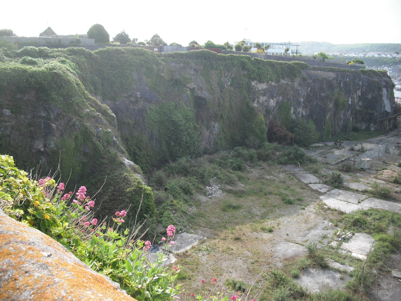
Photos: Saltash Waterside -The Tamar Rail Bridge with the sculpture of Brunel in the foreground; H Elliott's preserved shop in Saltash; the gatehouse at Royal William Yard, Plymouth; some of the plaques on the wall at Great Western Dock. 


Wednesday, 22 July 2015

Walk 135 Wembury to Plymouth (Devon)

Walk 135 Wembury to Plymouth (Devon)

(Second leg of English coastal walk – Broadstairs to Lands End)

Map: L/R 201
Distance: 13 miles or 22 km approx
Difficulty: moderate
Terrain: coastal path and roads
Access: Parking at both ends
Public transport: Buses run from Wembury to Plymouth. This walk finishes at the aquarium – there are plenty of buses around the Plymouth city area.

Walk down to the coastal path from Wembury. Look out for The Marine Centre where you can learn about the local rock pools and what can be done to preserve them. Walk around Wembury Point to Heybrook Bay.

In 1956 Heybrook Bay was the site of the Royal Navy's chief gunnery school, HMS Cambridge, which had firing ranges near the village. It was closed in 2006 and the National Trust has worked hard to reinstate a natural landscape including demolishing the buildings. Much of the area along this coast is a European Special Area of Conservation because of the huge variety of marine plants, animals fish and birds.

Follow the path around to the picturesque Bovisand Bay. Opposite here, out in Plymouth Sound, is Plymouth Breakwater. This structure is 1560 metres long and 65 metres high and 4 million rocks were used in its construction in 1812. It was built to provide safe anchorage for the British fleet in the Napoleonic Wars. The lighthouse at the end was built in 1841. Near to the breakwater is a round fort built in 1865. It was armed with cannons but was disarmed well before World War 1. Since then it has been used as a signal station and a military training school.

The walk through Staddon Heights and towards Mount Batten provides good views of the Sound and the various vessels making their way in and out of Plymouth.

Nearer to Mount Batten there is a good view of Drake's Island. Originally this was called St Nicholas Island after the chapel there. It has only consistently been called Drake's Island in the last 100 years or so. Drake sailed from here in 1577 and in 1583 was made its governor. From 1549 it was fortified against the French and the Spanish with barracks on the island for 300 men. In 1963 Plymouth Council opened a youth training centre there.

After Jennycliff Bay there is a short climb to some seats at the top of Dunstone Point providing a panoramic view of Plymouth and the sea. After resting here continue to Mountbatten Headland where Mountbatten Tower is prominent.

This tower was thought to have been built between 1646 and 1652 probably in response to a threat of war from the Dutch. It was named after William Batten who had command of the Parliamentary Navy during the Civil War. It is built of local limestone with walls about a metre thick. Its last known use was as a coastguard observation post during the 19th century.

Near here was an RAF station for seaplanes in the Second World War based on an earlier base in the First World War. Look out for the memorial to RAF Mountbatten personnel killed between 1917 and 1992.

The route continues through the bustling Mountbatten Centre which is a major provider for outdoor adventurous activities. The stretch of water here is known as the Cattawater and is where the River Plym merges with Plymouth Sound. A water taxi can usually be seen going between this point and Mayflower Steps in the main part of Plymouth.

Further round is Turnchapel a rather unexpectedly quaint old fishing village. If you fancy a pint of real ale The Clovelly Inn may well be your stopping/resting point. Continue around the path and inlet to Turnchapel Hard. You may spot the memorial here dedicated to the embarkation of the US army to spearhead the Normandy Landings on D Day. The road was reinforced to carry the US tanks and personnel.

The path passes through Hooe Lake where a notice states that this is the hub of cross country paths and trails. Continue around to Laira Bridge where there are good views of the River Plym.

From here the path, called The Coxside Trail, winds its way round to Plymouth aquarium. A lot of this area was in the process of regeneration from a former industrial base when I walked it. In an area called Stonehouse there is a plaque which explains that in 1776 a cave was found which contained prehistoric bones. Further remains were found in the 19th and 20th centuries including humans, rhinoceros, lions and hyenas.

Continue on to The National Marine Aquarium which is the UK's largest and contains over 70 species of shark.

Photos show: a view of Heybrook Bay; a view from near Dunstone Point across to Plymouth; redevelopment alongside the Coxside Trail.


Sunday, 12 July 2015

Walk 134 Mothecombe near Erme Mouth to Wembury (Devon)

Walk 134 Mothecombe near Erme Mouth to Wembury (Devon)

(Second leg of English coastal walk – Broadstairs to Lands End)

Map: L/R 202 and 201
Distance: 12 miles or 20 km approx
Difficulty: quite strenuous
Terrain: coastal path
Access: Parking at both ends
Public transport: Buses run from Wembury to Plymouth. Occasional buses run from Battisborough Cross near to Mothecombe. Check with Traveline. The water taxi is required between Noss Mayo and Warren Point is seasonal so check on South West Coastal Path website for details.

Walk down the hill from Mothecombe on to the coastal path which runs alongside the estuary of the River Erme. There are a number of rocky coves and isolated beaches on this walk.

After a couple of miles is the very distinctive St Anchorite's Rock. This is a well known point for climbers. As far as I can find out there is no St Anchorite but an anchorite is a religious hermit so maybe one lived here.

Soon there is a good view of Stoke Beach and Stoke Point. On the way to Stoke Point are some strange fortifications and a separate path leads to the church of St Peter the Poor. Fisherman built this in 1226 and it is now a ruin.

Continue round to the estuary of the River Yealm. The Noss Mayo ferry/water taxi runs three or four times a day – out of season and in bad weather it may not run. Check first.

After leaving the ferry the walk continues to Wembury. The triangular shaped uninhabited island called The Great Mewstone can be seen clearly on this walk.

Wembury is well known for its surfing and rock pools. It is mentioned in The Forsyte Saga by Galsworthy and reflects the author's interest in his own origins and descent through a long line of Wembury farmers. The parish church sits prominently on the cliff side overlooking the sea, it is dedicated to St Werburgh who was a nun in the 7th century.

Photos show: St Anchorite's Rock; the ferry taxi at Noss Mayo/River Yealm


Thursday, 25 June 2015

Walk 133 Thurlestone to Bigbury-on-Sea and beyond (Devon)

Walk 133 Thurlestone to Bigbury-on-sea and beyond (Devon)

(Second leg of English coastal walk – Broadstairs to Lands End)

Map: L/R 202
Distance: 10 miles or 18 km but this depends on how far you walk round and the extent to which Burgh Island is explored.
Difficulty: moderate to challenging – cliff path, some steep climbs
Terrain: coastal cliff path
Access: Parking at both ends
Public transport: As far as I can see this is not possible. Taxis one way back to a car seems the only option. A ferry is required to cross the River Avon during this walk.

Walk from Thurlestone to the coastal path – the path passes across a golf course or you can go along the road. There are some attractive sandy coves on the walk to Bantham.

Look out for the impressive boat house at Bantham which looks out on to the River Avon – pronounced locally as 'Awn'. To get to the other side you will need to use the ferry (one friendly man in a small boat with an outboard motor). It runs for an hour in the morning 10-11 and 3-4 in the afternoon except for Sundays. It is also seasonal, operating between April and September. As there is no alternative way of getting across it would be sensible to check before starting the walk: 01548856347 or 07811385725.

Once over the other side follow the path around to Bigbury-on-Sea with its large sandy beach. At the start of the twentieth century it was just a few fisherman's cottages but is now a popular destination particularly for those interested in water sports or for visiting Burgh Island opposite.

Opposite to Bigbury is Burgh Island which can be walked to via a causeway or, when the tide make this too difficult, by sea tractor. The island has strong associations with Agatha Christie. The prominent art-deco hotel provided a background to several of her novels including the Poirot story 'Evil under the sun'. Famous visitors to the hotel have included Churchill, Noel Coward, The Beatles
and The Duke of Windsor with Mrs Simpson. The island was completely cut off in World War 2 because there was a the Germans would use the causeway to attack the mainland. The ruin on top of the hill, which can be walked up to, was once a chapel and later became a hewer's hut. A man was employed to raise a hue and cry to alert local fishermen when a shoal of fish was spotted. In the 1880s it was said that 12 million fish could be caught in a day but they suddenly stopped coming. Who can blame them? If you fancy a drink try The Pilchard Inn which dates from 1336 and is said to be haunted by a smuggler shot dead on the island.

Back on the main land continue the walk to Challaborough - its attractive beach is very popular with surfers because of the sea's powerful waves.

Photos: The boats house at Bantham; the sea tractor to Burgh Island


Thursday, 11 June 2015

Walk 132 Salcombe to Thurlestone (Devon)

Walk 132 Salcombe to Thurlestone (Devon)

(Second leg of English coastal walk – Broadstairs to Lands End)

Map: L/R 202
Distance: 12 miles or 20 km.
Difficulty: moderate to challenging – cliff path some steep climbs to coves - allow plenty of time.
Terrain: coastal cliff path
Access: Parking at both ends
Public transport: Difficult. Possible to get from Thurlestone to Salcombe with a change of buses but only 3 times a day. To get to Salcombe you may need to use the foot ferry which runs all year, every half hour or so.

Start near the lifeboat station at Salcombe. Across this stretch of water in 1889 and anchored off the sand bar, Tennyson was inspired to write the poem “Crossing the Bar”. In the 1860s Salcombe 'fruities' were often seen on the water. These were a type of schooner that traded in citrus fruits from the Azores. The estuary is still popular with yachts and other small craft.

Salcombe has a number of quaint streets and it is worth a short time looking round these. Shipbuilding was associated with the town for many years, especially in the 19th century. The introduction of steam driven steel hulled craft caused shipbuilding to move away to more industrial areas.

Walk south out of Salcombe near to the remains of Salcombe Castle. This fort was the last one in England to hold out for the Royalists. It was built by Henry 8th but renamed Fort Charles in the Civil War. Continue along through North and South Sands and to the ragged rocks at Bolt Head. At Starehole Bay the last working tall ship was wrecked in 1936 – it took two months before she broke up and her rotting cargo of corn could evidently be smelt for miles around.

A couple of miles or so further along is Soar Mill Cove. This is renowned for its ship wrecks. In 1887 a tea clipper was wrecked here and a wall of tea 3 metres high was washed on the beach. Look out for the Ham Stone off the shoreline, especially if you like a variety of seabird life.

The path continues along to Bolberry Down. Near here the discovery of flint tools indicates a significant prehistoric settlement. This part of the walk is challenging and a different route is available for those who prefer an easier route.

Bolt Tail provides a panoramic view to the west across Hope Cove to Inner and Outer Hope. In 1760, HMS Ramilles was dashed on the rocks below and about 800 sailors died.

Quaint thatched buildings feature at Hope Cove. The area had a reputation for smuggling and the plundering of wrecked ships. In 1588 the San Pedro el Mayar, the hospital ship for the Spanish Armada, got wrecked on nearby rocks. Forty to fifty of the survivors were initially sentenced to death but were castrated instead and returned to Spain. Wreckage from this ship apparently still gets washed ashore – occasionally gold and silver appear.

The walk ends along a path inland to Thurlestone. Look out for the 'Stonehenge like' Thurlestone Rock on the shore as you approach Thurlestone.

Thurlestone rock and nearby beach.


Thursday, 14 May 2015

Walk 131 Torcross to East Portlemouth (Devon)

Walk 131 Torcross to East Portlemouth (Devon)

(Second leg of English coastal walk – Broadstairs to Lands End)

Map: L/R 202
Distance: 14 miles or 24km approx
Difficulty: moderately strenuous – cliff path
Terrain: coastal cliff path
Access: Parking at both ends
Public transport: Difficult. Getting to Torcross is possible by bus. The best way is to start early and get a ferry across to Salcombe where there are transport links.

Starting at Torcross follow the coastal path to Beesands. This was once a very busy fishing village which now concentrates on lobster and crab; the local pub uses this local produce in its food. Follow the sea wall along – this was built in 1979 after a severe storm caused damage.

About a mile and a half further is Hallsands. This was a thriving fishing community until its evacuation in 1917 during a severe winter storm. It is believed that the settlement was made more vulnerable when foreshore shingle was taken away for building at Plymouth dockyards. From here the path winds its way round to Start Point.

The low headland here gets its name from the Anglo Saxon 'steart' meaning tail. As a result of many shipwrecks Start Point lighthouse was built in 1836. It is accessible from the coastal path and is worth a look because of its battlemented parapet which reflects the Gothic architecture at the time it was built. It is now automated.

Continue the walk around Lannacombe Bay to Lannacombe Beach. This is advertised as having good sand for building castles in the unlikely event you have time for this. Look out for the exposed rock formations.

The next major landmark is Prawle Point, the most southerly point of Devon. Look out for the prime beef cattle near here which have replaced the cauliflowers (renowned in their time). The 'look out' at the top of the point served as a Lloyds signal station and a Royal Navy signal station until the coastguard took it over in 1902. It was closed in 1982 until taken over by the National Coastguard Institution in 1998. This is a voluntary organisation concerned about the loss of life that could result from the closure of coastguard stations.

The craggy walk around to East Portlemouth includes quaintly named features such as Gammon Head, Ham Stone, Pigs Nose, Shag Rock and The Bull.

Continue round to Mill Bay, the ferry and East Portlemouth. It was this stretch of water over to Salcombe on the opposite bank that Tennyson was inspired to write 'Crossing the Bar'. (The bar referring to the bar of sand at the entrance to the harbour).

Photos show: Start Point and lighthouse; Prawle Point; Salcombe from Mill Bay.


Saturday, 11 April 2015

Walk 130 Dartmouth to Torcross (Devon)

Walk 130 Dartmouth to Torcross (Devon)

(Second leg of English coastal walk – Broadstairs to Lands End)

Map: L/R 202
Distance: 12 miles or 20km approx
Difficulty: moderate – mixture of climbs and flat
Terrain: paths, some road
Access: Parking at both ends
Public transport: 93 bus goes to and from Dartmouth/Torcross every hour in the week

This walk can be started at Kingswear and one of the ferries taken across to Dartmouth or from Dartmouth itself.

In the centre of Dartmouth is the square lagoon surrounded by old buildings which make the area attractive and reflect its history. Look out for the 17th century Butterwalk. Further back up the River Dart, just outside the town, is the Royal Naval College.

Richard the Lionheart's armies set off for the Crusades from here in the 12th century. The town was twice under attack from the French during the 100 years war in the 14th century. After this a huge chain was placed across The Dart to prevent such raids. In 1620 the Mayflower made an unscheduled stop at Dartmouth for repairs to her escort ship 'Speedwell'. Over the centuries merchants have traded English wool for wine from Bordeaux.

On the walk south out of Dartmouth is Bayard's Cove Fort built in 1534. It was to protect the river but it has been suggested that the gun embrasures or openings faced the wrong way!

Just before Dartmouth Castle is the ancient church of St Petrox or St Petrocus. This is one of 17 churches dedicated to him in Devon. He lived in the 6th century and settled in Cornwall, founding a monastery at Padstow.

Dartmouth Castle looks out over the estuary and was built between 1480 and 1500 to protect the harbour against raids. The castle was the first one in the country to be designated for artillery.

The walk continues around Blackstone Point where there are some good views to the east and west. Soon after Compass Cove the path goes inland, then along a road to Stoke Fleming before returning to the coast just before Blackpool Sands. A bigger contrast to the other Blackpool Sands is hard to imagine! The coast here is surrounded by pine and other woodland. The pleasant, privately managed beach, had been awarded the Blue Flag (when I walked there).

The walk to Strete is via some steep terrain. There was once a coastal village near here called Strete Undercliff (famous for smugglers) which was swept away in the late 1700s.

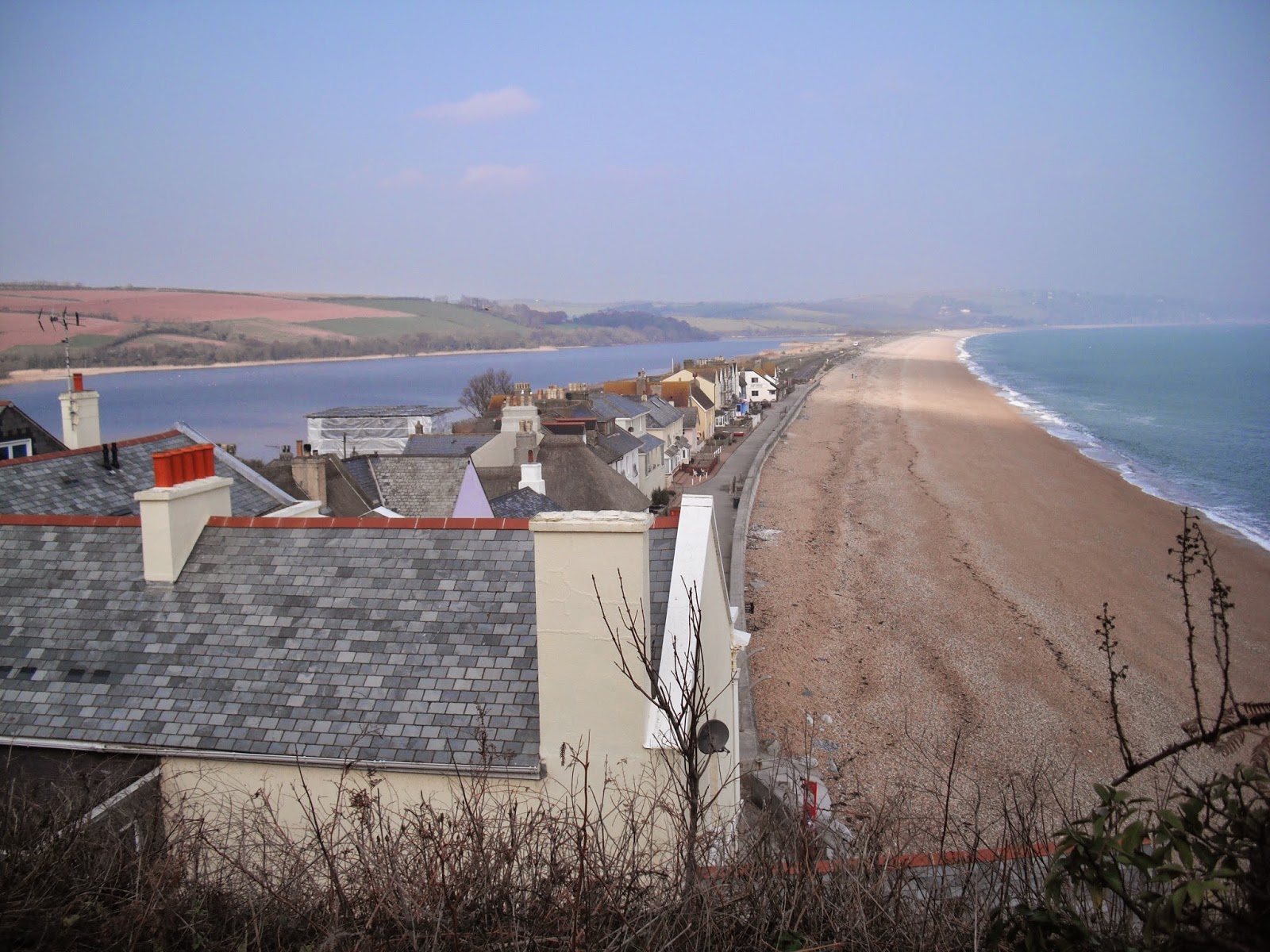
The rest of this walk is flat alongside Slapton Sands on one side and Slapton Ley on the other. The Ley is the largest freshwater lagoon in the south west. It is 1.5 miles long and is a national nature reserve of special scientific interest. The beach here is comprised of tiny red pebbles. This whole area is very vulnerable to erosion including the road which has been rebuilt in the last few years.

Look out for the obelisk which commemorates the area as a practice ground for American D Day forces in 1943. The villages (about 3000 people) near here were evacuated for these practices (including their livestock) for about 12 months. The obelisk memorial was presented by the USA authorities. Also watch out for the Sherman tank which was used in the practices – it was abandoned in the water and recovered and restored in the 1960s.

The walk finishes at Torcross.

Photos show: Slapton Ley and sands; The Square Lagoon, Dartmouth; Dartmouth Castle.