Total Pageviews

Wednesday, 3 October 2012

Walk 79 Sandwich to Dover (Kent)


Walk 79          Sandwich to Dover (Kent)

(Second leg of English coastal walk – Broadstairs to Lands End

Map: L/R 179
Distance: 14 miles or 22km.
Difficulty:  Moderate, some climbs
Terrain: footpaths and pavement
Access: Parking at both ends
Public transport: Trains to Sandwich and Dover to surrounding towns.

Sandwich, with its riverside, timber framed buildings, old archway and connections with Thomas Paine is well worth a stroll around. It was one of the original cinque ports but the harbour silted up in the 18th century and its importance diminished. It was attacked by the French in 1457 and ever since this time the mayors have worn black robes in memory of the many residents killed during the raid. I tried a sandwich in a pub here which claims to have the original ‘open’ format. The story goes that the Earl of Sandwich could not leave the table during a long gambling session so he put beef with his bread - hence the sandwich.

Follow the path out from the car park and alongside some fields before starting on the route across St George’s golf course. To avoid flying golf balls and the anger of serious golfers keep strictly to the marked path. The British Open is held here every nine years and for James Bond fans may be interested to know that it is here that he played golf against his enemy in the film Goldfinger.

After the trek across the golf course you emerge at Sandwich Bay. It is usually very quiet along here partly because vehicles have to pay a toll to pass through the exclusive Sandwich Bay Estate. Many of these impressive houses can be seen on the walk towards Deal. As you enter Deal watch out for the (few) remains of Sandown Castle. This was built as a coastal fortification by Henry V111. Further along are some interesting old buildings looking out to sea – these include a 1623 Tudor Cottage. The Royal Hotel has a plaque announcing that Lord Nelson and Lady Emma Hamilton ‘visited’ here in 1801.

Ramsgate can be seen from Deal Pier on a clear day. It is 1000 feet long and is used mainly for fishing although a bar/café at the far end is good reason to walk its length.

Continue the walk past the fishing boats and further attractive buildings. The distinctive Time Ball on top of its dedictaed museum is worth a closer look and visit (if open). This tower once enabled ships setting off on a voyage to check their chronometers with GMT. The black ball was dropped at 1 p.m. by electrical current sent from Greenwich.

Further along is Deal Castle built by Henry V111 to protect his fleet when anchored nearby. It is built in the shape of the Tudor Rose and is open to the public.

On the way out of Deal and into Walmer look out for a bandstand on the grass between the promenade and the road. This has plaques for the eleven bandsmen tragically killed by an IRA bomb in 1989. Alongside the coastal path is a plaque celebrating the first Roman landing in Britain – it features an engraving of Julius Caesar.

Further along, Walmer Castle can be seen set further back from the path. This castle was a favourite of the late Queen Mother who was The Lord Warden. Previous holders of this post include the Duke of Wellington (who died here) and Winston Churchill. Well worth a visit.

The walk continues past the unspoilt village of Kingsdown and The Zetland Arms which faces the sea – a great place to stop for a break. The path from here goes up on to the cliffs. One significant landmark  before getting to St Margaret’s at Cliffe is the memorial to the Dawn Patrol which guarded the English Channel from 1914-1919.

St Margaret at Cliffe with its stunning sea front is a popular place to start cross channel swims – the French coast is at its closest here (22 miles). Noel Coward once lived in the village and later rented the house out to Ian Fleming. The author was an ornithologist and named James Bond after a writer of books on birds.

The cliff walk gives great views out to the channel which is the busiest sea lane in the world. Most of this area is owned by the National Trust and includes South Foreland Lighthouse (open to visitors) – the first lighthouse to use electricity.

The path gives good views of Dover Castle – a must to visit with its Norman connections, medieval tunnels (spooky) and wartime tunnels. The path drops down into Dover with a good view of Dover Docks.

The walk finishes when the road near the docks is reached.   
Snaps show: the remains of Sandown Castle; the time ball tower in deal; entrance to Deal pier; St Margaret at Cliffe.


Sunday, 23 September 2012

Walk 78 Broadstairs to Sandwich (Kent)


Walk 78          Broadstairs to Sandwich (Kent)

(Second leg of English coastal walk – Broadstairs to Lands End

Map: L/R 179
Distance: 10 miles or 15km. approx..
Difficulty:  Fairly easy
Terrain: footpaths and pavement
Access: Parking at both ends
Public transport: Trains from Broadstairs to Sandwich – change at Ramsgate

Update - parts of this walk have improved recently with footpath instead of road walking.

Start at Broadstairs sea front. Along the cliff promenade is the ‘retro’ ice cream and coffee café called Morrelli’s. The fifties/sixties décor is unspoilt and has been recommended as a place to visit in the national press over recent years. Fort House (now named Bleak House) was visited by Dickens for his summer holidays and can be visited (update - not open for visiting in 2016). His desk and chair overlook the Goodwin Sands and it is where he wrote some scenes from his novels. Dickens also stayed in other buildings in the town and plaques mark these places e.g. The Albion Hotel. One wit has placed a notice on his house in York Street saying ‘Dickens did not live here’. A festival is held every summer to celebrate Dickens connection with the town.

Turn right out of Morreli’s and head south. You will notice a field and bandstand on your left. These are used for various events and form one of the venues for the large and very successful Broadstairs Folk Festival which is held every August. Over the cliff is the main beach, Viking Bay, so named because the Vikings are thought to have landed here.

Follow the cliff promenade to Louisa Bay. The large building behind here used to be the Louisa Bay Hotel which is now fitted out as apartments. There is a choice at this point – you can either walk on the lower promenade to Dumpton Gap or stay on the cliff top. The lower walk provides a good view of the cliffs with their unique formations. They are well worth a look especially for those interested in geology.

Dumpton Gap has a pleasant beach away from the more crowded areas of Broadstairs and Ramsgate. The walk from here is more interesting if continued on the cliff top rather than on the beach. About a half a mile along there is a unique house which appears to be modelled on a lighthouse. From here the path passes through a park where there was once a house which Queen Victoria stayed in when she was young. The house’s greenhouses have been preserved and can be seen hidden to the right as you walk through the park.

Exiting the park the promenade continues along the Eastcliff top into Ramsgate. The Granville, a former very fashionable hotel, designed by Pugin can be seen on the right. Look out for the many styles of architecture as you progress along Ramsgate seafront. Further along past the kiosk take the road that slopes down to the left on to the beach promenade. The walk takes you past the old outdoor swimming pool (still some marks on walls giving evidence of this) and near to the point where the old Ramsgate Sands train used to stop. On clear days you can look out to sea and make out the French coastline near Calais.

The hoardings past the end of the road and mini roundabout cover a re-development of the old Merry England site. This was an amusement park which had run for many years but burnt down in the 1990s. It has been bought for development as a hotel and apartments but progress has been very slow. Enterprising locals have used the hoardings to display large artworks done by local people and have called it The Ramsgate Wall.

The walk continues towards Ramsgate Harbour – look out for the old Victorian Pavilion which has until recently been used as a casino. The large needle structure on the edge of the harbour was presented by George 1V when he sailed into the town, bestowing Ramsgate as the only royal harbour in England. Near here is a plaque placed by Vera Lynn to celebrate the Dunkirk rescue; the town and its boat owners had a big part to play – visit the maritime museum for further details.

The attractive harbour, designed by Smeaton is the second biggest in England. It once included former prime minister Edward Heath’s boat ‘Morning Cloud’; he went to school in Ramsgate and lived in Broadstairs. Many other famous people are associated with the area, these include: Wilkie Collins, Frank Muir, Brenda Blethyn, Francis Frith, Elizabeth Fry, David Niven and Lily Langtry.

Continue along the road into the harbour alongside the large harbour wall. You will pass the old Smack Boys Home which was accommodation for the young boys who worked on the fishing boats (called smacks). The small sailors’ church is here as well and can be visited at times. A little further along go up the zig-zag steps which are known as Jacob’s Ladder. The cliff promenade continues with a good view of the old ferry terminal and the existing one which carries freight and cars to Ostend (update no longer operates) The passenger routes to France closed some time ago partly due to a tragedy in 1980 when 9 people fell to their deaths after a walkway collapsed. On your right is The Grange, a famous house designed and lived in by Pugin now owned by The Landmark Trust (who open it for a few weekends every year).

The walk continues along the West Cliff with a view to a large factory area which was, until recently, occupied by the American chemical giant Pfizer. Look out for the sculpture, Hand and Molecules’, donated by Pfizer, which is situated alongside the promenade.

The walk cuts inland and towards the village of Pegwell. Look out for the art-deco Pegwell Hotel with its distinctive tower overlooking Pegwell Bay. The walk goes across the cliff top where there is much evidence of erosion. Further round are the remains of the old hoverport which used to operate here.

The path winds round to an impressive replica of a Viking ship. This arrived here in 1949 from Denmark. It celebrates the landing of Hengist and Horsa 1500 years earlier. St Augustine is thought to have landed in Pegwell Bay before going to Canterbury and establishing Christianity in Britain. St Augustine’s Cross in Pegwell village marks this event.

The walk continues on the road before a path behind a petrol station passes alongside the marshes and a nature reserve. Then it’s back on the road again to complete the walk into the town of Sandwich. (Update - this is now improved with dedicated footpaths).
The four snaps show: Viking Bay, Broadstairs; Pegwell Bay Hotel; Pavilion and monument, Ramsgate Harbour; The Smack Boys Home, Ramsgate.


Sunday, 9 September 2012

Walk 77 Berwick upon Tweed to the border with Scotland


Walk 77          Berwick upon Tweed to the border with Scotland

 (First leg of English coastal walk – Broadstairs in Kent to Berwick at the border with Scotland).

 Map: L/R 75

Distance: 5 miles or 8 km (the return can be straight down the A1 and into Berwick on the main road if walking back).
Difficulty:  Fairly easy
Terrain: footpaths and pavement
Access: Parking at Berwick and on the A1 near the border.
Public transport: Buses run from Berwick to and fro and use the A1 where there are various bus stops.

Start in the centre of Berwick. If you get a chance it is well worth a visit to Berwick Town Hall where a guide (a halberdier when I visited) provides a very interesting tour of this building. A potted history of the town is brought to life and is reflected in the history of the town hall. Highly recommended – go to the tourist information office for tour times.

Information boards provide details of the paintings of Berwick by L S Lowry. Vantage points near the river give you a chance to admire the Grade 1 listed viaduct built in 1850. It was designed by Robert Stephenson, son of George and opened by Queen Victoria. The east coast rail line still crosses it.  

Take a walk towards the river and town wall – you may well pass The Kings Arms where Charles Dickens gave one of his famous readings. There are several remaining fortifications on the wall reflecting the fact that the town changed hands between Scotland and England several times. These are reputed to be the best surviving medieval walls in Europe. They are 1.5 miles long and approx.7 metres high and were completed by 1560 during the reign of Elizabeth 1st. The architectural historian Nicholas Pevsner loved Berwick describing it as one of the most exciting towns in the country.

Follow the wall then road towards the estuary. Look out for Fishers Fort designed for 6 cannons in the 1770s. The one on display is Russian and kept as a trophy after its capture at the siege of Sevastopol in 1855 during the Crimean War. There is a bulwark (defensive point) overlooking the river and an 18th century guard house called the Main Guard now cared for by English heritage.

The path passes alongside the river edge then climbs the cliff and passes near a caravan site. The coastal path goes along the cliff to the border. However, heavy rain was falling when I tried it and it was impassable so I had to go back to the A1, walk along the road then cut back in at Marshall Meadows. About half a mile north of this point is the border; the path goes inland for a short distance - Scotland and England are clearly marked alongside the railway line.   
Pictures show: the Main Guard; Fishers Fort; caravan site between Berwick and the border; the railway line and border marker.


Tuesday, 28 August 2012

Walk 76 Holy Island to Berwick-upon-Tweed


Walk 76          The coast opposite Holy Island to Berwick-upon-Tweed (Northumberland)

(First leg of English coastal walk – Broadstairs in Kent to Berwick at the border with Scotland).

Map: L/R 75
Distance: 10 miles or 15 km approx
Difficulty:  Fairly easy
Terrain: footpaths, sand and pavement
Access: Parking at Berwick (There is some parking near where the Causeway starts for Holy Island).
Public transport: 501/505 link to Berwick - times vary according to tides at Lindisfarne.

Walk through Beal to the Northumberland Coast Path. The vast stretches of Goswick then Cheswick Sands are alongside the sand dunes. Don’t be tempted to walk out towards the sea as there are dangerous quick-sands and when the tide turns it races in and there is a risk of being cut off.  

Much of the walk north meanders alongside a golf course. Parts were flooded when I went and were just about passable.  For a small stretch the path runs parallel with the main east coast rail line. I took my own route down to the coast so I could see Spittal Sands. The official coast path follows the road into Berwick.

Spittal is a former fishing village – its name derives from a leper hospital which stood here in the middle ages. L S Lowry, the famous painter, was active in painting scenes in and around Berwick. The sands at Spittal were one of his subjects. Information boards here and in Berwick provide lots of background detail. Until the 1950s a little ferry crossed the estuary to Berwick and Lowry painted this and other sailing boats.

With its long sandy beach and spa, Spittal became a popular holiday resort in the 19th century. There is an old chimney near the beach but I could not find out what it was used for.

Cut along the estuary to England’s most northerly town. Between 1147 and 1482 Berwick changed hands between the Scots and English thirteen times. The slightly ambiguous nature of the town is reflected in the status of its football team. Berwick Rangers are firmly in England but play in the Scottish league.

The town is particularly attractive, especially the old bridge which dates back to the 17th century. It was built after James 1st is said to have complained about the dodgy wooden one that he was forced to use. It is now used one way for traffic and for pedestrians; this is the one you should use to cross into the main town. Further along the river is The Royal Tweed Bridge which was opened in 1920 and takes most of the heavy traffic. Also down this end is the impressive railway viaduct.

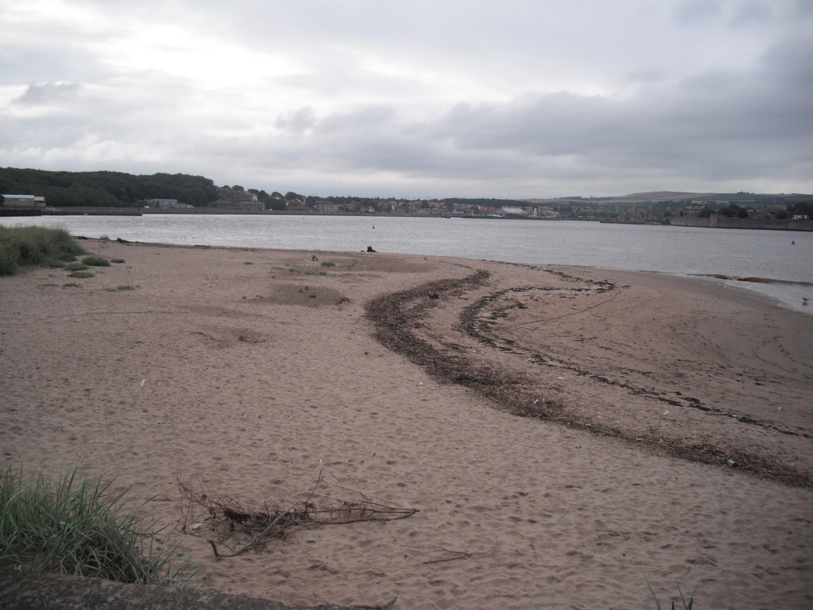
Pictures show: Goswick Sands; estuary near Spittal; the old bridge at Berwick; looking along the old bridge to the town.


Sunday, 19 August 2012

Walk 75 Holy Island (Lindisfarne)


Walk 75          Holy Island  (Lindisfarne) 

(First leg of English coastal walk – Broadstairs in Kent to Berwick at the border with Scotland).

Map: L/R 75
Distance: about 20 km or 13 miles unless driving on to the island in which case probably 4 miles max
Difficulty:  Fairly easy
Terrain: footpaths and pavement
Access: Parking on the island
Public transport: Bus 501,505 stopping near Beal on the main road.

THIS WALK NEEDS TO BE PLANNED CAREFULLY IN ADVANCE OTHERWISE YOU COULD BE STRANDED ON THE ISLAND OR WORSE FIND YOURSELF STUCK IN DEEP WATER IN A VEHICLE OR ON FOOT. CHECK THE SAFE TIMES TO CROSS TO THE ISLAND AND GET OFF AGAIN. BUSES VARY DEPENDING ON THESE TIMES.


Walk the couple of miles from the main road through Beal and on to the start of the Causeway to Holy Island. You will see many notices warning of tide dangers; despite these many cars get stranded every year and suffer terminal damage. I don’t suppose the coastguard people are very amused either! Half way across is a refuge – you don’t want to be using this. The views to the mainland are very attractive and well worth several stops to gaze back.  


The path follows the road and crosses a nature reserve. Continue on this path jointly known as St Cuthbert’s and St Oswald’s Way until the main village. It is well worth a visit to the heritage centre to learn about the history of the island which, together with Canterbury in Kent, is recognised as the cradle of Christianity in England. No visit is complete without a visit to the atmospheric priory of St Aidan. Although a ruin, there is enough left to appreciate the construction of the building and there is helpful information around identifying the various parts.


St Aidan established the priory in the 7th century but virtually nothing remains of this building which was destroyed by Viking invaders. Benedictine monks formed a new monastery here two centuries later and the Norman Priory now stands on the same site. Aidan is originally believed to have chosen this location because of its isolation and proximity to the Northumbrian capital at Bamburgh. It was therefore a good place to launch his conversion of the area to Christianity. In the mid 7th century Cuthbert became the fifth bishop and further built on the island’s reputation with his ability to heal the sick and work miracles. The monastery was used until the suppression of the monasteries by Henry V111 in 1537.


Try to  visit Durham when in the area (the cathedral there is the most magnificent one I have seen) there is an impressive statue in a shopping area showing the monks of Lindisfarne taking the body of St Cuthbert to ‘found’ Durham Cathedral – his tomb is to be found in the crypt.


Bcak to the island, take a walk to Lindisfarne Castle which is clearly visible from the priory (or if you are feeling lazy take the 'shuttle' bus). The Castle was built in the mid 16th century to defend the island from the Scots and then as a fort from 1559 until 1893. Sir Edwin Luytens, the famous architect turned the castle into a holiday home early in the twentieth century. The National Trust now own it and it is worth a visit.


Look out for the upturned boats around the castle which now serve as storage sheds. From near this point you can see some lime kilns. These were built in 1860 and were in use until 1900. Limestone was quarried on the island and was mainly used as a fertiliser. A walk to the nearby peaceful Gertrude Jekyll garden is worthwhile on a pleasant day.


The walk finishes with a stroll northwards across the links to appreciate the more remote areas of the island. Backtrack to the car park or back on to the main road past Beal.


Photos show: monk sculpture in Durham; two views of the Holy Island monastery/priory; upturned boat sheds near Lindisfarne Castle. 


Monday, 6 August 2012

Walk 74 Seahouses to Belford (Northumberland)


Walk 74          Seahouses to Belford (Northumberland)

(First leg of English coastal walk – Broadstairs in Kent to Berwick at the border with Scotland).

Map: L/R 75
Distance: about 10 miles or 16 km
Difficulty:  Mainly easy
Terrain: footpaths, pavement, cliff paths, sand
Access: Parking at both ends
Public transport: Bus 401, 411 from Alnwick to Craster, 501/505 Berwick/Alnwick/Belford Seahouses – check with Traveline.

The first part of the walk out of Seahouses is along the road. There is then a choice to continue along the road or to take a much more pleasant route along the beach to Bamburgh. This is possible when the tide does not come right up to the foreshore so it is worth checking the tide times first.

The Farne Islands can be spotted 2/3 miles offshore. It has the most famous bird sanctuary in the British Isles and has a large colony of grey seals. There are 28 islands of which 15 are visible at high tide. The islands are associated with St Aidan and St Cuthbert who used to stay here and meditate. Farne is also famous for the heroics of Grace Darling. She made headlines in 1838 when, at the age of 23, she helped her father (who was a lighthouse keeper on the islands) row out and rescue a number of men from the stricken steamer Forfarshire. Sadly she died from TB aged just 26. The lighthouse can be visited by boat and there are specialist trips to observe the wildlife. A museum in nearby Bamburgh is devoted to Grace Darling and provides interesting background to her story.

Bamburgh Castle is a significant landmark along this shore. There was a castle here originally built by King Ida of Northumberland but the present building was begun by Henry 1st. It has played its part in the tussles between England and Scotland and The Wars of the Roses. The walls of the castle form a 150 foot precipice. Most of the visible parts of the building were completed in the 18th and 19th centuries when it was used as a boarding school to train servant girls. In 1971 it was chosen as Macbeth’s stronghold in the film version of the play by Roman Polanski. The castle is now in private hands and is open to the public – well worth a visit.

The walk to Budle Bay can be a bit confusing at times as you are never quite sure whether you are on the path or the golf course. A lighthouse is nestled on Harkess Rocks.   

Follow St Oswald’s Way into Belford. This path links some of the places associated with St Oswald, King of Northumbria in the 7th century. He played a major part in bringing Christianity to the area.

The walk finishes at the old village of Belford.

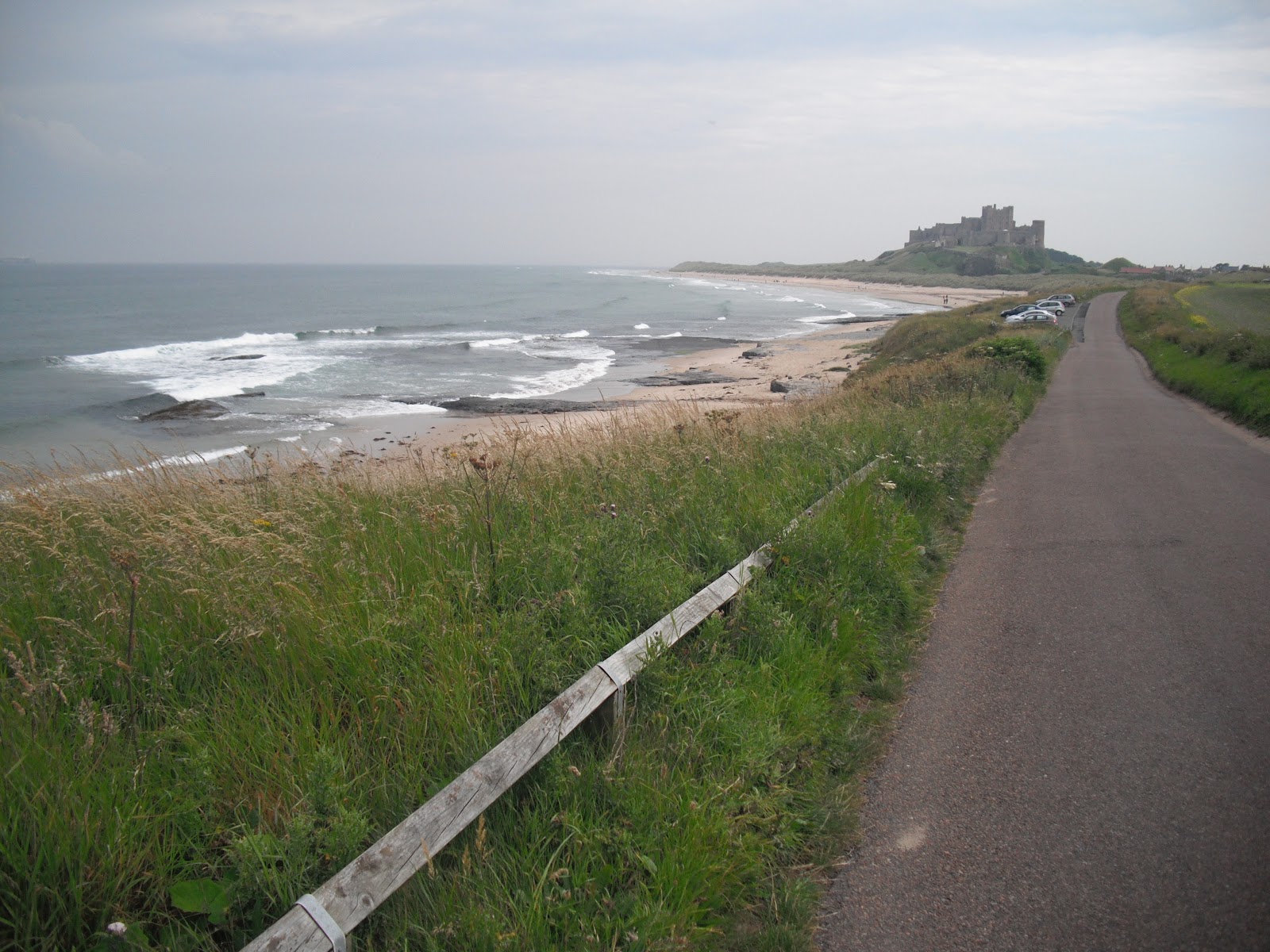
Pictures show: beach walk between Seahouses and Bamburgh; looking south to Bamburgh Castle; Bamburgh village and castle; lighthouse at Harkess Rocks.


Monday, 23 July 2012

Walk 73 Craster to Seahouses (Northumberland)


Walk 73        Craster to Seahouses (Northumberland)

(First leg of English coastal walk – Broadstairs in Kent to Berwick at the border with Scotland).

Map: L/R 81 and 75

Distance: about 10 miles or 16 km
Difficulty:  Mainly easy
Terrain: footpaths, pavement, cliff paths, sand dunes
Access: Parking at both ends
Public transport: Bus 401 from Alnwick to Craster, 501/505 Berwick/Alnwick to Seahouses – check with Traveline.

Walking out of Craster through pleasant fields the first significant landmark is the impressive Dunstanburgh Castle. This ruin, on a small hill close to the sea front, was built in the 14th century. The nearby derelict harbour once sheltered the navy of Henry V111. It changed hands several times during the Wars of the Roses in the 15th century and has been a ruin since 1538. The castle is now run by English Heritage and can be visited for a small admission fee. Coloured quartz crystals known locally as Dunstanburgh diamonds can be seen on the shore near the castle.


The walk continues past the sandy Embleton Bay and towards Low Newton by the Sea. This was once a fishing village and some of the quaint fishermen’s cottages are still there. An offshore reef has created a natural harbour.


Out past the intriguing named Football Hole is Beadnall Bay. This includes a bird sanctuary and a large area owned by the National Trust. Some distinctive lime kilns from the 19th century have been preserved.


After Beadnell you can walk along the road or across the sand dunes until the golf course to the south of Seahouses is reached. The path then goes around Snook Point before arriving in the town.     


Throughout the 19th century Seahouses attracted wealthy naturalists, birdwatchers and artists. Some visited because of the town’s proximity to The Farne Islands and many still do. The islands have been important wildlife sanctuaries since the days of St Cuthbert of Northumbria who lived on them from 676-684AD. From the 1920s Seahouses became a holiday destination – mainly due to the development of road and rail travel.


Pictures show: Dunstanburgh Castle; shore near the castle; Embleton Bay; harbour at Seahouses.