Total Pageviews

Sunday, 19 August 2012

Walk 75 Holy Island (Lindisfarne)


Walk 75          Holy Island  (Lindisfarne) 

(First leg of English coastal walk – Broadstairs in Kent to Berwick at the border with Scotland).

Map: L/R 75
Distance: about 20 km or 13 miles unless driving on to the island in which case probably 4 miles max
Difficulty:  Fairly easy
Terrain: footpaths and pavement
Access: Parking on the island
Public transport: Bus 501,505 stopping near Beal on the main road.

THIS WALK NEEDS TO BE PLANNED CAREFULLY IN ADVANCE OTHERWISE YOU COULD BE STRANDED ON THE ISLAND OR WORSE FIND YOURSELF STUCK IN DEEP WATER IN A VEHICLE OR ON FOOT. CHECK THE SAFE TIMES TO CROSS TO THE ISLAND AND GET OFF AGAIN. BUSES VARY DEPENDING ON THESE TIMES.


Walk the couple of miles from the main road through Beal and on to the start of the Causeway to Holy Island. You will see many notices warning of tide dangers; despite these many cars get stranded every year and suffer terminal damage. I don’t suppose the coastguard people are very amused either! Half way across is a refuge – you don’t want to be using this. The views to the mainland are very attractive and well worth several stops to gaze back.  


The path follows the road and crosses a nature reserve. Continue on this path jointly known as St Cuthbert’s and St Oswald’s Way until the main village. It is well worth a visit to the heritage centre to learn about the history of the island which, together with Canterbury in Kent, is recognised as the cradle of Christianity in England. No visit is complete without a visit to the atmospheric priory of St Aidan. Although a ruin, there is enough left to appreciate the construction of the building and there is helpful information around identifying the various parts.


St Aidan established the priory in the 7th century but virtually nothing remains of this building which was destroyed by Viking invaders. Benedictine monks formed a new monastery here two centuries later and the Norman Priory now stands on the same site. Aidan is originally believed to have chosen this location because of its isolation and proximity to the Northumbrian capital at Bamburgh. It was therefore a good place to launch his conversion of the area to Christianity. In the mid 7th century Cuthbert became the fifth bishop and further built on the island’s reputation with his ability to heal the sick and work miracles. The monastery was used until the suppression of the monasteries by Henry V111 in 1537.


Try to  visit Durham when in the area (the cathedral there is the most magnificent one I have seen) there is an impressive statue in a shopping area showing the monks of Lindisfarne taking the body of St Cuthbert to ‘found’ Durham Cathedral – his tomb is to be found in the crypt.


Bcak to the island, take a walk to Lindisfarne Castle which is clearly visible from the priory (or if you are feeling lazy take the 'shuttle' bus). The Castle was built in the mid 16th century to defend the island from the Scots and then as a fort from 1559 until 1893. Sir Edwin Luytens, the famous architect turned the castle into a holiday home early in the twentieth century. The National Trust now own it and it is worth a visit.


Look out for the upturned boats around the castle which now serve as storage sheds. From near this point you can see some lime kilns. These were built in 1860 and were in use until 1900. Limestone was quarried on the island and was mainly used as a fertiliser. A walk to the nearby peaceful Gertrude Jekyll garden is worthwhile on a pleasant day.


The walk finishes with a stroll northwards across the links to appreciate the more remote areas of the island. Backtrack to the car park or back on to the main road past Beal.


Photos show: monk sculpture in Durham; two views of the Holy Island monastery/priory; upturned boat sheds near Lindisfarne Castle. 


Monday, 6 August 2012

Walk 74 Seahouses to Belford (Northumberland)


Walk 74          Seahouses to Belford (Northumberland)

(First leg of English coastal walk – Broadstairs in Kent to Berwick at the border with Scotland).

Map: L/R 75
Distance: about 10 miles or 16 km
Difficulty:  Mainly easy
Terrain: footpaths, pavement, cliff paths, sand
Access: Parking at both ends
Public transport: Bus 401, 411 from Alnwick to Craster, 501/505 Berwick/Alnwick/Belford Seahouses – check with Traveline.

The first part of the walk out of Seahouses is along the road. There is then a choice to continue along the road or to take a much more pleasant route along the beach to Bamburgh. This is possible when the tide does not come right up to the foreshore so it is worth checking the tide times first.

The Farne Islands can be spotted 2/3 miles offshore. It has the most famous bird sanctuary in the British Isles and has a large colony of grey seals. There are 28 islands of which 15 are visible at high tide. The islands are associated with St Aidan and St Cuthbert who used to stay here and meditate. Farne is also famous for the heroics of Grace Darling. She made headlines in 1838 when, at the age of 23, she helped her father (who was a lighthouse keeper on the islands) row out and rescue a number of men from the stricken steamer Forfarshire. Sadly she died from TB aged just 26. The lighthouse can be visited by boat and there are specialist trips to observe the wildlife. A museum in nearby Bamburgh is devoted to Grace Darling and provides interesting background to her story.

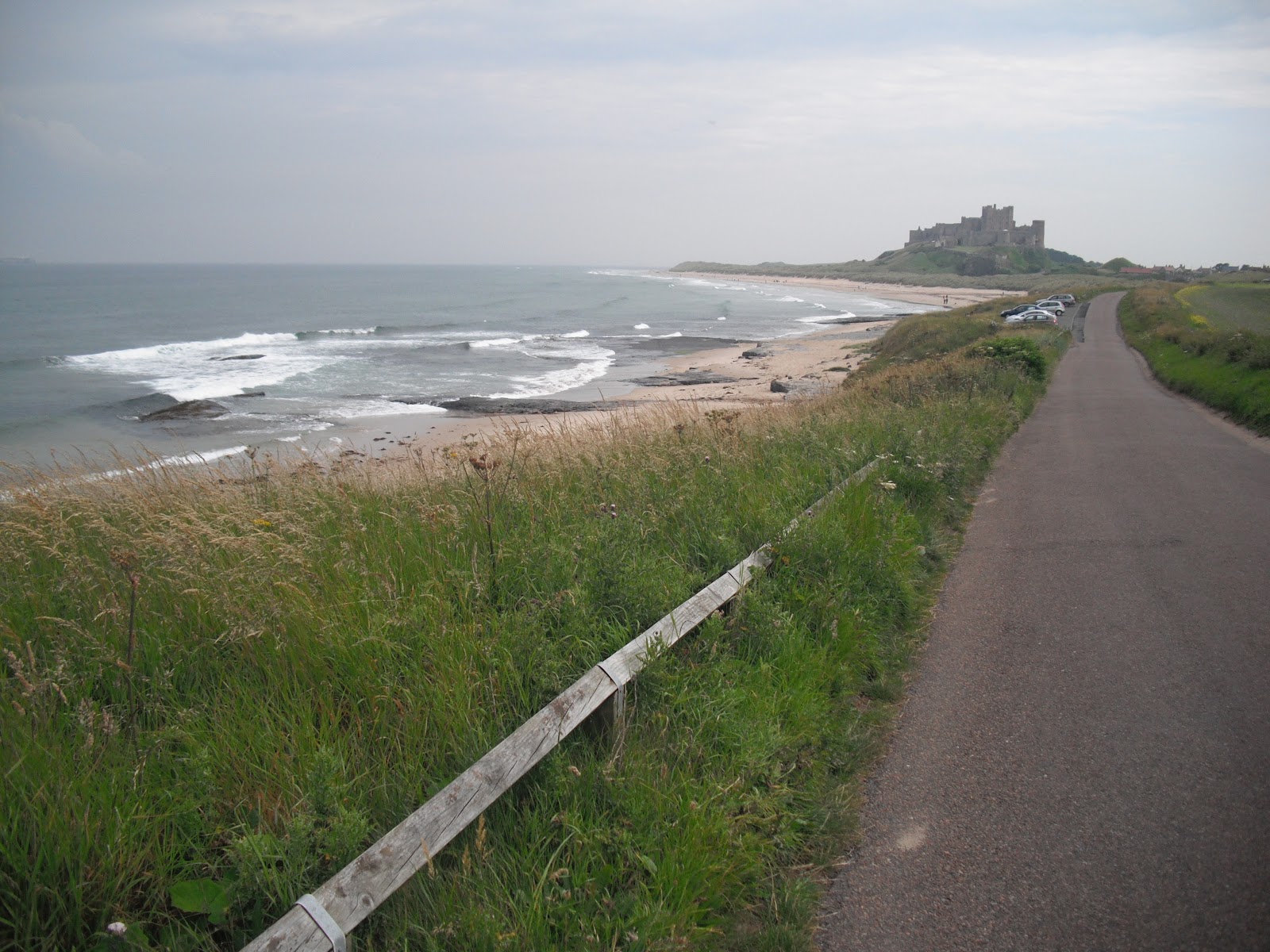
Bamburgh Castle is a significant landmark along this shore. There was a castle here originally built by King Ida of Northumberland but the present building was begun by Henry 1st. It has played its part in the tussles between England and Scotland and The Wars of the Roses. The walls of the castle form a 150 foot precipice. Most of the visible parts of the building were completed in the 18th and 19th centuries when it was used as a boarding school to train servant girls. In 1971 it was chosen as Macbeth’s stronghold in the film version of the play by Roman Polanski. The castle is now in private hands and is open to the public – well worth a visit.

The walk to Budle Bay can be a bit confusing at times as you are never quite sure whether you are on the path or the golf course. A lighthouse is nestled on Harkess Rocks.   

Follow St Oswald’s Way into Belford. This path links some of the places associated with St Oswald, King of Northumbria in the 7th century. He played a major part in bringing Christianity to the area.

The walk finishes at the old village of Belford.

Pictures show: beach walk between Seahouses and Bamburgh; looking south to Bamburgh Castle; Bamburgh village and castle; lighthouse at Harkess Rocks.


Monday, 23 July 2012

Walk 73 Craster to Seahouses (Northumberland)


Walk 73        Craster to Seahouses (Northumberland)

(First leg of English coastal walk – Broadstairs in Kent to Berwick at the border with Scotland).

Map: L/R 81 and 75

Distance: about 10 miles or 16 km
Difficulty:  Mainly easy
Terrain: footpaths, pavement, cliff paths, sand dunes
Access: Parking at both ends
Public transport: Bus 401 from Alnwick to Craster, 501/505 Berwick/Alnwick to Seahouses – check with Traveline.

Walking out of Craster through pleasant fields the first significant landmark is the impressive Dunstanburgh Castle. This ruin, on a small hill close to the sea front, was built in the 14th century. The nearby derelict harbour once sheltered the navy of Henry V111. It changed hands several times during the Wars of the Roses in the 15th century and has been a ruin since 1538. The castle is now run by English Heritage and can be visited for a small admission fee. Coloured quartz crystals known locally as Dunstanburgh diamonds can be seen on the shore near the castle.


The walk continues past the sandy Embleton Bay and towards Low Newton by the Sea. This was once a fishing village and some of the quaint fishermen’s cottages are still there. An offshore reef has created a natural harbour.


Out past the intriguing named Football Hole is Beadnall Bay. This includes a bird sanctuary and a large area owned by the National Trust. Some distinctive lime kilns from the 19th century have been preserved.


After Beadnell you can walk along the road or across the sand dunes until the golf course to the south of Seahouses is reached. The path then goes around Snook Point before arriving in the town.     


Throughout the 19th century Seahouses attracted wealthy naturalists, birdwatchers and artists. Some visited because of the town’s proximity to The Farne Islands and many still do. The islands have been important wildlife sanctuaries since the days of St Cuthbert of Northumbria who lived on them from 676-684AD. From the 1920s Seahouses became a holiday destination – mainly due to the development of road and rail travel.


Pictures show: Dunstanburgh Castle; shore near the castle; Embleton Bay; harbour at Seahouses.


Tuesday, 10 July 2012

Walk 72 Amble to Craster (Northumberland)


Walk 72          Amble to Craster (Northumberland)

(First leg of English coastal walk – Broadstairs in Kent to Berwick at the border with Scotland).

Map: L/R 81

Distance: about 19 km or 12 miles
Difficulty:  Moderate
Terrain: footpaths, pavement, sand, cliff paths
Access: Parking at both ends
Public transport: Buses from Newcastle/Alnwick to Amble. Bus 401 runs every couple of hours or so from Craster to Alnwick Bus Station – check with Traveline.

Amble is at the mouth of the River Coquet. This area has seen many invasions first by the Anglo-Saxons then the Danes. The accent of the local people is said to have originated from the settling immigrants. The town grew in later years as collieries opened; it was an ideal point to export coal and build and repair ships. There is now a modern, attractive harbour and it is an important base for touring the area.

The coastal path works its way past Amble harbour towards Warkworth. There is a stunning view of Warkworth Castle and its reflection in the estuary of the river. I was lucky as it was a sunny day, unfortunately the photo beneath does not do justice to the view. It was at this castle that Henry Percy and his son Harry Hotspur plotted to overthrow King Henry 1V. The castle features in the play by Shakespeare.


Warkworth is an attractive town to walk through. On the way out to the north is one of the few remaining fortified bridges in the country. It was built in the 14th century at an idyllic spot that spans the river. Take care to look for the path on the right after this point – I nearly missed it.


The walk continues across the dunes, with access points to the beach should you fancy a paddle. Birling Carrs (a cluster of rocks in the white sand) and a caravan site are two of the features along this stretch. Some of the caravans had strong straps holding them to the ground – presumably the winds can be very strong here! Along the path I saw hundreds of toads and was lucky not to have trodden on one. They seemed to be in twos – was this some sort of mating ritual?


The path cuts inland before Alnmouth and follows the road before cutting over to a bridge over the River Aln. (there is a shorter way across the estuary which is marked on the map but a bit chancy as it is only passable for 90 minutes a day). Follow the road into Alnmouth.


John Wesley the preacher once describe Alnmouth as a small seaport famous for all kinds of wickedness. This is partly borne out by an event in 1895; riots were caused  when a bunch of fishermen from Amble on a pub crawl clashed with locals. A local constable was beaten up and peace was eventually restored when reinforcements from Alnwick arrived and made several arrests. It looks a peaceful enough place now with an attractive main street and good views.


Alnmouth was a shipbuilding centre in the 13th century but suffered from Scottish raiders and later the Black Death. The town took several centuries to recover and was prosperous again by the 17th century. Today it is a popular holiday resort.


Follow the beach from Alnmouth then cut through to the golf course and the main coastal path. The golf course is the second oldest links course in England.


The walk to Craster has some very attractive views e.g. at Boulmer Haven. Unfortunately, the peace is regularly shattered by fast, low flying, air force planes.


Near to Howick look out for a fenced off structure on the cliff top. Excavations took place along here during 2000/2002 to reveal a stone-age settlement. A stone-age hut has been reconstructed on the site to show what the huts would have looked like in approximate 8000 BC.

Craster is a quiet place with a tiny harbour built early in the twentieth century. A dark rock was extracted here in 'heughs' or quarries (the road where the bus stops is called The Heugh) and used in the building of roads. However, it is the herring that made the place famous. A hundred years ago fish were brought here to be gutted, washed and smoked then exported to Billingsgate in London and to as far away as Russia. The smoke houses are still active with fish sent down from Scotland. One near the sea front boasts a shop, coffee lounge and restaurant. The smell from the smokehouse which was in operation when I visited was quite distinctive.   


Pictures show: Warkworth and castle; the old bridge at Warkworth; a caravan strapped down; view of Alnmouth and estuary; sculpture near South Sands; Anglo Saxon hut cliffs near Howick; herring smokehouse at Craster.


Saturday, 30 June 2012


Walk 71          Newbiggin by the Sea to Amble (Northumberland)

 (First leg of English coastal walk – Broadstairs in Kent to Berwick at the border with Scotland).

Map: L/R 81
Distance: about 20 km or 13 miles
Difficulty:  Fairly easy
Terrain: footpaths, pavement and sand
Access: Parking at both ends
Public transport: Buses from Ashington to New Biggin and Amble. Connections to Newcastle from Ashington.

Start the walk near Spital Point to the south of New Biggin by the Sea. Shipping and fishing can be traced back to the 14th century here. Coal mining was responsible for its expansion in recent times and before that it was a major port for grain.  


You might be forgiven for thinking there are two people standing on a platform looking out to sea. In fact this is a really striking sculpture called 'Couple on the Rocks' – there is a smaller version near the promenade. The sculpture was erected in 2007 and is the work of Sean Henry – it was the first permanent offshore UK sculpture.

Further along the promenade is The Cable House. In 1868 the first telegraph cable from Scandinavia came ashore at this point. The nearby lifeboat station owes its origin to a tragedy in 1851 when ten fishermen lost their lives. In the town look out for The Creswell Arms which proclaims that it is the last pub before Norway.

To the north of New Biggin and overlooking the sea is St Bartholomew’s Church. A church has been on this site since 1174. It was expanded in the 14th century and there is a mix of architectural styles marking its development. In front of the church on the sea side is a rock structure which was placed at this spot in 2000. A plaque explains that mementos of 20th century life are buried underneath including poems, pictures and writing created by local children. Look out for the decorative post near the church.

The path cuts across the golf course. Beware – the path is virtually unmarked and I had to ask several locals to show me the way, it included a dodgy walk across the fairway and several dead ends. Eventually I found a way but it didn’t bear much relation to the path on the map. I felt on much surer ground when reaching Lynemouth Power Station – a significant landmark from some distance away. This was opened in 1972 and was one of the last coal powered power stations to be built. It took coal from the Ellington and Lynemouth collieries which closed in 2005 due to a flood of imports. It may be converted to biomass as fuel in the future.

At Cresswell the path goes alongside wide sand beaches for a few miles. This area is popular with bird watchers. Many tales are associated with Cresswell including those connected with witchcraft – this is backed up by the fact that 23 witches were executed in the area. One tale tells of a tailor in 1752 who was tempted by the devil with the sin of pride and when a local vicar intervened the devil was said to vanish in a ball of fire.

The walk continues alongside Druridge Bay where over a million tons of sand has been removed for use in the building trade. This has contributed to the erosion of the coast. Nature reserves including Ladyburn Lake are on the land side of the walk.

Nearer Amble is a very good view of Croquet Island. This was once occupied by the Romans and until the 16th century was a refuge for hermits and monks. The island is now owned by the Duke of Northumberland and managed by the RSPB as a bird reserve and seabird colony. 18000 pairs of puffins were found nesting here in 2002. The remaining structure of the medieval monastery has been incorporated into the 19th century (now automatic) lighthouse and cottages. Landing on the island is prohibited to the general public.

Low Hauxley is just to the south of Amble. There is evidence of people living here since 6500 BC. The current village was built in the second half of the 19th century to house fishermen; they caught white fish in the winter and salmon in the summer alongside crabs and lobsters. The coastline here has treacherous rocks and as a result a much needed lifeboat station was built by the Duke of Northumberland in 1861. Unfortunately, there were still many losses, for example 5 boats were lost within 4 hours in 1872. A decline in fishing saw the lifeboat station close in 1939 and the last fishing coble (boat) left in the 1950s.

Pictures show: St Bartholomews Church, New Biggin; Couple on the Rocks sculpture and New Biggin Bay; Croquet Island.  


Tuesday, 19 June 2012

Walk 70 Whitley Bay to Blyth


Walk 70          Whitley Bay to Blyth (Northumberland)

 (First leg of English coastal walk – Broadstairs in Kent to Berwick at the border with Scotland)

Map: L/R 88 and 81
Distance: about 13km or 8 miles
Difficulty:  Fairly easy
Terrain: footpaths and pavement
Access: Parking at both ends
Public transport: Metro at Whitley Bay – buses from Blyth to surrounding towns and Newcastle.

Join the cycle path route at Whitley Bay.  

Whitley Bay is a holiday resort that is particularly popular with the Scottish. Its popularity was increased with the arrival of the loop railway which is now part of The Tyneside Metro. The town was known just as Whitley up to 1890 but was often confused with Whitby. This even caused a body to be taken to Whitby for a funeral by mistake. Whitley Bay is now a popular destination for stag and hen parties – the notices in some of the B&Bs/hotels make it clear that such groups are welcome. Bearing this in mind, the boisterous night life in the town is not surprising.

Along the front is an attractive building called The Spanish City Dome. This was part of a permanent fun fair established in 1909. When I was there it was being converted into a hotel and leisure centre. Famous residents of Whitley Bay include/have included the actor Robson Green and Ian Le Frenais the writer of The Likely Lads and other comedies.  

The walk continues out of Whitley Bay and alongside the road for a couple of miles to St Mary’s Lighthouse on St Mary’s Island - it can only be reached by a causeway at low tide. The lighthouse started working in 1897 and was decommissioned in 1984. It is on the site of an old monastery where a sanctuary light would have guided ships.  It is now run by the Friends of St Mary’s Island and can be visited most weekends and during school holidays.

Close to St Mary’s Island is Curry’s Point. On the 4th September 1739 Michael Curry was executed for the murder of the landlord at the Three Horseshoes Inn, Hartley (a nearby village). His body was hung in chains from a gibbet at this point within sight of the scene of his crime; ever since this gruesome event the headland has been known as Curry’s Point.

The coastline is rugged from here to Seaton Sluice.

Seaton Sluice was once a thriving industrial area which saw the production of coal, glass, ship building, bricks and salt. Coal mining began as early in the thirteenth century and continued until a disaster at Hartley Hew Pit in 1862 killed 200 men.

There was an artificially constructed harbour built at Seaton to service the old industries. As can be seen, this has now silted up and is now only suitable for small sea boats. The decline of its industries, the coal disaster and the development of ports in the 19th century at Blyth and Tyneside all combined to diminish the importance of the town. In the early 20th century an attempt was made to turn Seaton Sluice into a tourist area but this failed with the outbreak of the First World War.

I walked to Blyth on the beach – a pleasant walk on a calm, cold winter day. As you arrive to the south of Blyth there is a curved brick wall. Guns were housed on here during both World Wars when it was known as the Southern Gun Emplacement and Blyth Battery. After the war they were adapted as shelters with seats.

A wind farm is clearly seen to the north as the walk continues along Blyth promenade. Blyth dates from the 12th century as a port but major expansion didn’t happen until the early 1800s. The main early industries were coal, ship building salt and fishing. Nowadays the port is importing paper and pulp from Scandinavia and aluminium. Two white buildings sit on the dunes; these were searchlight emplacements used during World War 1 – sliding steel shutters exposed the light when needed.

Continue the walk on to Blyth quayside. This has been regenerated with the old power station being removed and the decline in industry. The large brown silos are used to store aluminium unloaded from ships. The ‘pointy’ sculpture called Spirit of the Staithes was unveiled by Princess Anne in 2003 to mark the regeneration of the harbour.  

Back behind the shore near to some houses is the oldest building in Blyth. It is the High Light Lighthouse the first part of which was built in 1788

Pictures show: Spanish City Dome, Whitley Bay; St Mary's Lighhouse; Curry's Point.


Monday, 11 June 2012

Walk 69 North Shields to Whitley Bay


Walk 69          North Shields to Whitley Bay (Tyneside)

(First leg of English coastal walk – Broadstairs in Kent to Berwick at the border with Scotland).

Map: L/R 88
Distance: about 4.5 miles or 7km
Difficulty:  Easy to moderate
Terrain: footpaths and pavement
Access: Parking at both ends
Public transport: Metro at North Shields and Whitley Bay

The walk starts on the cycle route which follows the road to the south of North Shields. The town’s name derives from ‘schele’ which is Middle English for sheds or huts used by fishermen. There is still evidence of these as you approach the quayside. An old dry dock near here is known as The Haddock Shop as it specialised in the building and repair of steam trawlers. Along the quayside you get a good view of The Tyne estuary and South Shields can be seen on the opposite bank.

Continue following the road which cuts a little inland. You should come across an interesting pub called The Prince of Wales Tavern. Outside is a larger than life wooden doll. In 1814 a female figurehead of a collier ship was placed at the entrance to Custom House Quay until it was vandalised in 1850. A second wooden doll replaced it but several pieces were cut from it by seafarers and used as good luck charms on voyages. There were several more dolls until this one was placed here in 1992.

Further along is the Fish Quay with its distinctive ‘low light’ white tower. The area around here is known as Peggy’s Hole – named after a naval ship moored on an area on the outermost part of the quay known as The Gut. During the French wars of the 18th century North and South Shields were regular victims of press gang raids. The many skilled seamen in the area were forced on to ships and some fought in the Battle of Trafalgar. During the 1800s North Shields sent whaling fleets to Greenland – a 3 year voyage. Later, Scottish girls used to work on the quayside gutting the herring catches before stocks were depleted.

Look out for the shops near the quay which boast fresh food of all sorts. Stan Laurel lived in the town for a few years before he became famous.

The walk continues out towards Tynemouth following the cycle path and promenades. On the way out of North Shields I thought I would find the restored Clifford’s Fort one of the oldest coastal gun batteries in Britain – it was built in a hurry in the Anglo-Dutch war of 1872. Despite asking around, I could not find it – there was a lot of excavation/building work going on at the time so I have an excuse!

Further along the promenade towards Tynemouth you come across an area called The Black Midden. This is an area of exposed rock and was once a notorious shipping hazard, for example it claimed 5 ships in 3 days in 1864 with the loss of 34 lives. As a result of this the Tynemouth Volunteer Life Brigade was formed and even now it provides a back up service to the coastguard. A museum about this organisation can be visited near the cliff top.

You won’t have missed the impressive statue of Admiral Lord Collingwood which stands on the cliff top. He was born in Newcastle and was a resident in the nearby town of Morpeth. He was second in command at The Battle of Trafalgar and the cannons on the huge base of the statue come from his ship The Royal Sovereign. The memorial was erected in 1845.

Further round is the North Pier which is the most easterly point of Tynemouth. It is 1000 metres long and took 40 years to build (started 1854). The light house on the pier was built in 1903 and is still functional.

On the hills of Tynemouth are the ruins of Tynemouth Priory which was destroyed by the Danes in 800. Nearby is Tynemouth Castle – three kings are buried within including the Scottish king Malcolm 111 (died 1093). Three crowns still appear on the North Tyneside Coat of Arms. The queens of Edward1 and 11 stayed in the priory and castle while their husbands were campaigning in Scotland. Both these buildings are open to visitors. On a lighter note the 1980s TV series Supergran was filmed in the area.  

It is worth taking a stroll up the main road into Tynemouth opposite the priory. Two of the buildings of note are the Martineau Guest House and The Turks Head Hotel. The guest house is named after Harriett Martineau who was England’s first woman journalist. She stayed in the building to regain her health between 1840 and 1845. The pub gets its name from a sailors’ knot, so called because of its resemblance to a Turkish headpiece (similar to a turban). In 1880 the pub was nicknamed The Stuffed Dog after Wandering Willie (a dog) famously survived after being thrown from a ferry and was mounted and displayed after its death.

Walking out of Tynemouth are Long Sands and St Edward’s Bay. The  former is a championship surfing venue and the whole area was a fashionable place to bathe in the 18th century.

About a mile north of here is Cullercoats. I was stopped by Mormons when walking the Isle of Sheppey and was again stopped for a conversion attempt by, what looked like, the same two men. Is someone trying to tell me something? The salt and coal trade flourished in this area in the 17th century. In the 1800s Cullercoats was described as the best fish market in the north. Many artists have lived and worked in the town with some contributing to the Royal Academy – it was recognised as an ‘artists colony’ from the early 1800s. Winslow Homer the famous American artist was one of those who stayed here to paint.

Walking through Cullercoats you will come across the Fisherman Lookout which is now used as a community centre. A lifeboat disaster in 1849 prompted the local landowner the Duke of Northumberland to set up an RNLI station and sponsor the design for the self-righting lifeboat. The Percy was built and delivered to Cullercoats in 1852. To the north side of Cullercoats is the site of a remarkable rescue which was re-enacted on the BBC programme Coast. In 1861 the local community, including many women, dragged a lifeboat 2 miles across difficult land to enable a rescue of sailors to take place. Sadly the only victim was a cabin boy.

The walk finishes at Whitley Bay.

Photos show: the wooden doll and pub; shop window at North Shields; Tynemouth abbey; Cullercoats lookout.