Total Pageviews

Sunday, 14 September 2014

Walk 121 Lyme Regis to Seaton

Walk 121  Lyme Regis to Seaton (Devon)

(Second leg of English coastal walk – Broadstairs to Lands End)

Map: L/R 193
Distance: 8 miles or 12 km approx
Difficulty: Very challenging – care needs to be taken underfoot – there is a warning near the start of the walk
Terrain: coastal path
Access: Parking at both ends
Public transport: X53 bus goes between the two towns every couple of hours

This walk appears to be easy on paper. However, the uncertainty of the surface underfoot can make it hazardous. I saw two people who had fallen and being treated for cuts. You have to look down and take things slowly. A warning notice alerts walkers to the fact that the walk is only a few miles but may take much longer than expected.

Start the walk on the front at Lyme Regis near the clock tower.  Lyme Regis marks the border between Devon and Dorset. It was a fashionable watering place in the 18th century and was evidently very popular with the citizens of Bath. The buildings surviving from that time means it retains much of its charm. The beach is famous for its fossils and this is reflected in The Fossil Shop on the main street. During the 19th century, Mary Anning, who became a famous fossil hunter, discovered some of the first fossils that has made this area famous and led it to become known as the Jurassic Coast. The huge ammonites and shells were from life here around 180 million years ago. 

Walk along the harbour and to The Cobb which was originally a sea defence built in the 13th century. It has literary and historical associations. For example, it has seen ships set sail to fight in The Hundred Years War and the Spanish Armada. Lyme MP George Summers left from here on a journey which led to the discovery of The Bahamas. In Jane Austen’s Persuasion, Louisa Musgrave took a tumble from The Cobb to blight the prospects of the heroine Anne Elliott. In the film of The French Lieutenant’s Woman, Meryl Streep was filmed looking out to sea – lots of people were seen posing this when I visited!

Continue to Monmouth Beach. In 1685 the Duke of Monmouth landed here and began his ill fated challenge for the throne of his uncle, James 2nd – this ended in bloody fashion at the Battle of Sedgemoor. Twelve of his men were subsequently hanged in Lyme Regis.

The path out of Lyme Regis can be accessed from Monmouth Bay. As explained above this path has a warning notice: ‘The terrain can be difficult and walking arduous and will take around 4 hours’. It also states that there is no access to the sea. Only glimpses of the coast can be seen on this stretch. One landmark in the first half of the walk is a ruined building that was once a freshwater pumping station and an engineer’s house. Water was pumped up from here to a nearby estate and used as drinking water.

Further along, Downland  and Bindon Cliffs are famous for their enormous landslips. On Christmas Eve 1839 an enormous piece of these cliffs tore free from the mainland to form a deep chasm. It carried huge chunks of wheat and turnip fields and became an area known as Goat Island – a Victorian tourist attraction for some time.

At the end of the walk, approaching Seaton, look out for the tree sculpture which is formed into a grabbing hand (complete with fingernails). To get into Seaton you cross The Axmouth Old Bridge which was opened in 1877 but has been closed to traffic since 1990. This is the oldest standing concrete bridge in England. Axmouth Harbour which is to the south of the bridge has existed since Roman times. A tramway runs up the side of The River Axe and it is worthwhile (at another time) taking a tram to look at the river and wildlife.  

Look out for the clock tower which provides a suitable background to some pleasant landscaped gardens. A large holiday camp nearby was once used as an internment camp in World War 2. Large pebbles from the beach have been sent as far afield as New Zealand for paint blending and rubber processing.

Photos show: Beach and clock at Lyme Regis; Main Street and Fossil shop, Lyme Regis; Lyme Harbour; The Cobb; Monmouth Beach; Hand sculpture near Seaton; Seaton front and clock tower.


Tuesday, 19 August 2014

Walk 120 Bridport to Charmouth (near Lyme Regis) Dorset

Walk 120 Bridport to Charmouth (near Lyme Regis, Dorset)

(Second leg of English coastal walk – Broadstairs to Lands End)

Map: L/R 193
Distance: 10 miles or 16 km approx.
Difficulty: moderate with some challenging parts
Terrain: coastal paths
Access: Parking in Bridport and Charmouth.
Public transport: Regular bus service between the two towns, X53, X31 or 76.

This walk could be continued to Lyme Regis via a rather long inland route on the coastal path, or by following a path along the cliff. The latter did not look to be in good condition when I went so I stopped at Charmouth. Things might have improved by now.

Follow the coastal path out of Bridport to West Bay then walk along the cliffs to Eype beach. The nearby village is divided into Higher Eype and Lower Eype. There are several village buildings here dating back to the 18th and 19th centuries. Eype means steep place and I can confirm this as we stayed in a rather nice country club hotel here (good food) -got stuck on the one track steep hill with a vehicle coming the other way which was scary!

There are some stunning views from the cliffs along this stretch including from Doghouse Hill and Thorncombe Beacon. Soon after East Ebb Cove is the settlement of Seatown a place of fishing and smuggling in the past. The whole area is rich in fossils but these must not be removed. Behind the village is the magnificent Golden Cap which, at 191 metres, is the highest point on the entire south coast. Take a rest at Seatown as the next task is to walk to the top!

At the summit of Golden Cap look out for the triangulation point marking its highest point. The name derives from the golden greensand rock which caps the top. It enjoys World Heritage status. Follow the path along for the next couple of miles into Charmouth. This is the site of where Danish pirates slaughtered many people in 831. In 1651, after the Battle of Worcester, Charles 11 escaped and was hidden in the Queen’s Arms Inn in Charmouth. The king fled when he knew he was discovered – just in time.  There is a heritage centre to find out more about the area near the mouth of the River Char.

Photos show: looking back towards Eype from Doghouse Hill; East Ebb Cove; Seatown with Golden Cap behind it; a view from Golden Cap towards Charmouth. 


Sunday, 27 July 2014

Walk 119 Abbotsbury ro Bridport (Dorset)

Walk 119  Abbotsbury to Bridport (Dorset)

(Second leg of English coastal walk – Broadstairs to Lands End)

Map: L/R 194 and 193
Distance: 12 miles or 20 km approx
Difficulty: moderate
Terrain: coastal paths and some road
Access: Parking in Abbotsbury and Bridport.
Public transport: X53 bus operates between the two towns about once an hour.

The walk starts on the coastal path south of Abbotsbury. After half a mile or so look out for the “chocolate box” Lawrence Cottage with its uninterrupted views of the sea. Continue along to the National Trust owned West Bexington beach.

This next landmark on this peaceful stretch is Cogden Beach also known as Burton Bradstock beach. This is a very popular spot with a large car park. It is also famous as the place where Reggie Perrin, as played by Leonard Rossiter, took his clothes off to fake his own death in the TV series.

Further along is East Cliff – the yellow sandstone cliffs on this stretch are attractive but crumbling away. On the descent from the cliffs is West Bay which lies at the mouth of the River Brit. Workers in West Bay have provided the maritime world with quality rope, twines and nets for centuries.

Complete the walk by turning in land to Bridport. This town has a number of interesting old buildings including many from the 18th century in Main Street – the museum is housed in a 16th century building. The town was referred to as Port Bredy in Thomas Hardy’s Wessex novels. A few well known people are associated with the area including one of my favourites, the politically left wing singer and songwriter Billy Bragg.

Photos are: West Bexington Beach; Lawrence Cottage; Burton Bradstock Beach; West Bay.


.  


.


Monday, 30 June 2014

Walk 118 Weymouth to Abbotsbury (Dorset)

Walk 118  Weymouth to Abbotsbury (Dorset)

(Second leg of English coastal walk – Broadstairs to Lands End)

Map: L/R 194
Distance: 12 miles or 20 km approx
Difficulty: moderate
Terrain: coastal paths and some road
Access: Parking in Weymouth.
Public transport: X53 bus leaves and returns once an hour on weekdays up till about 8 at night

The walk starts at Ferrybridge near to the road across to Portland. Walk westwards along the coastal path to the bay near Charlestown. For the next few miles you get a good view of Chesil Beach. (An appropriate book to read when having a rest might be Ian McEwan’s, On Chesil beach). There is a rifle firing range on this stretch and, if it is active, you will need to follow the alternative path.

The path winds its way along to Fleet Lagoon. In 1824 there was a great gale or tempest which battered the Dorset coast and the village of Fleet was nearly washed away.

Further along is Gore Cove. There is a hotel here that was once called The Moonfleet. It was named after the 1898 novel by J Meade Falkner and was popular with children in the past. The village of Moonfleet is based on this area and the story is also set in Carrisbroke Castle on the Isle of Wight. It is a romantic tale set in times when smuggling was rife.

The walk into Abbotsbury is pleasant enough but the path cuts inland which restricts views of the coast. The town has a big 15th century tithe barn (this is where tithes were stored – the one tenth of produce taken as a tax to support the church and clergy during that time). There are also the ruins of an 11th century monastery. The swannery at Abbotsbury is the largest in England and has been around since the time of Henry V111. It originally provided birds for the monks table at the monastery. Just outside of Abbotsbury is St Catherine’s Chapel. This lady was the patron saint of spinsters who used to meet there and invoke the saints to help them get a husband.

Photos show: The bay near Charleston; the firing range; Fleet lagoon.


Wednesday, 28 May 2014

Walk 117 Weymouth and Portland (Dorset)

Walk 117 Weymouth and Portland (Dorset)

(Second leg of English coastal walk – Broadstairs to Lands End)

Map: L/R 194
Distance: 17 miles or 25km
Difficulty: moderate
Terrain: road, cliff and other paths
Access: Parking in Weymouth.
Public transport: Plenty of buses between Weymouth and Portland.

This is a bit longer than the normal walks I do as it involves a circular walk around the island of Portland. Start off on the coastal path near to the George 111 statue in Weymouth and walk along the coastal path adjacent to the beach.

Look out for varied architecture including The New Vic Hotel which has a rather smart bust of Queen Victoria above its entrance. There are good views to the sheltered Weymouth Bay from here and soon the River Wey will have to be crossed for the walk to Nothe Fort. On the hills near Weymouth is a chalk carving of a horse meant to represent George 111 – dismayed that the work generated royal disapproval the artist killed himself. Fortunately, these days we are a little more sanguine about royal criticism – there would be an architect’s bloodbath if Prince Charles comments about some modern buildings were taken too much to heart!

The bridge across the Wey gives a good view up and down the river – lifeboats and old sailing vessels were in evidence when I was there. A plaque near here states that Captain Richard Clark departed from Weymouth to join Sir Humphrey Gilbert in his discovery of Newfoundland. Continue the walk up to and along the pier where ferries leave for the Channel Islands and Brittany. A less welcome visitor arrived here in 1348 as it was near Weymouth that the Black Death entered Britain killing nearly half the population in one year!

Weymouth Harbour was once a major port in the UK for both fishing and cargo – less so now although the catch is still the third largest in England. The bridge here is raised every two hours to let shipping through.

Continue the walk to Nothe Fort. This was built in 1860 by the Royal Engineers, with help from prisoners from Portland Prison, as part of the defence of Portland Harbour. It housed 12 gun batteries with 70 rooms on 3 levels. It remained in active service until 1956 and is now owned by the council.

Walk westwards and after about a mile is Sandsfoot or Weymouth  Castle and gardens. This was completed on the orders of Henry V111 in about 1539 to support Portland Castle in the protection of Portland Harbour. It has 2 storeys, dungeons, cannons and quarters for 50 men. The castle was in bad repair by 1584 due to damage by the sea and remedial work had to be done. It was held for the king in the Civil War and was then used as a mint. It then became a storehouse and never saw serious military action.

Portland Harbour was built in Victorian times and was an important naval base during the times of the Spanish Armada. It was closed (under the then name of HMS Osprey) in 1999 and the work transferred to Somerset. The cycle track along this stretch is part of The Rodwell Trail and follows part of the old Weymouth to Portland railway line which was closed in 1965. Look out for the platform and a sign of one of the old stations.

The walk along the road to Portland is a bit tedious. It becomes better near the end where there is a good view of Chesil Cave. This point, which lies at the end of Chesil Beach, gets the full blast of the Atlantic and is the site of many shipwrecks. The walk on the west side of the island starts with a rather steep and difficult climb alongside some houses to West Cliff. The path wasn’t entirely clear and it is possible that I took a route that was more difficult than it should have been. There is a very good view back to Chesil Beach which is one of the greatest examples of a tombolo in the world (a tombolo is a spit of land formed by longshore drift that has completely sealed in a section of the coast). The beach is 17 miles long and has been built up by a steady deposition of pebbles, the bulkiest near to Portland and the smaller down the coast at Abbotsbury. Local fishermen can tell exactly where on the beach a pebble comes from by its size.

Continue the walk along the path adjacent to the rugged coastline past Blacknor and towards Portland Bill. The scaly cricket’s only British home is in this area possibly brought here on a World War2 landing craft.

The 115 ft high lighthouse at Portland Bill was built in 1906 although there is an older disused one a little bit inland. To the right of it is an obelisk constructed in 1844 and warning of a low ledge stretching out 30 metres into the sea. Look out for Pulpit Rock further to the west which is a popular attraction because of its shape.

Continue the walk around the island where a mixture of erosion and quarrying has resulted in unusual rock formations. The area has been quarried for centuries to extract limestone. This has been used in such notable places as St Paul’s Cathedral, the Tower of London and the United Nations HQ in New York. Further round near Freshwater Bay there appears to be some new quarrying going on – a crane with a load still attached was abandoned – must have been knocking-off time!

Further up the east coast is Rufus Castle which is at the top of a steep climb from Church Ope Cove. The castle was built for William Rufus, king of England from 1087-1100, and is also known as Bow and Arrow Castle because of the many spaces for these weapons in the 7 ft thick walls. All that is left is a ruin and the arch is the only original part that remains.

Look out for the grim facades of the Young Offenders Institution and prison at Grove with the barbed wire and cameras. Near the end of the walk, on a hill near Fortuneswell, is an impressive sculpture of a quarryman. Descend into Fortunewell where there are buses back to Weymouth if needed.

Photos show: Chesil Beach from Portland; Portland Bill lighthouse; Quarrying areas on the south coast; sculpture of quarryman near Fortuneswell. 


Wednesday, 7 May 2014

Walk 116 Lulworth Cove to Weymouth (Dorset)


 Walk  116 Lulworth Cove to Weymouth  (Dorset)

(Second leg of English coastal walk – Broadstairs to Lands End)

Map: L/R 194
Distance: 13 miles or 20 km.
Difficulty: moderate/quite challenging in parts
Terrain: mainly cliff paths
Access: Parking at both ends.
Public transport: Train and bus are possible to Lulworth but involve a train and a bus - bare bones service. Taxi best option. Good bus and train links from Weymouth to surrounding areas.

This walk features some of the most outstanding views on the English coast. It is worth popping into the Heritage Centre at Lulworth Cove to learn about the area’s geology. Follow the coast path westwards and up the steps to Dungy Head. The view back makes clear the horseshoe shape of Lulworth Cove. Forward are the outlines of Weymouth and Portland with the dramatic cliffs of St Oswald’s Bay in the foreground.

Next up is the iconic ‘Durdle Door’, an arch of limestone rock. A unique species of butterfly, The Lulworth Skipper, was discovered here in 1832. The walk continues up to Swyre Head, the highest point of the Purbeck Hills which form this part of the coast. (The area between Durdle Door and here is known as Scratchy Bottom!)

A little further along is Bats Head. There is a small gap near the point of the head and it is thought that erosion will eventually lead it to looking much like Durdle Door.

Continue along to White Nothe then Ringstead Bay – an area popular with divers. Burning Cliff, which overlooks the bay, is owned by The National Trust and is so called because in 1827 a peat fire, possibly started by lightning, burnt for six years.

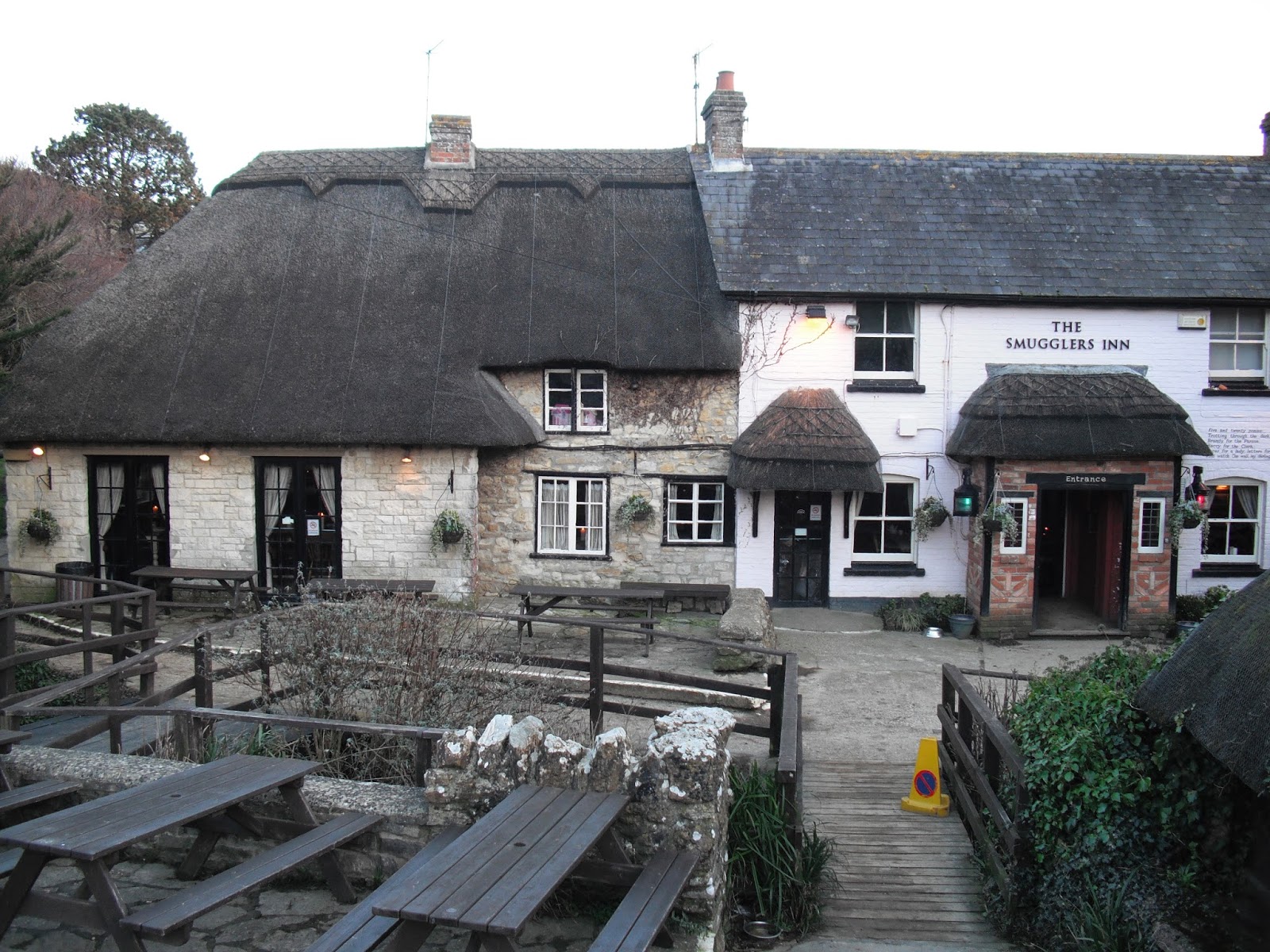
A mile or so further along is the settlement of Osmington Mills. The mills were water mills which were used to grind corn. The Smugglers Inn, once the house of notorious smuggler, Emanuel Charles, dates back to the 13th century. John Constable came here in 1816 on his honeymoon and the views inspired his paintings of the Weymouth coast.

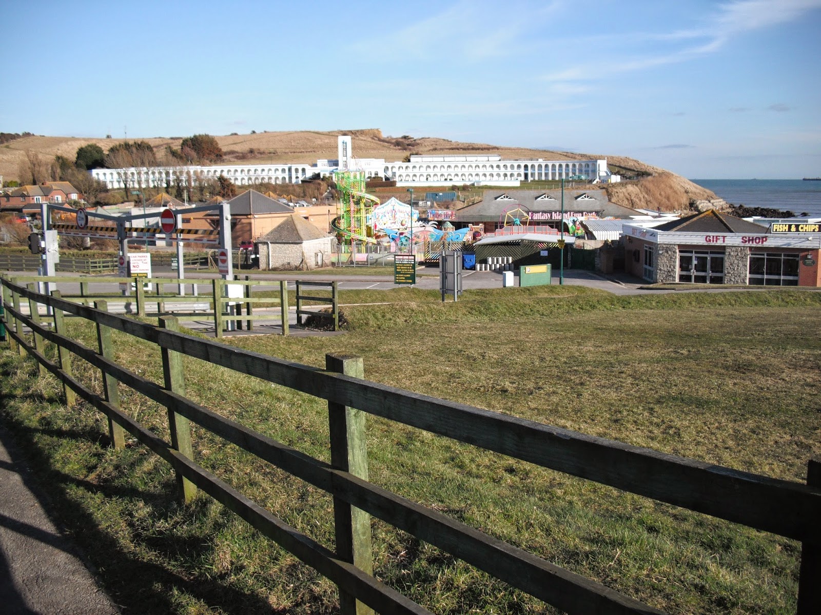
Continue along passing Black Head and an activity centre and on to Bowleaze Cove. This is a popular area for holiday makers with the Waterside Holiday Park an additional attraction. However, it is the long white building that sits above the village which is most impressive. This a grade 2 listed building designed in a Spanish Riviera style. It was owned by Pontins between 1950 and 1960 but was back as a hotel when I went there. The exotic sounding River Jordan exits on to the beach. Curiously, remains of elephants have been found in the area.

Continue along Furzy Cliff where there is a panoramic view of Weymouth and Portland. Descend on to the sea front where a piece of sculpted rock marks the recent building of sea defences. The entry promenade road into Weymouth has a row of colourful B&Bs/guest houses. Further along there is a mixture of Georgian and Victorian buildings. Look out for the pavilion jutting out on to the beach, this was built in 1960 to replace one destroyed by fire in 1954.

There are several things to look out for on the front. The ANZAC memorial (Australia and New Zealand) commemorates the troops from these countries who were stationed in Dorset and moved to fight in Palestine. The colourful clock tower commemorates the jubilee of Queen Victoria in 1887. The war memorial on the Esplanade features 3 events: 749 men killed off nearby Lyme Bay when they were attacked by torpedoes when training in 1944; also in this year 802 men died when their troopship sank in the channel; approx. 3000 American troops died after they left here for Omaha beach on D Day.

Further along is a full size replica of a bathing machine used by King George 111 during one of the 14 summers he spent here between 1789 and1805. On first arriving he was so impressed by the views that he exclaimed ‘I never enjoyed a sight so pleasing’. However, Queen Mary thought it a dull and stupid place!

Do not miss the impressive George 111 statue. Part of his cure, for what was then known as ‘the king’s madness’, (in fact a chemical imbalance in his body which damaged his nervous system) was to bathe in the sea water. The king’s visits helped to establish Weymouth as a popular resort and the statue was funded by ‘the grateful inhabitants’. The railway station is close to this area.

Photos show: Durdle Dor; Osmington Mills; Bowleaze Cove; View to Weymouth and Portland; George 111 statue in Weymouth. 


Wednesday, 23 April 2014

Walk 115 Kimmeridge Bay to Lulworth Cove (Dorset)

 Walk  115 Kimmeridge Bay to Lulworth Cove  (Dorset)

(Second leg of English coastal walk – Broadstairs to Lands End)

Map: L/R 195 and 194
Distance: 8 miles or 12 km.
Difficulty: challenging especially if muddy – some slippery slopes
Terrain: mainly cliff paths
Access: Parking at both ends. NOTE: This walk is on the Lulworth firing ranges and is only open at certain times. Check on: dorsetforyou.com before going.
Public transport: There appear to be no options for Kimmeridge. A morning bus service goes from Wareham to Lulworth. Local taxis specialise in the trip. I left my car at Lulworth Cove car par and arranged (in advance) for a taxi to Kimmeridge. A bit expensive but OK if you can share with other walkers.

Follow the coastal path westwards out of Kimmeridge Bay. Soon you will come to a ‘nodding donkey’ pumping up oil from a small BP well. This has been tapped for over 40 years and has been producing about 80 barrels a day. From Iron age times, oil shale (oil impregnated soft slate) was extracted and used to produce artefacts including jewellery and furniture. In the 1850s the oil was exported to Paris as fuel for gas lit lamps.

About a mile further on, past Howbarrow Bay, is Gad Cliff which overlooks Brandy Bay. This bay derives its name from the smuggling that took place in the 17th and 18th centuries. About a mile further along is Worbarrow Tout which sticks out impressively into the sea. Care is needed on the walk down from here and up the steep path to Flowers Barrow (no steps or handrail). I fell at this point and ended up at the doctors with a knee injury. I did manage to hobble on to Lulworth Cove though.

Inland from here is the ghost village of Tyneham. It can only be accessed when the coastal path is open. The village was seized by the army in 1943 on Churchill’s orders and used for practising manoeuvres. The occupants were moved out and tanks moved in (as did thieves who stripped the buildings!). The village is still empty despite years of protests.

Flowers Barrow, which overlooks Warbarrow Bay, was the site of an iron age fort and has been eroded over the years. There appears to be no evidence that it was much more than a small settlement.

Visible from the path near here is Lulworth Castle which is a mile or so inland. It was built in the early 17th century by Thomas Howard as a hunting lodge, it then became a country house. It was gutted by fire in 1929 and was restored in 1998.     

 As you approach Lulworth Cove the views back to the east are stunning. The first view of the cove is the large car park and road stretching up the hill. Descend into the cove which is famous for its geology and picturesque outlook. The entrance to the cove is narrow because the rocks at this point are formed of the hard Portland Stone whereas the softer Purbeck stone in the cove is still eroding.

|Photos show: nodding donkey at Kimmeridge Bay; Gad Cliff and Brandy Bay; Warbarrow Tout; Lulworth Cove.