Total Pageviews

Monday, 11 November 2013

Walk 107 Hythe, Calshot, Lepe and Bucklers Hard (Hants)


 Walk  107  Hythe, Calshot, Lepe and Bucklers Hard (Hants)

(Second leg of English coastal walk – Broadstairs to Lands End)

Map: L/R 196
Distance: Four separate short walks totalling 3/4 miles at the most.
Difficulty: Easy
Terrain: paths and pavement
Access: Parking at all 4 locations
Public transport: Buses are possible from Southampton to Hythe (8 and 9) and from Hythe to Calshot (8). A passenger ferry from Southampton docks goes to and from the pier at Hythe. The other locations are to difficult to access using public transport.

This is one of those rare occasions when I have abandoned the idea of trying to walk from each location. It is no doubt possible using a lot of minor roads, mostly inland, but I prefer to focus on the coast only.

The first location is Hythe. Start at the marina and walk south to the pier which is a prominent feature. A passenger ferry to Southampton can be caught at the end. In 2003 a drunken captain of a dredger collided with the pier and it had to be rebuilt in 2004. The captain was jailed for 8 months. Hythe is a very old port with records going back to 1293. It was well positioned for trading, ship building and fishing. During World War 2 it was a base for motor torpedo boats and air sea rescue. The USA army also had a base here from 1968-2006. Christopher Cockerel (the inventor of the hovercraft in the 1960s) had his factory here.

The next stop is Calshot near the southern end of Southampton Water. Residents of the island of Tristan Da Cunha were evacuated to the village in 1961 when a volcano erupted. Many of them returned when the island was safe but some remained behind hence the community around Tristan Close. Looking west across the beach at Stanswood Bay the Isle of Wight is clearly visible. Walk to Calshot Spit with its activity centre and castle. The large activity centre is housed in hangars once used for flying boats and aircraft and in buildings once used by the navy. The facilities include an indoor climbing centre, a velodrome and a dry ski slope. The sea is used for many other activities.

The Royal Naval Flying Corps was based here in 1913. Look out for the two red brick buildings named after significant people. Lawrence House named after T E Lawrence (Lawrence of Arabia) was based here from 1929-1931. Houston House is named after Lady Houston who sponsored the R J Mitchell (of Spitfire fame) designed Supermarine which won the Schneider Trophy for the fastest seaplane. The competition was held here in 1931.

Near the end of Calshot Spit is Calshot Castle. This was built in 1540 by Henry V111 as part of his defence on the southern coast (device forts) when he split with the Catholic Church. From 1774 until 1956 it was used as a residence and is now owned by English Heritage. A moat surrounds the castle which can be visited at certain times. Calshot Spit is constantly changing shape due to gradual accretion and erosion. Nearby is a nature reserve. I was told that some unusual species live here due to the warming water that comes from nearby Fawley Power station.

The  next stop is Lepe where you can park very close to the beach. Looking west is Needs Ore Point which is in the estuary of the River Beaulieu. Henry 11 landed at Lepe to take possession of the English throne.

The last stop is Bucklers Hard. This owes its existence to the second Duke Of Montagu who aimed to create a port to import West Indian sugar. The idea came to nothing but a shipbuilding industry grew up instead and by the end of the 18th century 4000 men were employed here.  It was at Bucklers Hard that many of the ships that fought in the Battle of Trafalgar were built by Henry Adams and Sons. Nelson’s ship Agamemmon was built here and it was while commanding the ship in Corsica that he lost his eye. The famous Mulberry Floating Harbours were also constructed for the D Day landings in Normandy in June 1944. Their role was to keep the allied forces supplied.

There are a number of interesting features and places to learn more including a maritime museum, a chapel and a workman’s cottage.
Snaps show: Calshot Castle; Bucklers Hard; River Beaulieu; Hythe Pier.

Wednesday, 30 October 2013

Walk 106 Hamble Le Rice to Southampton


 Walk  106  Hamble le Rice to Southampton (Hants)

(Second leg of English coastal walk – Broadstairs to Lands End)

Map: L/R 196
Distance: 10 miles or 15 km approx.
Difficulty: Easy
Terrain: paths and pavement
Access: Parking at both ends
Public transport: Bus 6 runs frequently between Southampton and Hamble Le Rice

Walk down the side of the River Hamble and past the large marina and then cross over to the oil terminals which are adjacent to Southampton Water.

Hamble Le Rice (until fairly recently known just as Hamble) was known for being an aircraft training centre during World War 2. It retains its links with aviation as many residents work at the Hamble Aerostructures Factory.

Look out for the large gun which points over Southampton Water near to the oil terminals. This is a similar anti-aircraft gun to that which used to protect the oil terminal during World War 2. If you are lucky enough to walk here at low tide you may see the remains of St Andrew’s Castle. This was built by Henry V111 in 1543 to defend against the French.

Soon after leaving Hamble is the Royal Victoria Park which extends up to the shoreline. These are the grounds of a former military hospital – the first purpose built one in the country. The construction was partly due to Queen Victoria’s horror at the conditions soldiers endured when injured in the Crimean War. The hospital was demolished in 1966 but the rather impressive green domed chapel remains. It can be visited as it is now a heritage centre.  The remains of a pier are nearby. This was built in 1865 and was originally 190 yards long. It was designed to receive hospital ships from all parts of the British Empire. After the hospital was opened in 1900 the pier was used by patients for fishing. It was demolished in 1955.

Walking northwards from here look out for the sculpted stone which was presented by people from the Basque area in Spain. It is a meeting stone once used by village people.

The walk continues northwards and passes by Netley Castle. This was originally a Tudor Blockhouse (a small detached fort) and was converted into a ‘show’ castle in Victorian times. The castle was a convalescent home for a long time but has now been converted into flats.

Continue the walk up to the Weston Shore, overlooked by some particularly unattractive blocks of flats. (Probably great views if you live in one). On the shore there are clear views to Southampton docks.

The walk into Woolston is along a road. This is an area I know well as my mother in law lived here for the last part of her life. She was a fierce opponent of The Itchen Bridge which is now a toll bridge into Southampton. I have to agree that, knowing the place before and after, it is a blot on the landscape. It was built in 1977 and replaced the floating bridge ferry (when I went it this had been converted into a restaurant). Woolston itself (as the name would suggest) was a wool trading port until about 1876 when ship building began. Vosper Thorneycroft had a large factory here that was closed in 2004.

Cross the Itchen Bridge into Southampton (walking is free). The help points along the bridge for those contemplating suicide seem to be depressingly necessary.

There is little of the coast that can be walked in Southampton. However, there are many historical points to look at around the old docks area. These include the 14th century town walls which were nearer to the coast than they are now. Through the Westgate archway of these walls marched the army of Henry V on its way to Agincourt in 1415.The pilgrim fathers embarked from the West Quay on the Mayflower in 1620.

Town Quay and West Quay are berths for cruise ships. There is also a ferry to Cowes on the Isle of Wight. Alongside the quays is Mayflower Park, this area was a spa resort in Georgian times and there was a waterside promenade for people to exercise. Jane Austen and her family frequently walked this shore. Less idyllic is the silver dome on the opposite shore – this is a waste incinerator.

Two of the significant buildings on the West Quay are Harbour House, now a casino and the Royal Pier Pavilion, now a Chinese restaurant. A pier was opened here by Princess Victoria in 1833 and in 1906 the pavilion was introduced. Like many other piers, fire destroyed much of it in 1987 and 1992.

Look out for the Platform Tavern down a side street opposite the quay. It dates back to 1873 and is of interest as it was built against the town wall. The tide from the River Test used to come right up to the town walls. There is a section of the wall which has been recreated to show where the boats would have been moored against the walls.   The pub gets its name from a part of the quay called The Platform – it contained a gun battery that was used for ceremonial purposes. The Woolhouse, now the maritime museum, is worth a visit. It was erected in the 14th century to store wool before it was exported. During the Napoleonic Wars it housed French prisoners of war.

This is only a flavour of Southampton. There is much of historic and cultural interest to look at if you have the time.

Snaps show: The Woolhouse, Southampton; Itchen Bridge, Woolston; Tudor Market Hall, Southampton; The gun emplacement at Hamble.

Wednesday, 16 October 2013

Walk 105 Alverstoke to Bursledon (Hants)


 Walk  105  Alverstoke to Bursledon (Hants)

(Second leg of English coastal walk – Broadstairs to Lands End)

Map: L/R 196
Distance: 13 miles approx. or 20 km
Difficulty: Easy
Terrain: mainly paths, some shingle and pavement
Access: Parking at both ends
Public transport: Several buses from Alverstoke to surrounding areas – trains and buses from Bursledon

Start the walk in the Browndown area of Gosport, near Alverstoke. There is a permissive path mainly on shingle which runs alongside MOD land used for military training.  This finishes on arrival at Lee on Solent.

This small town got its name in the 19th century when there were serious attempts to develop it into a seaside resort. It had a pier built at this time but this was demolished in 1958. The town has long been associated with flying; seaplane trials started here in 1915. The Royal Navy base HMS Daedalus is here and the large red buildings back from the sea front provide accommodation for personnel working there. The actors Lawrence Olivier and Ralph Richardson trained as pilots here during World War 2. Look out for the hovercraft museum – large examples of these craft are clearly visible on the seafront.

After leaving Lee on Solent you arrive at Hill Head; its harbour was created by the movement of shingle. Prior to the 16th century this area was uninhabited and was sometimes referred to as Hell Head because of the dangerous waters.

A short distance from Hill Head is Titchfield Haven. This is a nature reserve nationally renowned as a winter refuge for ducks, wading birds and geese and a summer breeding area for the rare avocet.

I found the walk from here to Warsash rather chilly even on a summer’s day. On the other side of Southampton Water is the rather ugly view of the large oil refinery at Fawley.

After a few miles you arrive at Warsash with its distinctive clock-tower. The nearby Rising Sun is a particularly attractive pub and worth popping in for a drink. A plaque on the pub wall records the fact nearly 3000 hand picked and highly trained commandos embarked from the town on the day before D Day as a vanguard for the main assault. For those of us who remember it, the TV series Howard’s Way was partly filmed at Warsash.  A ferry departs from the harbour to Hamble Le Rice on the other side of the River Hamble – there is evidence of a ferry being here from the 1400s. The ‘hard’ where it lands is reputed to be very old. Look out for the Royal Thames Yacht Club (the oldest such club in the UK formed in 1775) who own an area here. In past centuries the town was important for ship building. The unusual name for the town is thought to come from the name of a seagrass meadow in the 1500s.

Continue the walk northwards along the River Hamble passing the marina near Bursledon. Near this point is the wreck of The Norseman, a wooden ship built in 1847; it was gutted by fire in World War 2 and beached on the mud. The Elephant Boatyard located in Old Bursledon was where Henry V111’s boats were built. The area including the Jolly Sailor pub was another location for filming of the TV series Howards Way.

Follow the A27 and bridge into Bursledon.
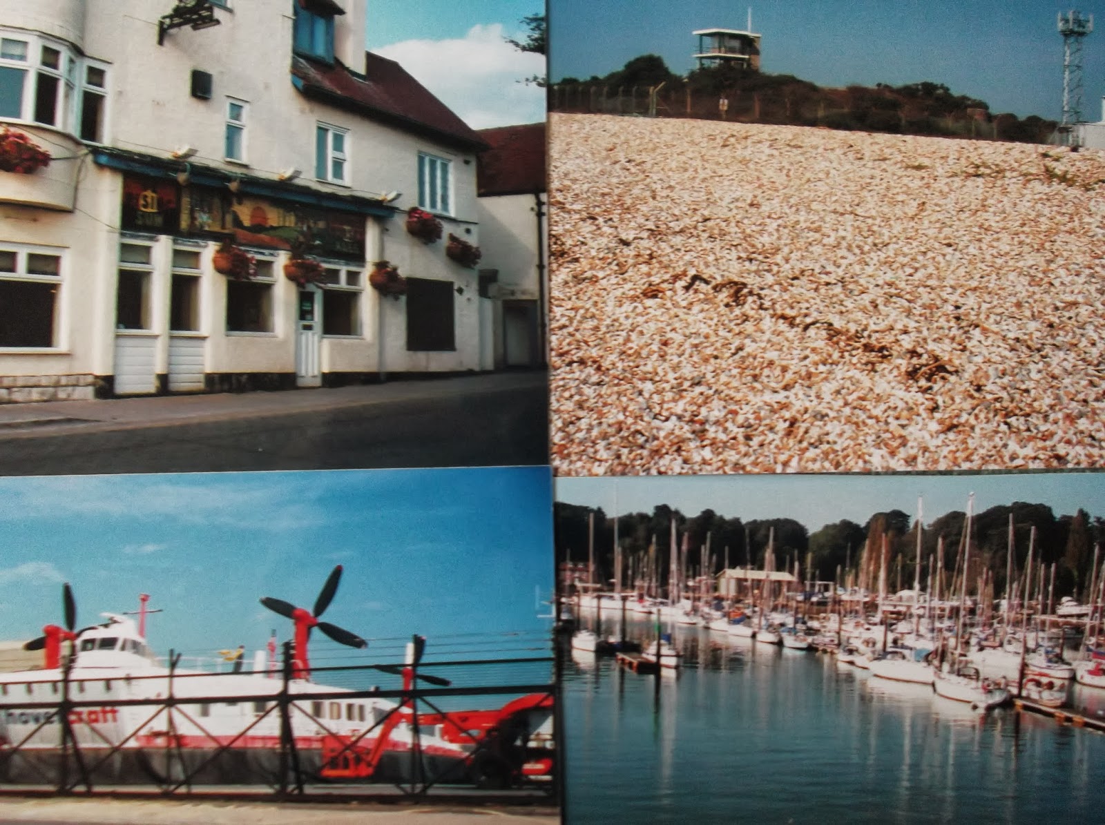
Snaps show: The Rising Sun at Warsash; the shingly beach from Alverstoke with MOD land in the background; hovercraft at Lee on Solent; Bursledon marina.

Thursday, 3 October 2013

Walk 104 Portchester to Fareham then Hardway to Alverstoke (Hants)


 Walk  104  Portchester to Fareham then Hardway to Alverstoke (Hants)

(Second leg of English coastal walk – Broadstairs to Lands End)

This walk is split into two sections, the first could be done in the morning. I suggest a bus (or car ride) between Fareham and Hardway to avoid a rather boring road walk which is not on the coast. Completing the road walk from Fareham to Hardway will add roughly another 4 miles.   

Map: L/R 196
Distance: First half 4 miles or 7km approx. Second half 7 miles or 11km approx.
Difficulty: Easy
Terrain: paths and pavement
Access: Parking at both ends
Public transport: Regular train service to Portchester. First half of walk, buses run frequently from Fareham Bus Station to Hardway. Second half, several buses run from Alverstoke to Fareham.

Follow one of the minor roads off the A27 (or under the A27 south of Portchester Station). A path runs down the side of the coast opposite Horsea Island. Looking back from the path there is a good view of Portdown to the north of Portsmouth and Port Solent on the opposite bank.  After about three quarters of a mile you come to Portchester Castle.

This is an attractive ruin looked after by English Heritage. It has played an important role in the defence of the Solent for many years. It was originally built by the Romans in the 3rd century and is the only Roman stronghold in Northern Europe whose walls mainly stand to their full height. It became a Norman Castle in the 12th century and Henry V used it as a departure point for Agincourt in 1415; definitely worth a wander around the grounds. Look out for the gunpowder store which dates from about 1750 and was one of three built well away from the castle walls (for obvious reasons). The castle was regularly occupied by the military in the many wars of the 18th and 19th centuries when it was also used as a prison.

Follow the Kings Way from here and navigate on to the bus station at Fareham (if using public transport). The Kings Way or the Allan King Way is a 45 mile long distance path in Hampshire created by the Ramblers’ Association as a memorial to a former publicity officer.

Fareham is a market town which formerly used its clay soil for producing bricks, tiles and chimney pots.  Use the bus or car to Hardway as described above.

The coastal village of Hardway on the west of Portsmouth Harbour dates back to the Roman conquest. It was an area known for smuggling. The view now is mainly of ships and a small pier but for sometime in the past there was a local ‘hard’ where convicts were gathered for transportation. In 1770 the Royal Navy’s principal armament depot was situated nearby. This supplied arms from Nelson’s time to the Falklands War and was closed in 1989. The Explosion Museum situated on Priddy’s Hard tells the story of the arms depot. It is supposed to be one of the most haunted locations in the UK with many people reporting strange events thought to be associated with the several people who died whilst working in the depot or being deported from the ‘hard’.

Continue walking south. An impressive looking sea mine is situated near some beach huts. This is an example of a buoyant acoustic mine which is activated by the noise of approaching ships. It was used in World War 2 - the whole area played an important role in the war. Repairs and refuelling of navy ships took place and D Day embarkations were from near here in 1944.

Follow the path along the road past the marina, hospital and prison. The path then skirts a golf course before it reaches Gilkicker Point, the most southerly point of the area. On the left is Fort Gilkicker one of a series of twenty forts built in the 1860s under the instructions of Lord Palmerston (then prime minister) to encircle Portsmouth. They were supposed to counter a threat from Napoleon 111. None of them were used in serious combat and they became known as Palmerston’s Follies.

Continue the walk along Alverstoke seafront which looks out on to Stokes Bay. Fourteen Mulberry Harbours (floating piers) were built here in 1943 and 1944. In earlier times it was a vital part of the defence against the Spanish Armada.

At the end of the golf course navigate inland to Alverstoke. There were ambitious plans in the 19th century to develop an area called Angleseyville into an exciting holiday area. Look out for the Anglesey Arms Hotel which was the only part of this plan to be completed - an impressive building where Queen Victoria stayed on her way to the Isle of Wight. Buses leave from various points in Alverstoke.

Snaps show: Portchester Castle; a gunpowder store at Portchester Castle; Gosport Ferry; acoustic mine at Hardway.

Saturday, 14 September 2013

Walk 103 Isle of Wight - Gurnard Bay to East Cowes

Walk  103  Isle of Wight- Gurnard Bay to East Cowes

 (Second leg of English coastal walk – Broadstairs to Lands End)

Map: L/R 196
Distance: about 5 miles or 8 km including exploring the towns
Difficulty: Moderate
Terrain: mainly pavement
Access: Parking at both ends
Public transport: Bus 1 runs from Newport to Cowes. Further bus connections at East Cowes. The walk involves using the floating bridge to cross the River Medina to East Cowes. 

This is quite a short walk that could be combined with a visit to Carrisbroke Castle in nearby Newport. This is the castle where Charles 1st was kept before his execution in London. A museum tells the story of the castle including that of the donkeys which still turn the water wheel (for demonstrations only).

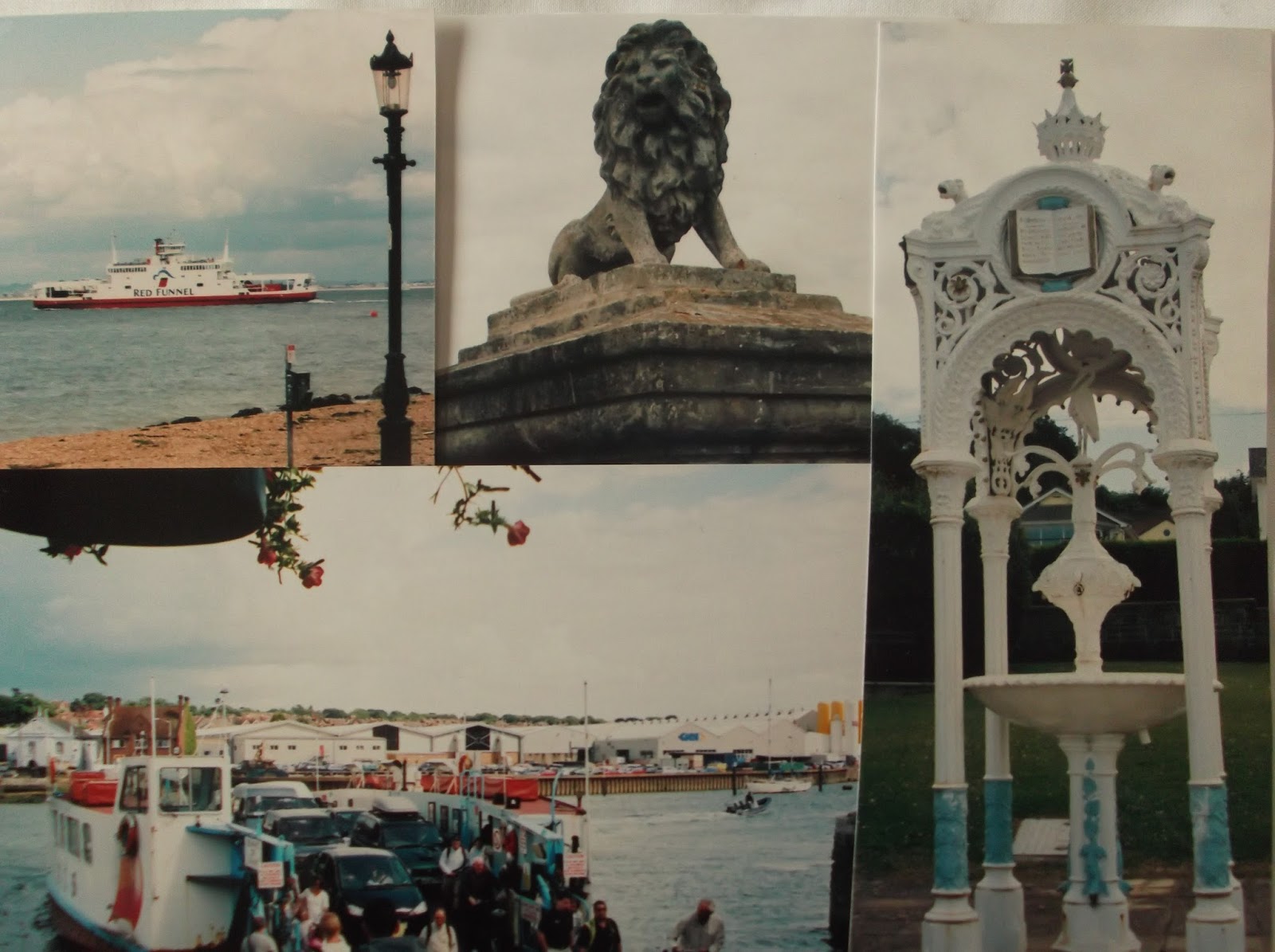
Gurnard Bay has a small beach with a few beach huts. The view across the sea is quite pleasant with the not so nice industrial area of Fawley just visible in the distance. The walk into Gurnard and Cowes follows the road. Look out for some quite impressive houses on the way to Egypt Point. This part of the coast gets its name from a gypsy encampment that was nearby in the sixteenth century. Between 1897 and 1989 a lighthouse operated here and the structure is now used as a landmark for yachtsmen. Egypt Point was one of Queen Victoria’s favourite spots when she lived on the island. Look out for an impressive and elaborate water fountain with a carved open bible on its roof. I have been unable to find out the significance of this although it clearly has some religious origin.

Ferries coming and going to Southampton can be regularly seen on the walk into Cowes. The town is probably the most famous and fashionable yachting centre in the world. Cowes Week takes place during the first 9 days of August when there are several regattas. East and West Cowes are split by the River Medina. On the west side are some smart brass cannons pointing out to sea, these come from a fort built by Henry V111 to defend The Solent. During World War 2 Cowes was the centre of operations for the D Day landings.

There are several yachting clubs in West Cowes. The Royal Yacht Squadron founded in 1815 is regarded as the most exclusive in the world. There is also a strong boat building tradition in Cowes. Personalities who have a connection with the town include Ellen McArthur, George V, Edward V11 and William Arnold. The latter, who was the father of Thomas Arnold, fought against the pirates and smugglers active here in the 19th century.

The floating or chain ferry carries foot passengers and cars to cross the River Medina. Before the 1860s the ferry was horse drawn. During the 19th century Cowes was a fashionable spa town with bathing machines. Look out for the ‘unclaimed shop’ (if it is still trading) – this sells or sold lost property.

The walk around the Isle of Wight finishes here.

Snaps show: Southampton to Cowes ferry; the lion sculpture at Egypt Point; the water fountain near here; the chain ferry.

Sunday, 25 August 2013

Walk 102 Isle of Wight - Alum Bay to Yarmouth


 Walk  102  Isle of Wight- Alum Bay to Yarmouth

(Second leg of English coastal walk – Broadstairs to Lands End)

Map: L/R 196
Distance: 6 miles or 11 km. approx.
Difficulty: Moderate
Terrain: mainly footpaths
Access: Parking at both ends
Public transport: No 7 bus runs regularly between the two points

From Alum Bay continue the walk across Headen Warren before dropping down into Totland.

There were some strange sculptures in the rocks when I walked along here. Bent iron poles with bits hanging from them stuck into the rocks Are they still there I wonder. The pier at Totland is used by Trinity House for taking out pilot boats and guiding ships into The Solent.

Continue to Colwell Bay. After the path cuts inland there is a building jutting out into the sea. This is Fort Albert built in 1856 as a defence against the French. It was used in later years for the first torpedo development trials.

On the walk into Yarmouth the path passes through the Fort Victoria Country Park. If there is time you may want to visit some of the attractions here. They include an aquarium, an underwater archaeology centre, a planetarium and a model railway.

After a little bit of road walking you enter Yarmouth. This is an attractive town, situated at the mouth of the River Yar and the oldest one on the island. It is listed in the Domesday Book and was the first town to be granted a royal charter. The town cannot be enlarged from its present size as it is surrounded by solid rock. Yarmouth Castle was built by Henry V111 in response to the sacking of the town (twice) by the French. The 215 metre pier dating from 1876 is unique in Britain as it is the only one remaining built entirely of wood (apart from screws, nails etc.) It is a listed building. The interestingly named Old Gaffer Festival takes place in Yarmouth every May or June. A gaff is a specially rigged sailing boat and about 100 of these compete in a three day festival.

Snaps show: The rock sculptures at Totland; Yarmouth Pier; part of Yarmouth town; Totland Pier; Fort Albert, Colwell Bay.

Thursday, 15 August 2013

Walk 101 Isle of Wight - Brighstone to Alum Bay


Walk   101  Isle of Wight- Brighstone to Alum Bay

(Second leg of English coastal walk – Broadstairs to Lands End)

Map: L/R 196
Distance: 13 miles or 20 km. approx.
Difficulty: Moderate
Terrain: mainly footpaths
Access: Parking at both ends
Public transport: A little tricky but possible with buses from Brighstone to Alum Bay changing at Totland.

The coastal path continues from Brighstone and runs parallel to the main road. Hopefully, there will be no further damage to the cliffs that necessitate walking along the road. From Brook Bay there is a good view of Hanover Point with its white cliffs and Compton Bay beyond. This area is famous for evidence of dinosaurs including the discovery of iguanodon footprints fossilised in the mud. This part of the coast is preserved by the National Trust.

Shippard Chine is crossed by a small footbridge and a further one at Compton Chine. The next main feature is Freshwater Bay. This is a picturesque cove overlooked by a hotel (with a bar!). The nearby village of Freshwater was the birthplace of Robert Hooke the famous physicist.

There is a climb out of Freshwater Bay on to Tennyson Down with its distinctive monument. This is dedicated to Lord Tennyson  (1809-1892) who lived near Freshwater from 1853 to 1868. It stands 482 feet above sea level and the air here was described by Tennyson in one of his poems as worth ‘sixpence a pint’.  The views from here are impressive.

Continue the walk around to the Needles. The iconic, instantly recognisable, view of the rocks is seen best from Alum Bay  or Needles Old Battery. The latter, now owned by the National Trust is worth a visit. It is a fort from the 19th century and was also used in both World Wars. Exhibitions in the fort explain its history and there is an underground tunnel which leads to a lookout.

Continue around to Alum Bay. A chair lift down to the beach is the best way to view the banded sandstone cliffs. These have more than 20 colours ranging from chocolate brown to strawberry pink. It is now prohibited to take sand from the beach or cliffs. However, glass containers with samples can be bought from the cliff-top shop.

At the top of the cliff there is a small amusement park with cafes etc. A memorial near to the chairlift marks the site of the Needles Wireless Telegraph Station. Marconi and his British collaborators carried out a series of important experiments from here between 1897 and 1900. In 1899 information for the first newspaper produced at sea was transmitted from this spot - to the ‘St Paul’ which was 36 miles away at the time.

Snaps show: Freshwater Bay looking east; the rocks at Alum Bay; The Needles from the battery; the chair lift at Alum Bay; Freshwater looking west; a cannon at Needles Battery.